101 at 100: The History of Oregon’s Most Iconic Highway
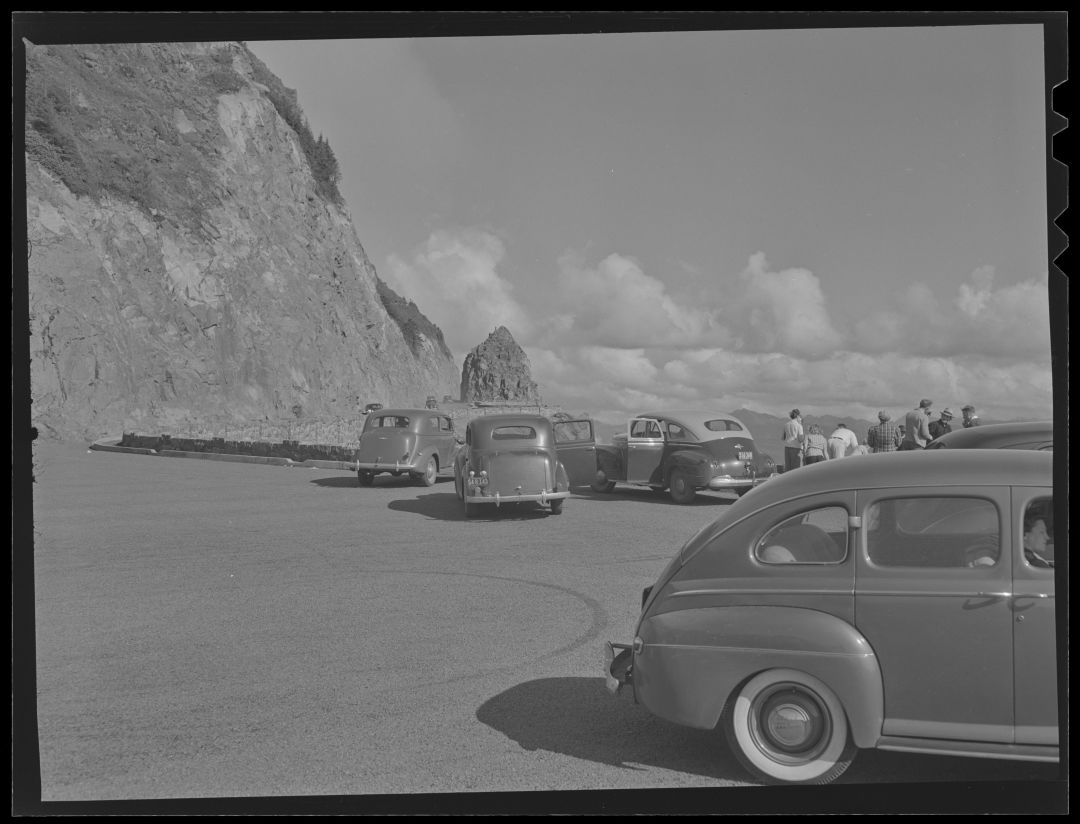
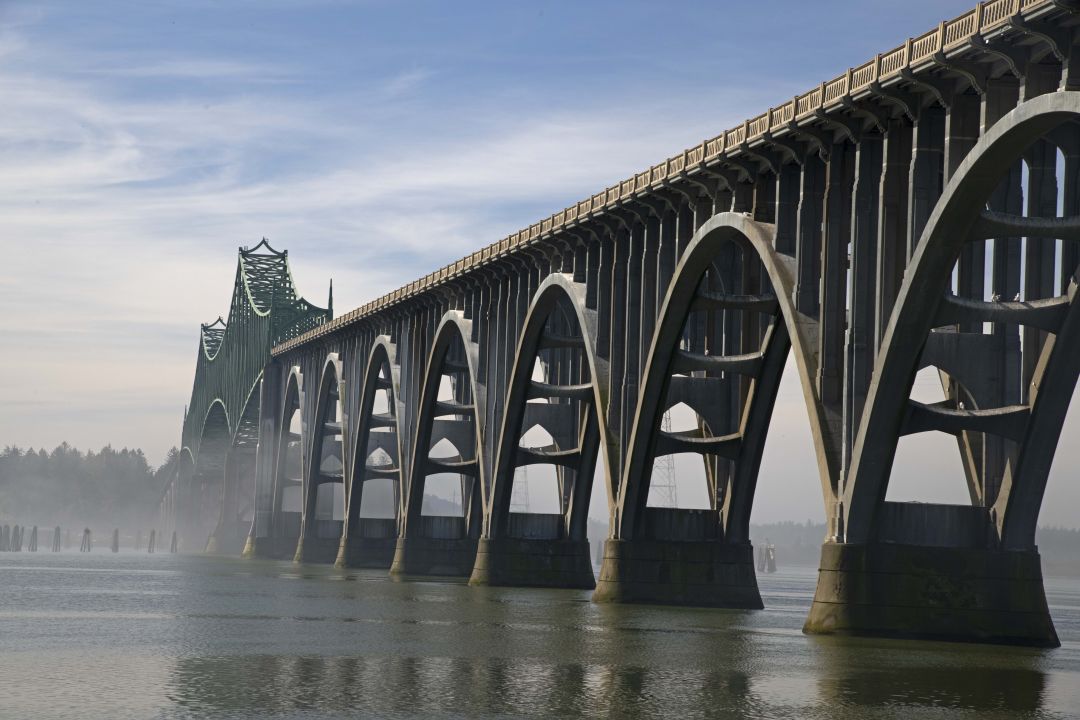
Generations of Oregonians are familiar with that invigorating moment when you crest a coastal headland and catch that first sudden sweep of the Pacific. Maybe it’s just past Neahkahnie Mountain, or rounding into Newport as the Yaquina Bay Bridge rises ahead in steel-blue arcs. The road curves, the fog lifts, and the coast reveals itself.
For nearly a century, U.S. Highway 101 has delivered that moment. Stretching 363 miles from Astoria to Brookings, the coastal highway has been more than a route on a map: it has carried families to beaches and fishing towns, linked isolated communities, and helped define the Oregon coast.
Now, as the highway marks 100 years as a federal route, the Oregon Historical Society invites visitors to look beyond the view in a new exhibition, 101 at 100: The History of Oregon’s Most Iconic Highway. Now open in downtown Portland through October 11, 2026, the interactive installation traces how a scenic road became a lifeline for coastal culture, commerce, and connection.
A road built on older paths
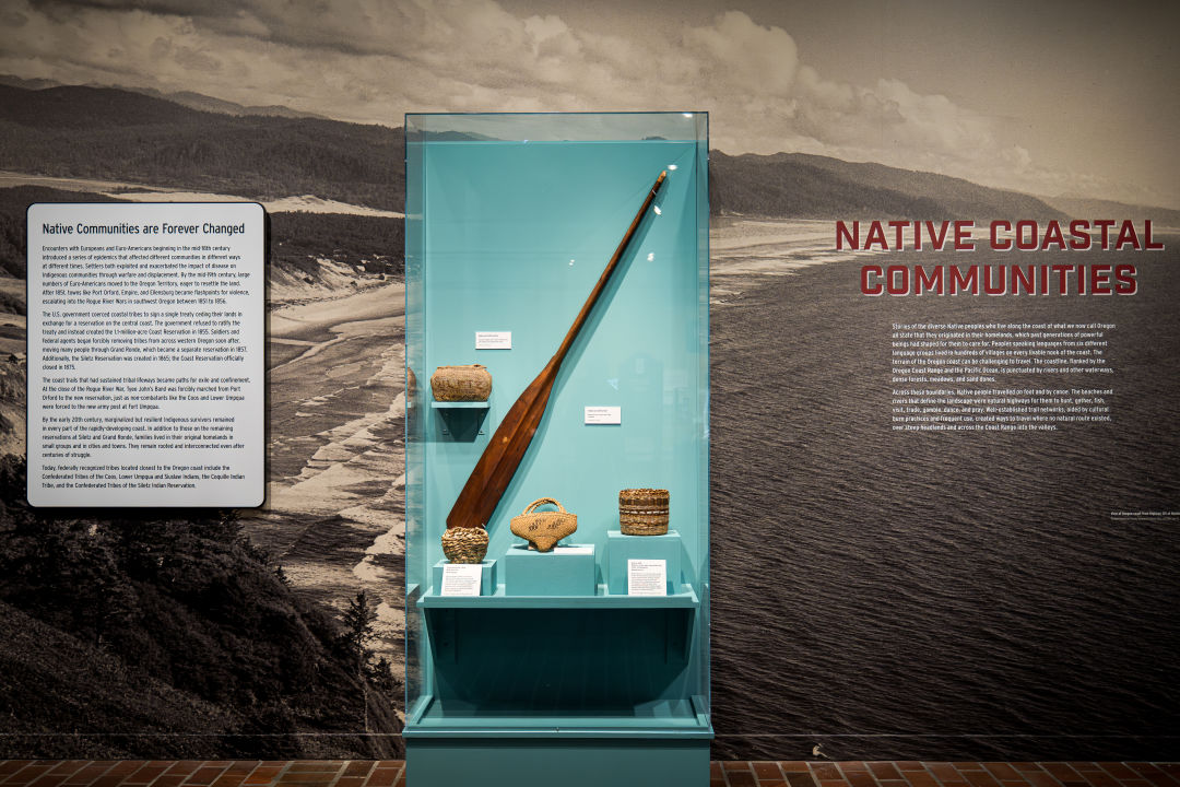
Long before automobiles, Native communities traveled Oregon’s shoreline via waterways, beaches, and extensive trail networks, moving goods and knowledge along a dynamic coastal corridor. In the 19th century, non-Native settlers carved rough wagon roads of sand, wood, and gravel across a landscape as challenging as it was beautiful — cliffs dropping into surf, dense coastal forests, and shifting dunes.
By the early 1900s, that isolation had become an economic barrier. As cars grew more common, coastal residents and state leaders pushed for a continuous road. Oregon formed its Highway Commission in 1913, launching an ambitious decade-long effort to construct a coast highway across seven counties. Completed through remarkable feats of engineering, the route was designated U.S. Highway 101 in 1926, permanently linking communities that had long faced geographic separation.
101 at 100 follows this evolution from Indigenous travel routes to modern highways, highlighting how infrastructure reshapes where people can live, work, and move.

Engineering the scenic coast
Unlike many inland highways designed purely for speed, large stretches of Highway 101 were engineered to work with the coastal landscape and to showcase it. Builders blasted passages through headlands, spanned bays with graceful bridges, and traced curves along cliffs to preserve ocean views. The result was an infrastructure that doubled as experience: a road meant not only to connect places, but to reveal them.
The exhibition brings these feats to life through historical photographs, maps, and stories from the people who built and depended on the route — from bridge engineers and road crews to loggers, farmers, and tourism entrepreneurs whose livelihoods shifted as access improved.

“Having grown up on the Oregon Coast in Reedsport, Highway 101 was a constant presence in my life,” says OHS Boyle Family Executive Director Kerry Tymchuk. “This exhibition invites visitors to discover the rich diversity of Oregon’s coastal communities and to appreciate the remarkable feat of engineering that made Highway 101 possible.”
The highway that shaped the coast
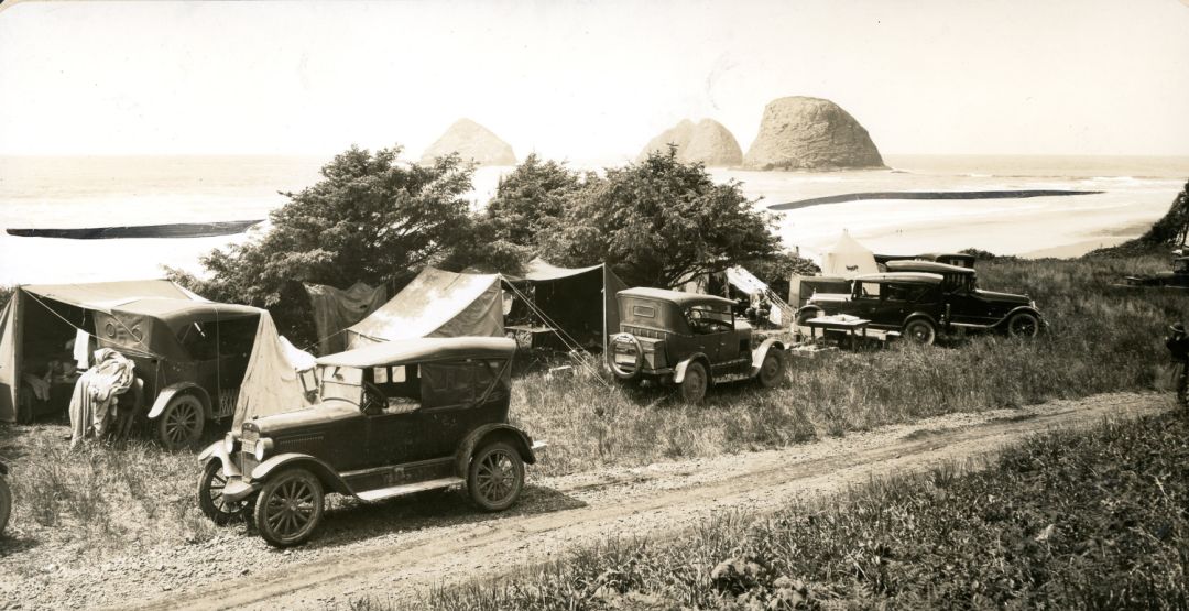
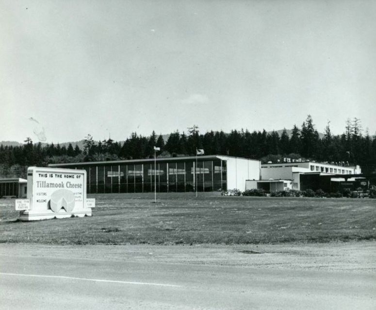
As travel became easier, Highway 101 helped transform the coast into both home and destination. Resorts, campgrounds, fisheries, dairies, and roadside businesses flourished along its length. Visitors arrived in growing numbers, drawn by beaches, lighthouses, and cool coastal air, while residents gained more reliable access to markets, services, and neighboring towns.
The exhibition also encourages reflection on the broader implications of mobility: how transportation corridors influence settlement, opportunity, and belonging — questions that continue to shape coastal Oregon today.
A contemporary love letter
Presented alongside the main exhibition is From Highway 101: Images of Oregon’s Most Iconic Highway, a photographic series by local photographer Peter Marbach. His images capture the present-day life of the road: from mist-softened shorelines and monumental bridges to the vibrant communities that line the route, these photographs offer a centennial-year portrait of a landscape still in motion.
Together, the two exhibitions invite visitors to see Highway 101 not just as a scenic drive, but as a century-long story of movement and change.
Plan your visit
101 at 100: The History of Oregon’s Most Iconic Highway is on view at the Oregon Historical Society in downtown Portland through October 11, 2026. The museum is open daily (10 am–5 pm Monday–Saturday; 12 pm–5 pm Sunday). Admission is always free for youth 17 and under, OHS members, and Multnomah County residents. Learn more at ohs.org/visit.