The Willamette River's History
This may look like a psychedelic electrical storm. But it’s actually the Willamette River, past and present.
Daniel Coe, a cartographer with the Oregon Department of Geology and Mineral Industries, hired a Cessna Grand Caravan equipped with lidar to fly over the Willamette Valley more than 150 times. Lidar emits 100,000 pulses of light per second and measures how long they take to reflect back to the source, which allowed Coe to chart rises or drops in the valley floor to within two inches. The data reveals the veins of now-vanished historical channels the Willamette carved in its past.
Ever since the Missoula Floods swept through the valley, the Willamette has wandered. Landslides and debris altered its course; so did humans. Coe captured these changes by assigning colors to the varying elevations—the present-day river is closest to sea level, while higher elevations contain ghosts of former channels and tributaries long since filled in with soil. His map recently landed in Atlas of Design, a new book showcasing some of the world’s most striking cartography.
For Coe, aesthetics play a huge role in map design. “Maps with clarity in design are more likely to be examined, read, and used,” he says. Coe hopes his anatomy of the Willamette gives Oregonians a deeper perspective on the state’s defining river. “Seventy percent of Oregon’s population currently lives in the Willamette Valley,” he notes. “And humans inhabited the valley for thousands of years before European colonization. These river channels allow us to understand the Willamette’s true, dynamic nature.”
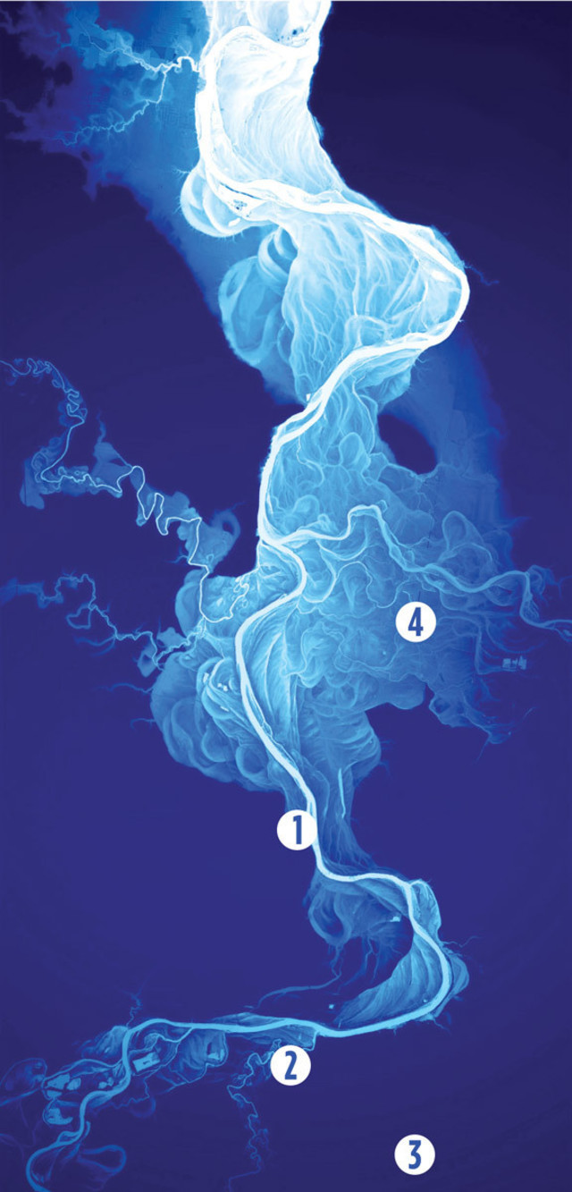
1. The brightest, thickest band is the present-day Willamette River.
2. The more faded white bands indicate old channels that gradually filled with debris and soil over time, thus raising their elevation.