The Danger Zone
EVER SINCE Mount St. Helens exploded 28 years ago this month, killing 57 people and covering 11 states with 540 million tons of ash, Northwesterners have cast a wary eye at jagged summits like Hood and Jefferson. In fact, there are 10 active volcanoes lying within 300 miles of Portland. Sure, these stone sentinels provide a spectacular natural skyline, but they’re also worrisome, what with their deadly potential and all. Enter the U.S. Geological Survey’s Cascades Volcano Observatory in Vancouver, Washington. The 26-year-old group monitors the mountains using seismometers, satellite radar, and GPS, which can pinpoint areas where the ground is moving—even just a fraction of an inch. Of course, eruptions can happen with little or no warning. So we’re playing it safe and keeping an eye on these five local peaks. Just in case.
MOUNT RAINIER
Last eruption: Around 1840, lava fragments were ejected from the summit cone.
If it blows: Rainier’s plentiful ice and snow cover means an eruption could spell disaster for the resorts dotting its slopes and the cities farther downhill. The blast would create massive debris flows, or “lahars” (basically thick stews of mud, rock, and melted snow and ice), that would converge on the towns of Puyallup and Tacoma, about 50 miles away.
Threat level: Fortunately for Tacoma’s 200,000 residents, Rainier hasn’t shown any recent seismic activity. But that doesn’t mean your great-great-grandkids shouldn’t be a bit concerned.
MOUNT HOOD
Last eruption: In the 1790s; minor explosive activity in the 19th century
If it blows: Kiss your ski season goodbye: Resorts and little towns like Zigzag would be obliterated by avalanches and pyroclastic flows (currents of hot gas and rock that can move at 50 mph and reach 1,000 degrees Fahrenheit). Deadly debris flows would reach Gresham and the Columbia River in about three hours.
Threat level: While Hood has experienced a swarm of small earthquakes since the 1970s, volcanologists aren’t concerned about an imminent eruption. Of course, there’s still a contingency plan on the books.
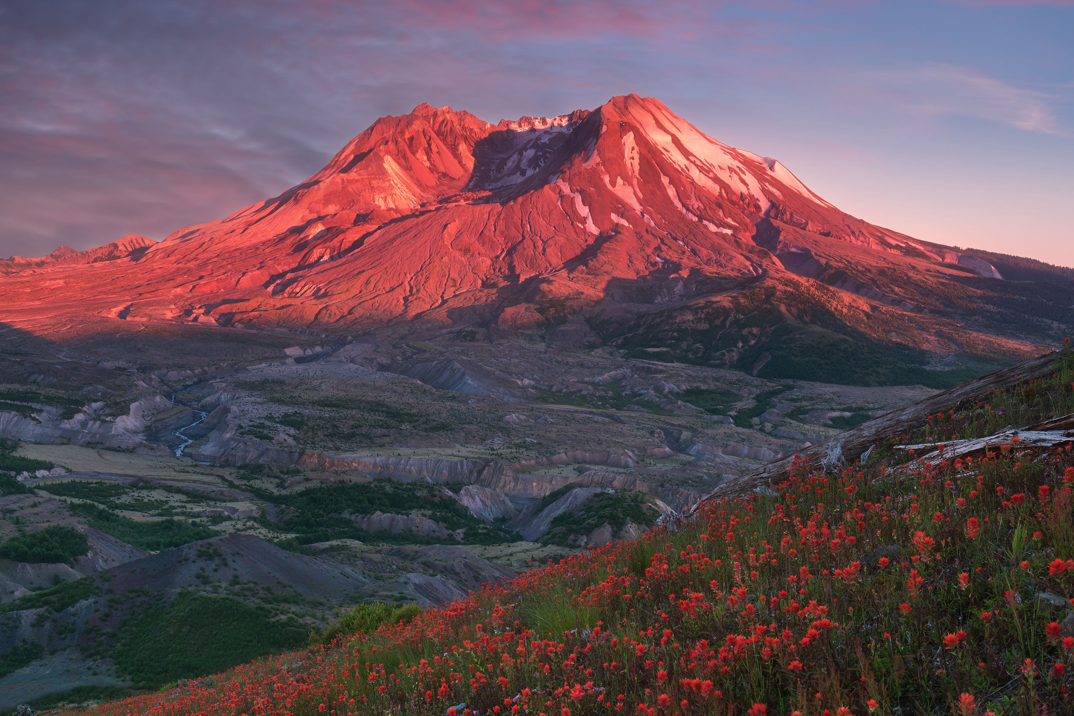
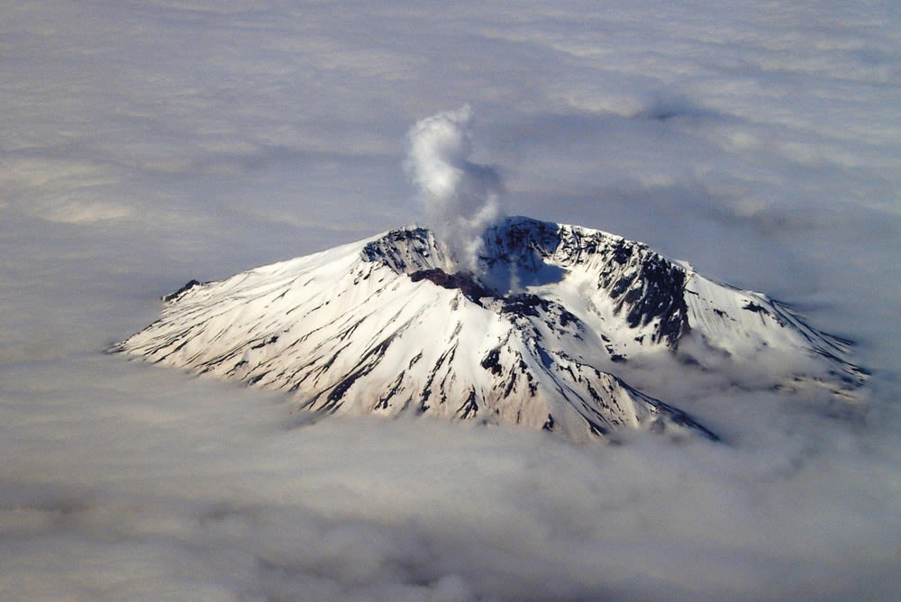
MOUNT ST. HELENS
Last eruption: May 18, 1980—the deadliest and most costly eruption in U.S. history
If it blows (again): It wouldn’t be as terrible as in 1980. There’s no summit cone left for magma to build up inside; the summer camps, lodges, and cabins around Spirit Lake were destroyed already; and Route 504, the only major access road, has been rerouted to safer, higher ground.
Threat level: Since the mountain reawakened in September 2004, a series of smaller eruptions has created a new lava dome in the center of the crater. Which means those developers thinking about plopping cabins south of the peak near the Swift Reservoir may want to reconsider.
MOUNT JEFFERSON
Last eruption: More than 20,000 years ago
If it blows: Debris avalanches would race down the Metolius and Whitewater Rivers to the east, and the Breitenbush and
North Santiam Rivers to the west—making it a really bad day to go fishing at Detroit Lake State Park.
Threat level: Jefferson is the least active of all the Northwest’s volcanoes, but it still isn’t considered extinct. And after all, you’ve always got to watch the quiet one.
THREE SISTERS
Last eruption: Possibly 50 B.C., though there were minor seismic hiccups in the 20th century
If it blows: Even a midsize debris flow—enough to fill 20,000 Olympic swimming pools—would bury the town of Sisters with all of its quaint bed-and-breakfasts. The popular adventure town of Bend, on the other hand, would remain untouched.
Threat level: Since 1997, an area about 10 miles in diameter near the South and Middle Sisters has risen by nearly a foot, thanks to magma collecting deep beneath the surface. Volcanologists say they aren’t worried. But they’re watching. Closely.