Hiking Wahclella Falls in Winter


While nearly every Portlander and tourist alike has ventured out to Multnomah Falls on a clear weekend morning (See “50 Things Every Portland Must Do"), not quite as many press on past the massive double falls—Oregon’s tallest at 620 feet—to the lesser-known Wahclella Falls, a mere ten more miles up the highway. Named after a nearby Native American village in 1915 by the Mazama mountaineering club, Wahclella Falls is open year-round, its water flow not subject to seasonality or adverse weather.
While decidedly smaller than Multnomah, Wahclella is also a double falls—its upper and lower sections tallying a combined 350 feet—that cascades thunderously into a deep blue, misty gorge encircled by moss-covered basalt.
After leaving my home in Southeast Portland around 9 a.m., I reached the trailhead in just 35 minutes. The small, circular parking lot was empty, save one or two cars (the Wahclella Trailhead requires a National Forest Park Pass or the onsite purchase of a $5 day pass). The sun not yet fully out, the road remained icy from last week’s snowfall, and I strapped small crampons onto my boots to make the two-mile round trip all the easier.
From the Wahclella Falls Trailhead, clearly marked at the end of the parking lot, the hike begins as a leisurely flat walk down a closed access road. Snow-covered and a bit icy on this particular morning, the road runs parallel to Tanner Creek, a tributary of the Columbia River edged in bright green, moss-covered trees. The road comes to an end at a small dam used by the Bonneville Fish Hatchery, and from here the footpath narrows to become a true trail, just wide enough for one person.
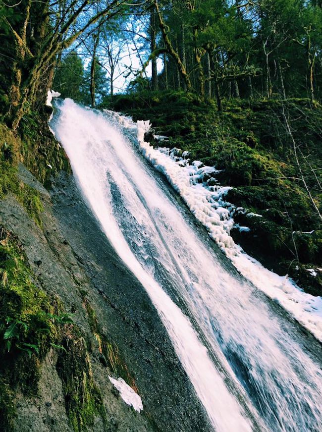
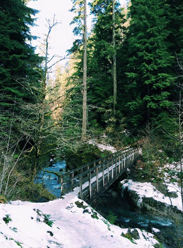
Seemingly the only person for miles, I continued on, shortly arriving at a blind curve, on the other side of which roared Munra Falls. Though a small waterfall in comparison to what awaits at the trail’s end, Munra offers the chance to stand nearly inside its rushing stream of water from a small footbridge built across its face. After crossing the bridge, the trail begins to climb. While the snowmelt can make for slow going in some places, the path never becomes strenuous or steep, and summer hiking is pretty much a breeze.
After a short set of stairs, you'll arrive at the Wahclella Falls Trails Junction. You can decide to hike both sides of the loop, or return the same way you came. I chose the lower path as it offers better views of the approach to Wahclella Falls and beautiful views of Tanner Creek in both directions from the lower bridge.
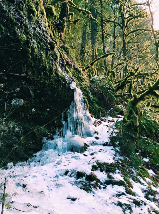
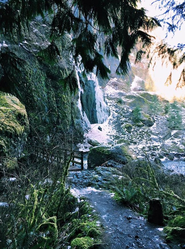
Crossing the bridge, the trail opens up into a kind of valley. No longer surrounded by trees, the path instead meanders through boulders that came to rest after a chunk of the Tanner Creek Canyon came crashing down into the creek in 1973. As I navigated the rocks, I watched large sheets of ice give way, roaring their way to the canyon floor and breaking into fist-sized blocks that shine like geodes. With Wahclella Falls in sight in the distance, I picked up my pace, watching the sky for falling ice.
I crossed the last wooden bridge, rounded some rocks, and found myself standing directly in front of the falls. While the upper section of the falls is not completely visible, the lower drops 65 feet into a deep canyon, the power of its stream misting my face on my rock perch. White water gives way to a deep blue plunge pool that looks ideal for swimming...in warmer weather. I took in the falls for longer than intended, the cool mist tingling my face, and turned to hike back to my car only when I was shaked from my reverie by the sound of other voices, the first I’d heard in my hour on the trail.
When I returned to the access road, the parking lot had begun to fill up. Families spilled onto the snow, young children and dogs in tow. Perhaps Wahclella isn’t as under-the-radar as I’d hoped, but for these few hours before noon, it felt like quite the secret.