10 Hikes and Bike Rides Every Portlander Must Know

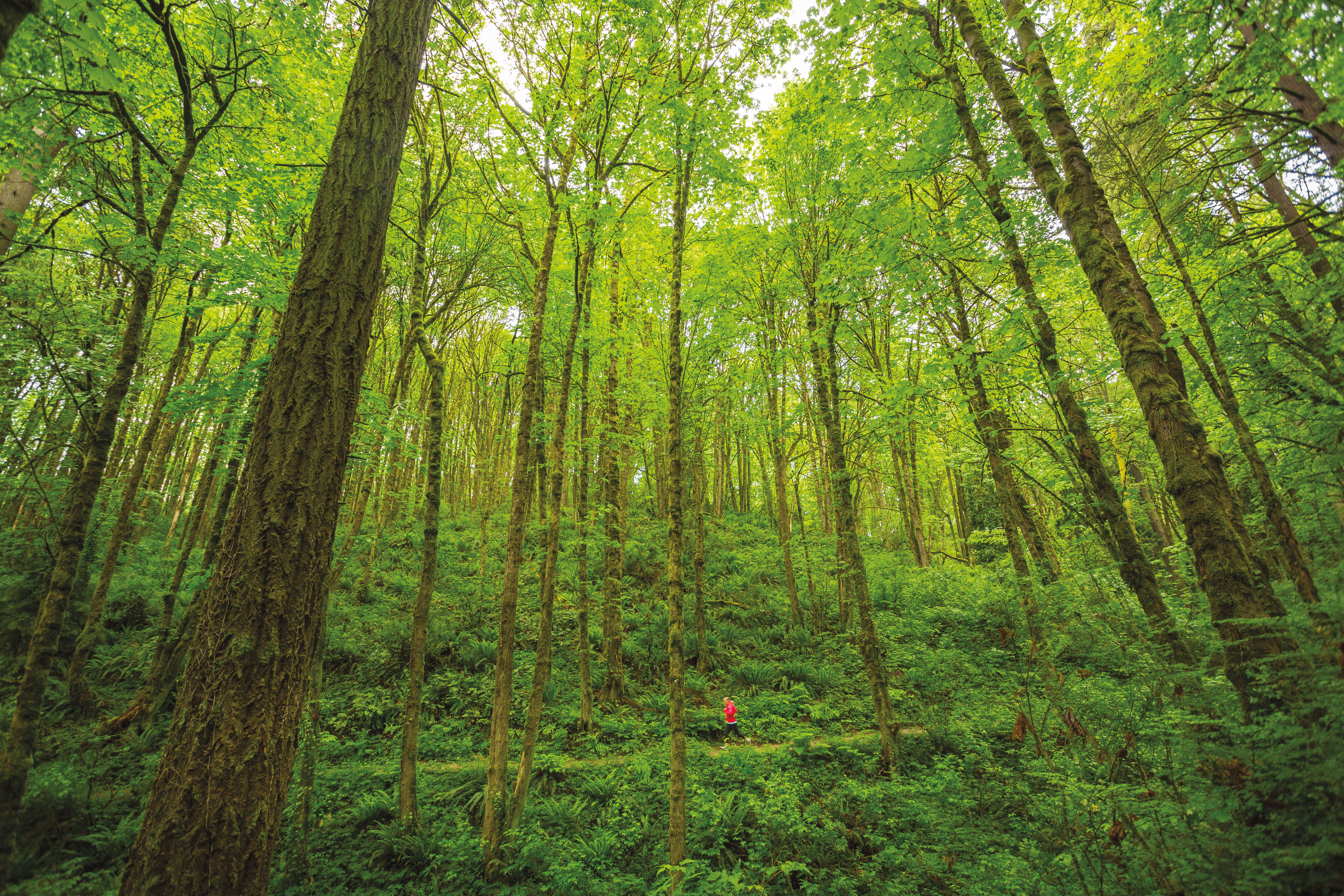
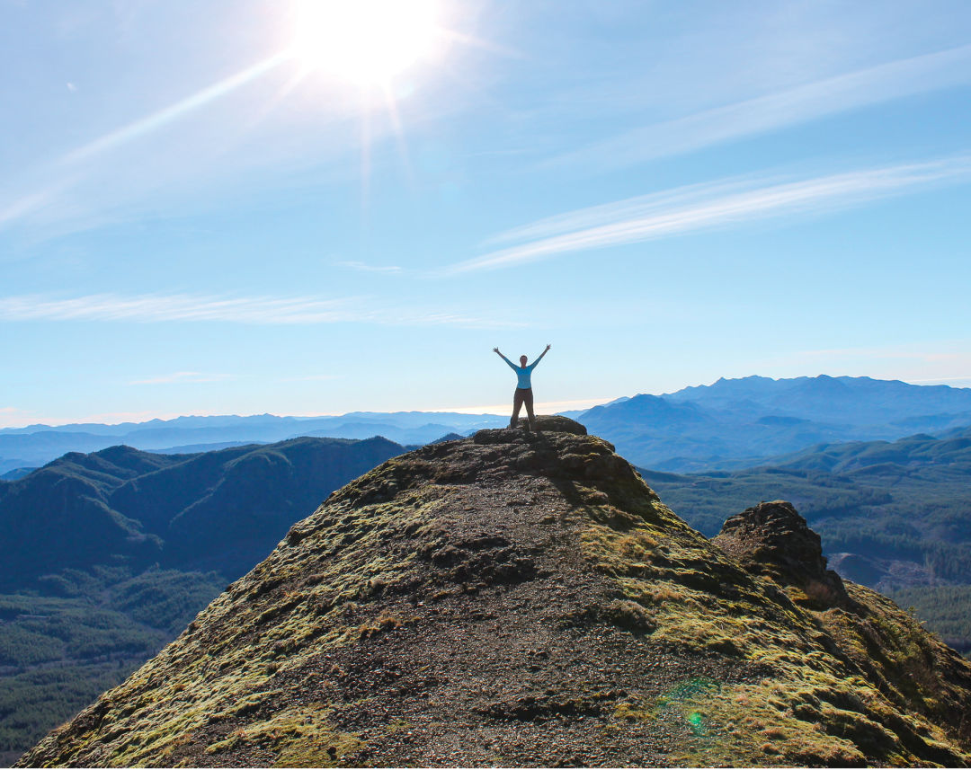
Running the Wildwood Trail
Image: Courtesy Nashco Photo
In the City
Lower Macleay to the Wildwood
Set in a lush canyon alongside cool Balch Creek, the largest stream in Forest Park, Lower Macleay Trail is an explosion of licorice ferns, leafy salal, moss-jacketed hemlocks, and a 242-foot, jade-crowned giant—the country’s tallest fir within a city. Scope out the creek’s population of native cutthroat trout, then explore the 1936 “Stone House” at the trail’s fork with the iconic Wildwood Trail.
Activity: Hiking
Distance: 2.2 miles (round trip)
Difficulty: Easy
Fee: Free
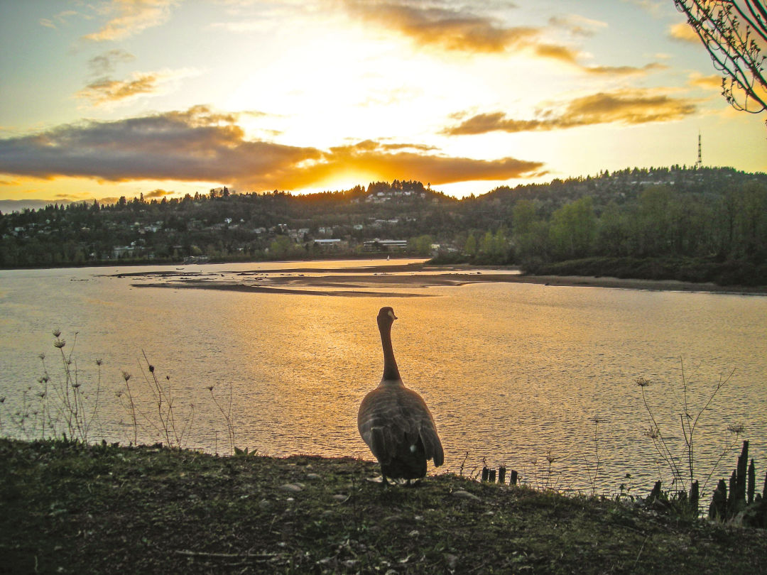
Oaks Bottom
Image: Courtesy Julie Reposa
Springwater Corridor
This commuter superhighway between Portland and Boring isn’t just for the spandex species. The well-groomed path also provides frequent encounters with woodpeckers, geese, and deer. In fact, the trail (a former railroad route) intersects with several distinct habitats as it plays leapfrog with Johnson Creek, crossing the water more than 10 times. In the low-lying wetlands of Oaks Bottom, watch for the Rose City’s official bird, the great blue heron.
Activity: Biking, hiking
Distance: Up to 42 miles
Difficulty: Easy
Fee: Free
Columbia River Gorge
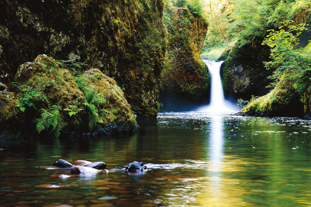
Punch Bowl Falls
Eagle Creek (CURRENTLY CLOSED)
This wildly popular hike packs some serious wow factor into a relatively short distance. Whether you decide to end at Punch Bowl Falls, continue to High Bridge, or trek all the way to Tunnel Falls, the sound of the trail’s namesake creek coursing toward the Columbia is a constant companion. Equally stirring: sections of trail that are little more than ledges, prompting the Forest Service to bolt handrails into the rock.
Miles from Portland: 47
Activity: Hiking
Distance: 3–26 miles (round trip)
Difficulty: Moderate
Fee: $5 National Forest day pass
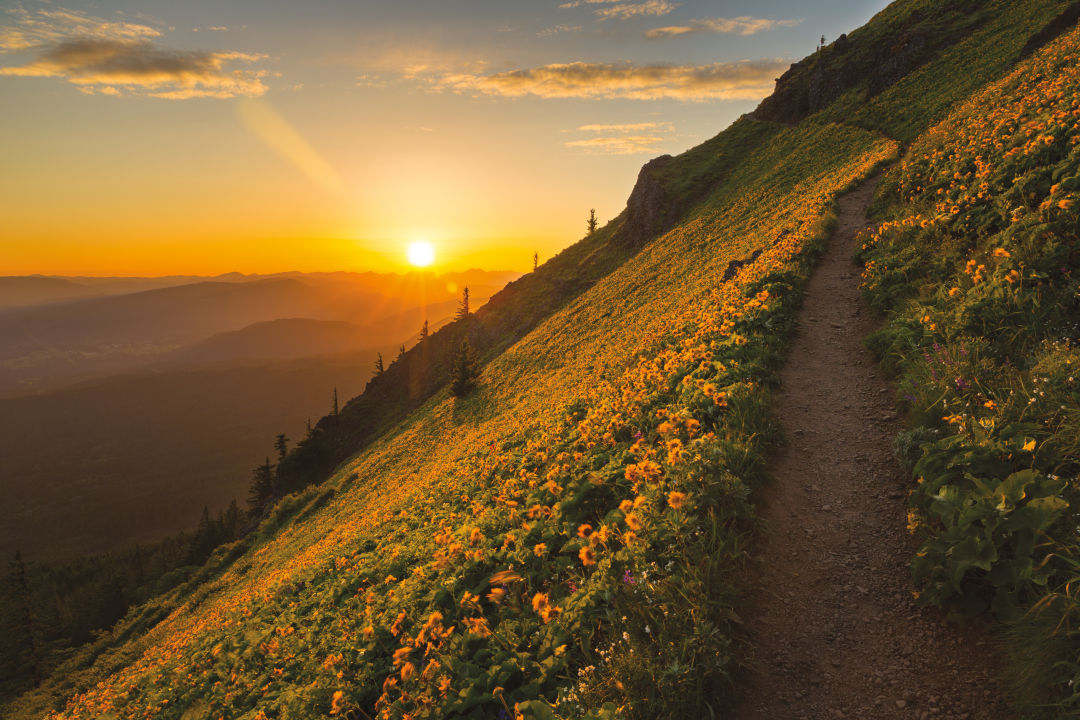
Springtime brings an explosion of wildflowers to Dog Mountain.
Image: Courtesy Blaine Franger
Dog Mountain
This popular Washington trail offers fantastic views of the Gorge and surrounding Cascadian peaks. You’ll work for it: The entire way up is steep, beginning with a 700-foot climb of no fewer than 10 switchbacks. Two forks both take hard-breathing hikers to the summit: in springtime, a riot of lupine, balsamroot, larkspur, and paintbrush. In other seasons, it’s enough to (finally) be on top of the world.
Miles from Portland: 55
Activity: Hiking
Distance: 5.9 miles (round trip)
Difficulty: Hard
Fee: $5 National Forest day pass
Beacon Rock
While reportedly only the world’s second-largest freestanding monolith (cool nod to the Rock of Gibraltar), the Gorge’s own Beacon Rock impressed Lewis and Clark, whose 1805 journals describe a “remarkable high detached rock.” And thanks to a monumental feat of Great War–era engineering, you can climb to the summit of this 848-foot-high ancient volcanic core via a real-life Chutes and Ladders game of catwalks. (As an added precaution, metal guardrails line the entire path.) parks.state.wa.us
Miles from Portland: 40
Activity: Hiking
Distance: 1.8 miles (round trip)
Difficulty: Moderate
Fee: $10 Washington state parks day pass
Mosier Tunnels Trail, Historic Columbia River Highway Trail
Had you biked or hiked this stretch of trail two decades ago, you’d have dead-ended in a pile of rubble after a mere two miles. But in July 2000, the cleared Mosier Twin Tunnels section reopened as a paved, gently graded, car-free oasis, attracting all forms of human-powered locomotion: hikers, bikers, parents with jogging strollers, in-line skaters, and even downhill skateboarders. It’s a perfect trail for families with kids of varying ages and speeds.
Miles from Portland: 64
Activity: Biking, hiking
Distance: 9 car-free miles (round trip)
Difficulty: Easy
Fee: $5 state parks day pass
The Coast
The 3,283-foot summit of Saddle Mountain
Saddle Mountain
Conquer the arduous path to the 3,283-foot summit of Saddle Mountain, and you’ll bag the highest peak in the northern Coast Range. Cloud-free days bring a bonus: uninterrupted views of the Oregon and Washington coastlines, as well as Mounts Rainier and St. Helens. But even if you don’t hit the trail under a bluebird sky, the company of white-barked red alders and rare ice age–era plants such as Saddle Mountain saxifrage and bittercress provide plenty of inspiration to reach the top.
Miles from Portland: 72
Activity: Hiking
Distance: 5 miles (round trip)
Difficulty: Hard
Fee: Free
Mt Hood National Forest

The Timberline Trail circumnavigates Mt Hood.
Image: Courtesy Blaine Franger
Timberline Trail
Built in the 1930s, the iconic Timberline Trail—a rite of passage for Oregon hikers—circumnavigates Hood’s rugged, 11,240-foot peak. Ford the gurgling Newton, Sandy, and White Rivers. Tramp through thick old-growth cathedrals of Douglas fir toward mesmerizing cascades like Ramona Falls. Absorb colossal vistas from Cooper Spur’s barren pumice plane. And at Elk Cove, gawk at one of the West’s best wildflower displays: western pasque, witch’s hair lichen, Indian paintbrush, trillium, lupine, and evergreen huckleberry.
Miles from Portland: 62 (Timberline Lodge Trailhead); 87 (Cloud Cap Trailhead)
Activity: Hiking
Distance: 41.5 (for the loop around the mountain)
Difficulty: Hard
Fee: $5 National Forest day pass
Mount St. Helens
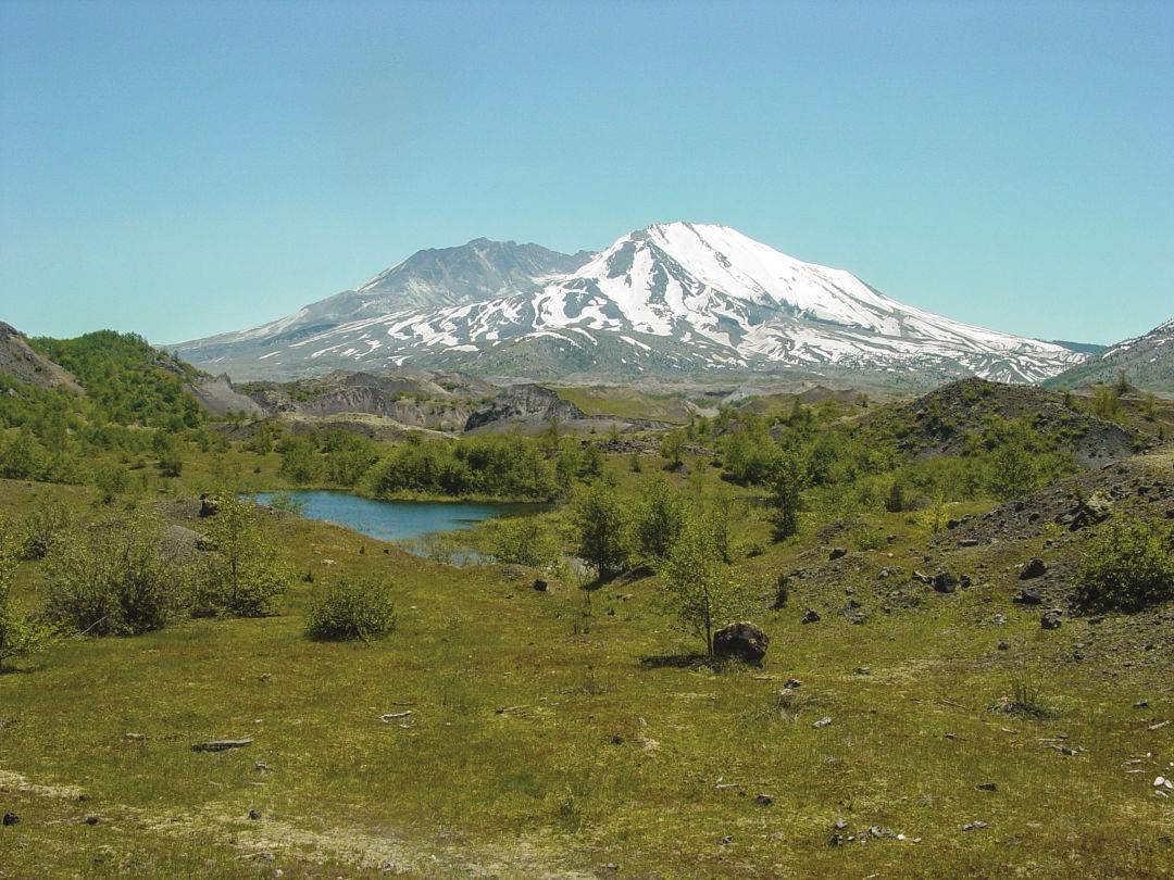
Mount St. Helens
Hummocks Trail
This family-friendly 2.4-mile loop is defined by a sequence of hummocks—huge chunks of the Washington volcano’s former peak blasted sideways and deposited on the valley floor after its famed 1980 eruption. The trail winds through this Badlands-esque landscape, flanks the Toutle River Canyon, then swings toward a cluster of wetland ponds, where the canopy of an alder forest provides a shady spot from which to spy on a huge beaver dam.
Miles from Portland: 102
Activity: Hiking
Distance: 2.4 miles
Difficulty: Easy
Fee: Free
Also Close!
Banks-Vernonia
Timber-laden locomotives once roared along this 21-mile stretch west of Hillsboro, but today it’s all yours for the cruising. The gently graded, paved trail links the rural towns of Banks and Vernonia, and its multiple access points allow families to tailor rides to just about any distance. One highlight: the sweeping view from the top of the Buxton Trestle—an 80-foot-high structure a few miles outside of Banks.
Miles from Portland: 28
Activity: Hiking, biking
Distance: Up to 42 miles (round trip)
Difficulty: Easy
Fee: Free