Hike of the Month: Yakama Nation Mt Adams Recreational Area
August 30—opening day at the Yakama Nation Tract-D Recreation Area.
Image: Gabriel Granillo
As I drove up miles of unpaved and unmaintained gravel roads, my car rattled and shook and made new noises I’d never heard a car make. It’s not quite an all-wheel drive vehicle like the pamphlet I later received would recommend for making your way around the Yakama Nation Mount Adams Recreational Area.
But on my slow trip up, I spotted two black cattle near the entrance of the 21,000-acre expanse. They both had green tags stapled to their ears. One of them looked about at the rustling trees and the dust my tires had been kicking up. The other stood up and stared at me with an intense gaze. I rummaged through my backpack and pulled out my cell phone to take a photo when, like some sort of bad omen, the intense one began snorting at me. It kicked away rocks from underneath its hooves, as if it might charge my car at any second. I decided against taking a photo, apologized to the cattle, and continued my nervous drive up toward the Yakama Nation, the cattle watching me as I drove away.
In 1855, as I would later read in the fold-out map/pamphlet, the Yakama Nation and the United States signed a treaty which ceded certain land to the Yakama and established “ambiguous” boundaries. This treaty map “became misplaced in government files,” the pamphlet reads, and a later US survey established new boundaries many miles east of the Cascade Crest. It wasn’t until 1930 that the original treaty map was found. But even after that, and after determined legal battles by the Yakama, the US didn't return the 21,000 acres around Mount Adams, including its summit, to the Yakama Nation until 1972.
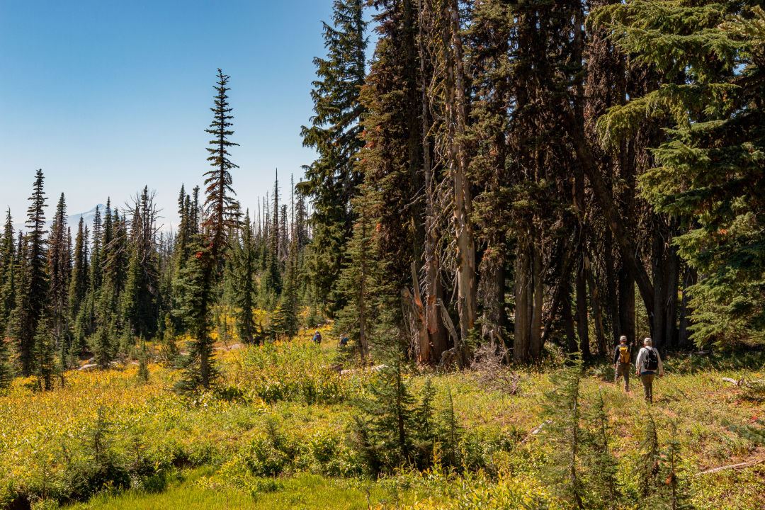
Along the T9 trail at the Yakama Nation Mount Adams Recreational Area
Image: Gabriel Granillo
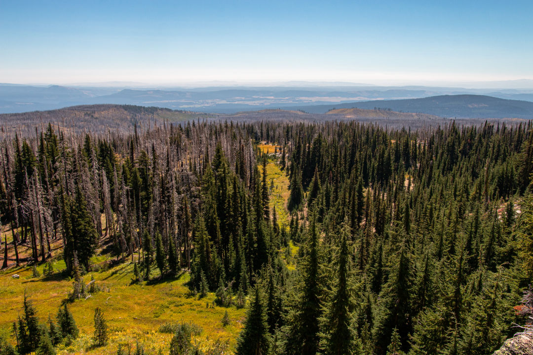
The land is also no stranger to wildfire. The Horseshoe, Cougar Creek, Cascade Creek, and other fires have keep this area in flux in recent years—a high-risk, hard-to-access place bursting with beauty and promise that we are lucky to experience. The Yakama Nation opens this land to the public once every year, and when they do, it’s typically very brief. This year, it’s open from August 30 until October 1.
There are two lakes at which to begin your excursion: Bench Lake, where for $10 (on top of a $20 day-use fee) folks can spend the afternoon fishing and hiking around Hellroaring Creek, and Bird Lake, which features a seven-plus-mile trail system that takes you through ambling water and wildflowers so bright and colorful they're almost blinding.
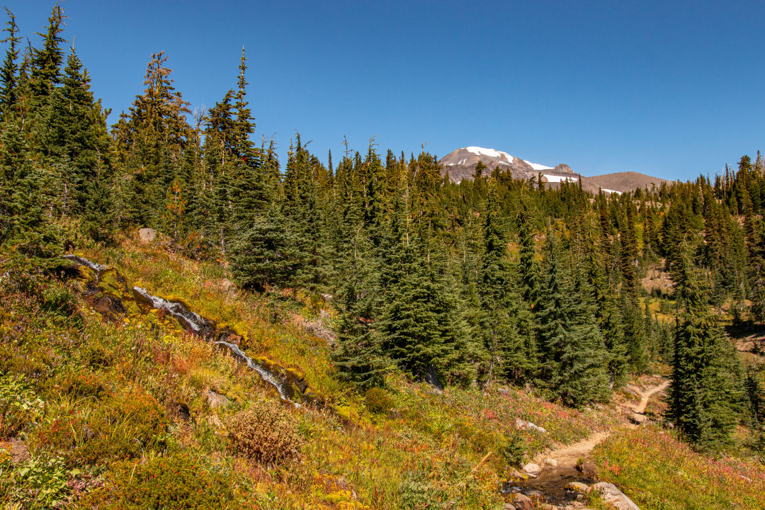
View of Mount Adams from Bird Lake Creek
Image: Gabriel Granillo
Starting off at Bird Lake, there’s a small lot at which to park, pack up, and head out. The Bird Lake Trail takes you through bare-bones trees protruding like blackened spikes through the earth. The dirt along the trail is soft and gray, ash-like.
But as you continue your trek through the trees, color begins to fill in—dark blue waters, bright purple camas, orange and yellow butterflies, magenta paintbrush, and tiny blue huckleberries if you look carefully among the bushes. Follow the sound of water, and about halfway down the trail you’ll come upon Crooked Creek Falls gushing down a nearby hill. If you follow a small path up the creek, you can wet your hair underneath the waterfall.
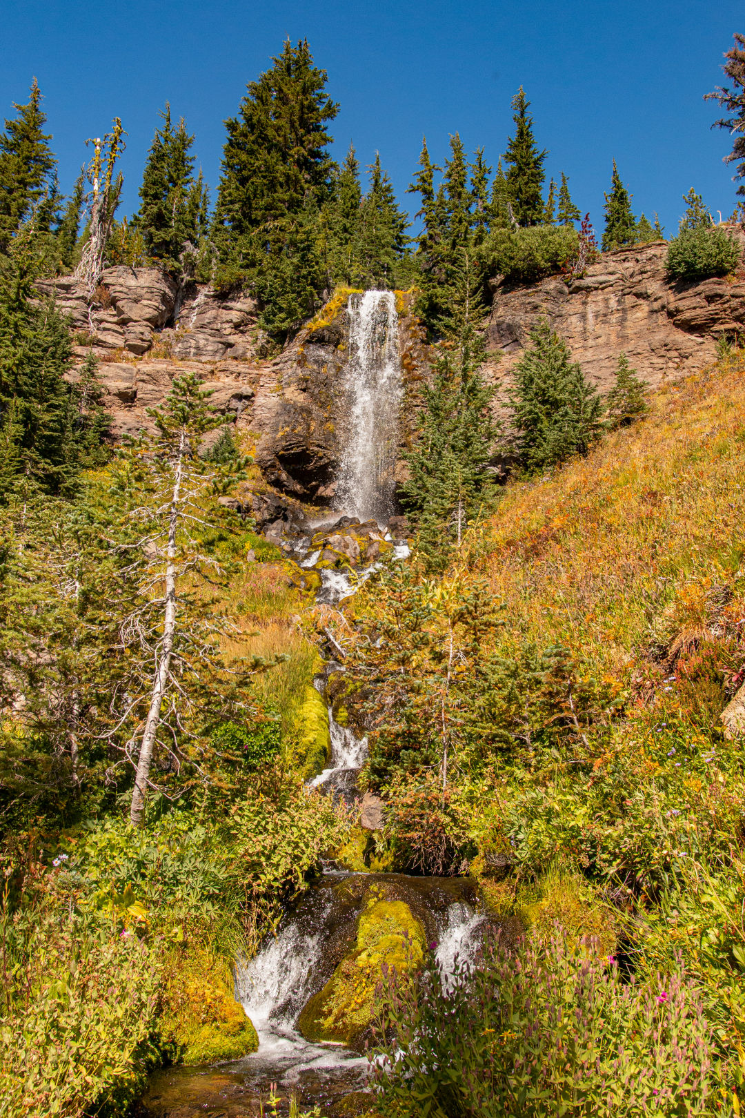
Crooked Creek Falls
Image: Gabriel Granillo
Shortly after Crooked Creek Falls, you’ll come upon the T9 trail, which you can take eastward through more meadows to stunning Mount Adams views and the boundary between the Yakama Nation and the Gifford Pinchot National Forest, or follow westward for Bird Creek Meadows. If you opt for the meadow, you can make a pit stop at the day-use picnic area and munch on a few snacks while you rest up and refuel. It was here, about two hours into my hike, that I finally ran into other hikers. As the day progressed, more and more made their way through the meadows, but for a comfortable, isolated hiking experience, the recreational area provides.
Once you’ve stretched out a little bit—and do make sure to stretch—take the Trail of Flowers up to the Hellroaring Viewpoint. Climb through rocky, shade-less terrain, where you’ll be greeted with a breathtaking, unobstructed view of Mount Adams. Take a moment to listen to faraway waterfalls and to the wind pushing through Hellroaring Meadows.
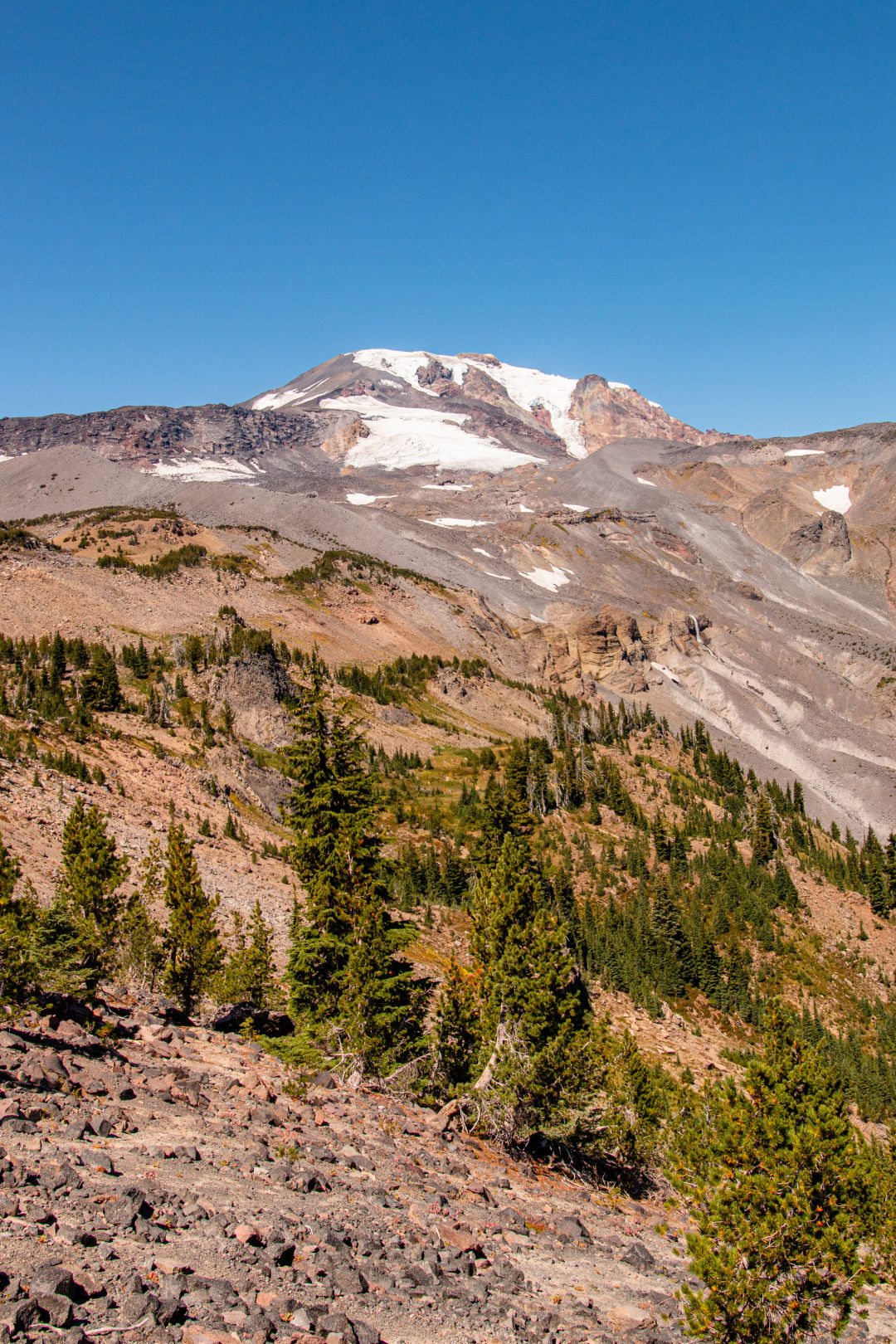
View of Mount Adams from Hellroaring View Point
Image: Gabriel Granillo
After you’ve soaked in the view, it’s all downhill from there. (Though you could follow the Mountain Climber Trail up toward Sunrise Camp for an extra challenge.) As you head down, look out for square reflective signs tagged on trees. These will help you keep track of the trail, as it’s easy to find your way wandering aimlessly among the land. For the full loop, take the Mountain Climber Trail down toward the parking lot, and then hit up the T9 trail back to the Bird Creek Meadows picnic area. From there you can swing by Bluff Lake, and then back to Bird Lake.
Tighten up your laces and bring extra water. The hike, as well as the drive up, can be difficult, but the views and the alone time among the battered-but-beautiful area is worth it. And if you need a little inspiration, let a sign upon a tree on the T9 trail near the entrance guide you. The sign features a quote by Aldo Leopold, the famed author and naturalist: “The richest values of wilderness lies not in the days of Daniel Boone, nor even in the present, but rather in the future.”
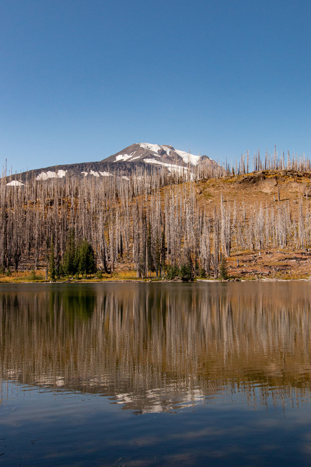
Damage to the area by various wildfires including the Cougar Creek fire.
Image: Gabriel Granillo
Looking out at the field of half-burned trees before me from a viewpoint at Bird Creek Meadows, Mount Hood with a thin layer of haze surrounded its peak, I thought about the wildfire that consumed this place, the wildfires currently looming large in Lake Tahoe, and I wondered what sort of future we’d see 5, 10, 20 years from now. What condition would we leave the land for our children and for future generations who should be blessed with the same opportunities to see and experience nature the way we do. Though my legs had been aching, my body feeling the change in elevation, the persistence of the people of this land, who fought for more than a century to reclaim it, gave me hope and some persistence of my own.
Driving down the 10-mile stretch of unpaved roads, I again spotted the cattle near the entrance gates, this time with about three or four others. As I drove by, one stood up, the intense one from before. I recognized his big, watchful eyes, and felt like I suddenly understood what he had been trying to say to me earlier. I didn’t stop and I didn’t take out my phone. I thanked the cattle for their time and drove back home.
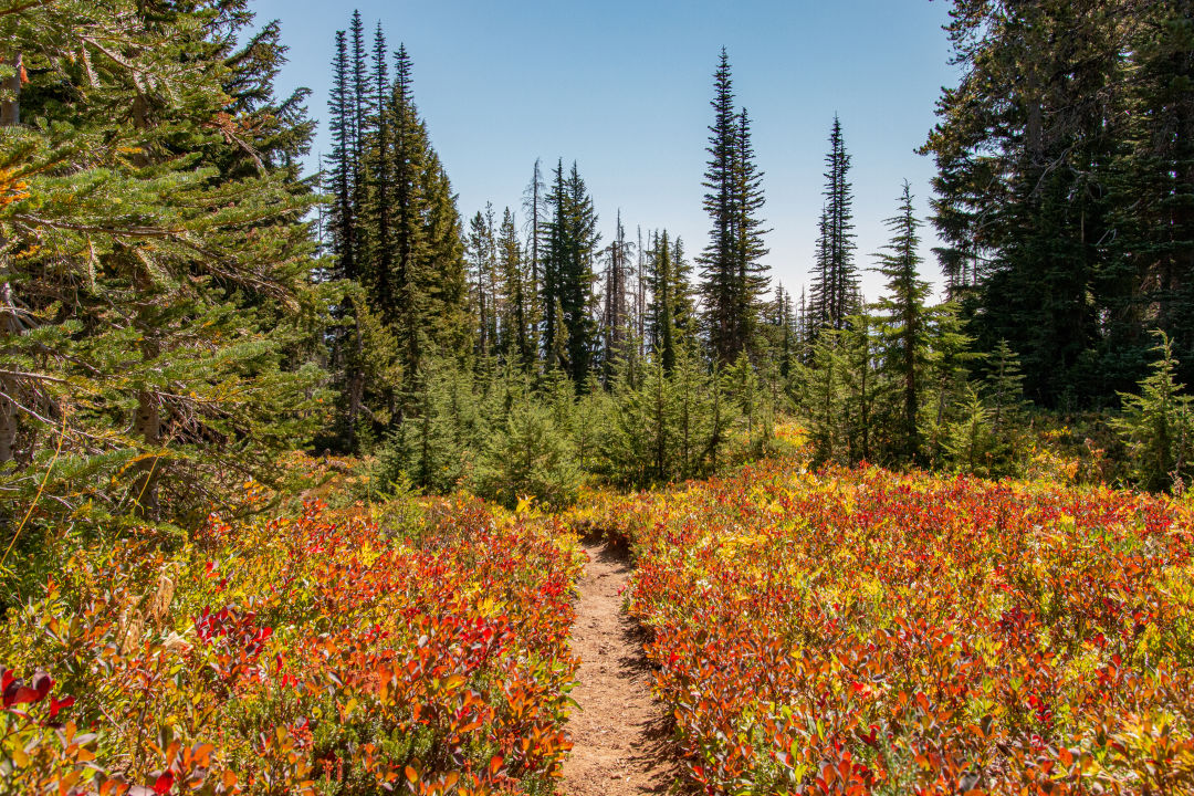
Along the Flower Trail
Image: Gabriel Granillo
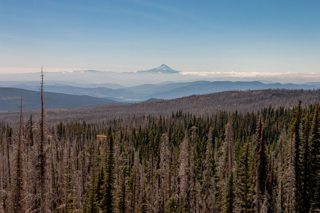
View of Mount Hood from the Yakama Nation Mount Adams Recreational Area
Image: Gabriel Granillo
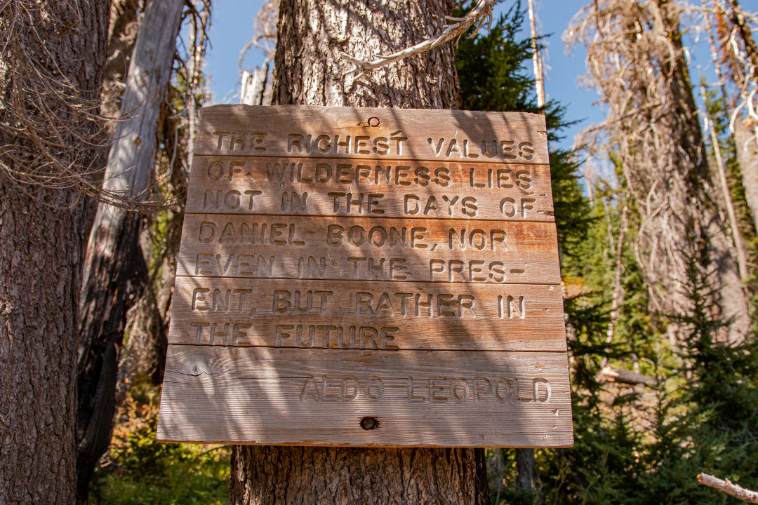
“The richest values of wilderness lies not in the days of Daniel Boone, nor even in the present, but rather in the future.”—Aldo Leopold
Image: Gabriel Granillo
Drive time: 2 hours and 30 minutes // Distance: Varies // Difficulty: Difficult // Directions: Take Interstate 84 for about an hour to exit 64 for Mt Hood Highway toward OR-35 White Salmon/Govt. Camp. Cross the Hood River Bridge (toll is $2) and follow WA-14 W for two miles, and then right on WA-141 Alt/WA-141. Alternative N for 19. Hang a right onto Mt Adams Rd and follow unpaved roads for about 10 miles until you reach the area. Compact cars—as I've learned—are not advised.
Day-use fees are $20, plus $10 for fishing permits. The area will be open through October 1.
Do you have a trail to recommend? Send your trail tips to [email protected]


