All Hail the King Tides: What to Know about the Coastal Phenomenon
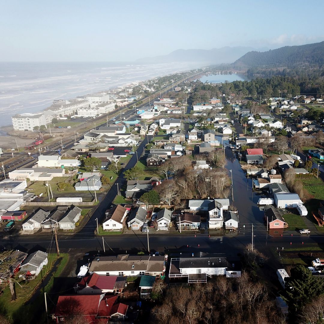
Rockaway Beach - flooding on South 2nd Ave and Coral St
There are a few ways to describe the annual Oregon King Tides Project, now in its 12th year: a citizen-science project, a crowd-sourced visual documentation of rising sea levels not just in Oregon but along the coasts of California and Washington, a call to action. But one thing it’s not, says Jesse Jones, is “a spectator sport.”
Jones, a volunteer coordinator with CoastWatch who has been involved with the Oregon King Tides Project (co-coordinated by CoastWatch and the Oregon Coastal Management Program) for three years now, says photographers from all over Oregon come to the coast each year to help document how changing high tides—and ultra-high "king tides"—are affecting coastal communities. Sometimes, she says, those good intentions are met with ill-preparedness.
“We ask people to take photographs from a safe point,” Jones says. “This is a time that we are made aware of these [king tides], the power of the ocean on our shores. Some of our places where we live and work are there at the edge.”
Fair warning aside, the project, Jones says, is an exciting opportunity for Oregonians to gather important visual data to help cities on the coast plan for rising sea levels and changing tides, both of which are being exacerbated by climate change. “The king tides of today,” she says, “are the high tides of tomorrow.”
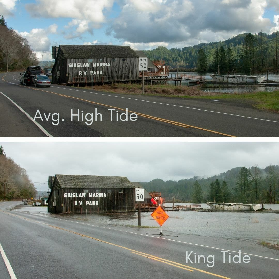
The Siuslaw Marina and Store, Cushman, on Hwy. 126 four miles east of Florence, during average high tide and king tide.
Image: Courtesy John Bragg
So what is a king tide, exactly? King tides are a non-scientific term referring to the highest winter tides that occur each year—and this year those highest tides are predicted to happen November 5–7, December 3–5, and January 1–3, 2022. These king tides occur when the earth, moon, and sun are in alignment at their closest points. Their gravitational influences on each other create extreme tidal events known as perigean spring tides.
The Oregon King Tides Project began in 2009, after a few folks from the National Oceanic and Atmospheric Administration wanted to talk about climate change and rising sea levels in a way that brought it down to the local level. Among those folks was Marina Psaros, a sustainability expert and one of the founders of the King Tides Project. Psaros helped launch King Tide projects in California, Oregon, Washington, and Australia. From the very beginning, she says she knew the impact of photographs would be stronger than words.
“The whole idea was to put the photographer at the center of their own experience,” Psaros says. “And it was really about social media. We wanted people to share what they were seeing and to be able to talk about climate change in their own words and in their own communities.”
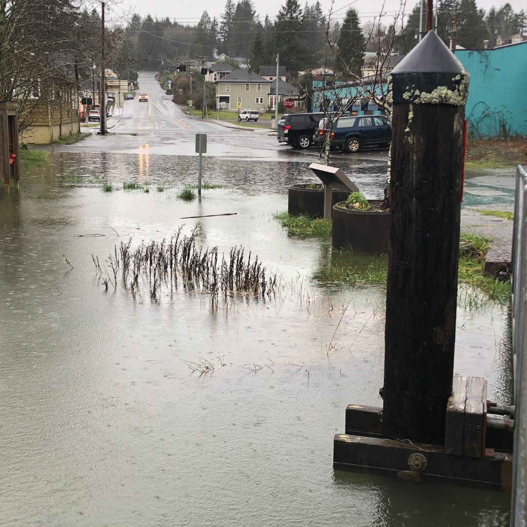
Nehalem River merges with 6th Street in Nehalem
Image: Courtesy Tamara Enz
In the 12 years since the King Tides Project’s founding, climate change has caused sea level to rise globally. In Oregon, as sea levels rise, low-level shore lands and the communities near them have been affected and estuary floodplains have increased. Documenting these changes not only help the vulnerable communities near the sea who are most impacted by them, it also helps us think about city planning, design, and building in a way that is conscious of realities of climate change.
“Climate change is affecting all of us. And what happens in our oceans affects all of us,” Psaros says. “Something like 40 percent of the world of the entire global population lives within 50 miles of the sea. What happens to our coastlines and our cities and communities the world over will have an impact on all of us.”