Hike of the Month: Gnat Creek
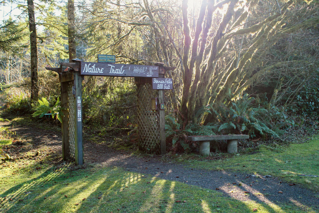
Image: Sam Stites
Getting out of the house in winter is hard. Rain-soaked trails, gray skies, and a general shortage of daylight all lead to a lack of motivation to be outdoors. But for many of us, cabin fever is real. So is the seasonal depression that comes with not being able to move our bodies in the ways we’d like to.
So, if you’re trying to finish out the month strong (or start February off on the right foot) by adventuring in the outdoors, we’ve got just what the doctor ordered with a hike at Gnat Creek.
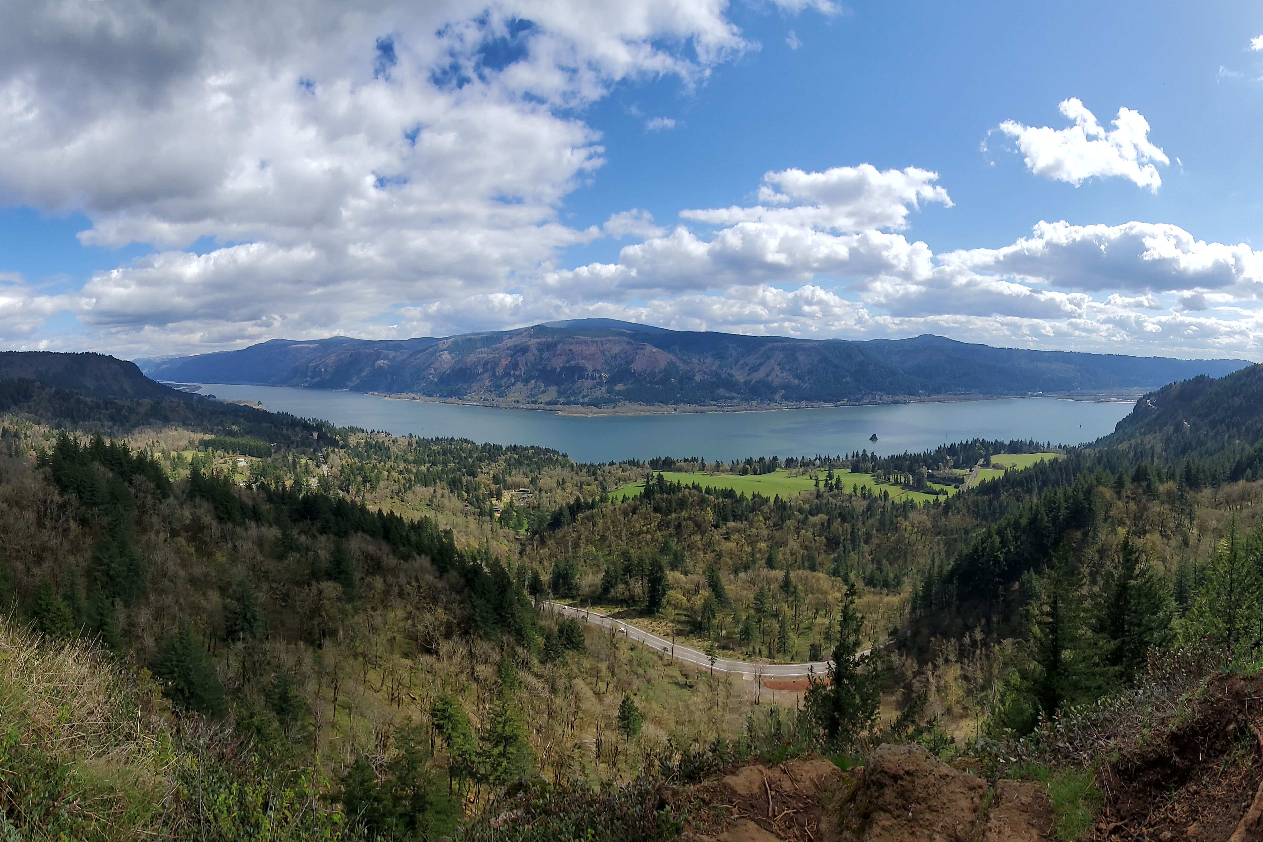
Gnat Creek is a lightly trafficked, out-and-back route through a replanted forest of Douglas fir and western hemlock logged a century ago, peppered with alder trees and sword ferns. The trail can begin from two different points depending on what length you’re looking for. I started from the Gnat Creek Fish Hatchery located along Highway 30 just past Wauna mill near the mouth of the Columbia River. The other starting point is the Gnat Creek Campground just another quarter mile down the road. The 1.5-hour drive to this hike is a heavenly escape if you’ve been stuck inside or surrounded by the hard elements of concrete, steel, and glass for too long. But the sound of water surging over and through rock, as well as the aroma of fresh evergreens and dank fungi you can take in along this trail make it the perfect place to get away from the doldrums of city living in wintertime.

Image: Sam Stites
Arrive at Gnat Creek Fishery in time to make sure you’ll have plenty of light: the tree canopy gets thick at some points and can make navigating the trail difficult if you can’t see roots and rocks sticking up. I showed up around 1 p.m. and was leaving the parking lot by 5 p.m., but I also took about an hour to hang out around the fishery and read all the information about the rearing the Oregon Department of Fish and Wildlife does there of rainbow trout, chinook salmon, and sturgeon. If you’re a nerd for that kind of thing, be sure to bring some quarters to feed the fish in the holding ponds or stick around to watch one of the hatchery workers dump buckets of pellets so you observe the feeding frenzy. There are also interpretive signs—thanks to a local Boy Scout’s Eagle project—located throughout the route that tell you about the geological, natural, and indigenous history of the area.
The trail is generally well kept, and pine needles make it less muddy than you might expect for winter. But there are points where you cross small, seasonal streams that flow down into the creek, so waterproof boots are highly recommended. No need for trekking poles as the terrain is relatively moderate, but you will need to clamber over a couple small trees that have fallen across the trail.
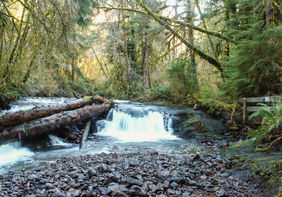
Image: Sam Stites
From the fishery, head over to the wood archway that says “Nature Trail" at the southwest corner of the parking lot. Stop briefly to take in the falls across the creek from the ODFW volunteer campsite and head on up the trail cut through brambles and hugging the west side of the creek.
About 800 feet down the trail, you’ll turn left and head down toward the creek. Keep left again at a fork to meet up with Barrier Falls, where there’s a small bridge crossing a stream that links up with the creek below the falls. Cross the bridge and follow the trail along the creek for another quarter mile before it turns to the right and pops you up across the road. As you cross, notice there’s a concrete structure down it to your left. That’s a fish ladder for wild populations of steelhead and coastal cutthroat trout to access the upper reaches of the creek for immaculate spawning habitat.
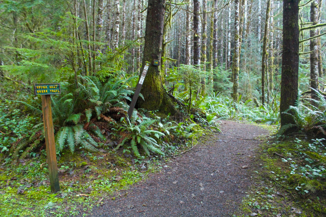
Image: Sam Stites
Cross the road and bear left to continue to Upper Gnat Creek Trail, which heads up the hill and deeper into the forest.
You’ll make a short climb and drop back down to a short footbridge before continuing to climb for about the next 20 minutes, crossing a few smaller streams that you can tiptoe on rocks to get across before rising and falling gently as it meanders along the hillside high above the creek. Despite being a good 200 to 300 feet above the creek, you can still hear rushing water most of the way, but some turns will lead you up the hill and sweet silence will press against your ears. Being alone, I did get slightly worried that I could wind up being a snack for some form of big cat—I should’ve brought my bear spray, or dog—but loud footsteps kept anything that might’ve stalked me at bay.
At about the 1.5-mile mark, you’ll drop back down and hug the creek again as you approach the turnaround point at the trail’s intersection with Bigfoot Creek, where a road leads off deeper into the forest. Another trail to your right goes uphill for about a quarter mile, but stay on the trail to your left to reach the turnaround.
The turnaround is just that, a small loop that features a bench overlooking the creek where you can rest, eat a snack, and slurp some water while taking in the sights, smells, and sounds of this dense and exuberant forest. When you’re ready, complete the loop to head back to your vehicle at either the fishery or campground if you decided to do the longer hike. I’d wager the longer hike would take around four to five hours to complete, as opposed to the two to three hours the shorter route from the fishery took me. According to my GPS, the hike was 4.7 miles, but that also includes all the jaunts I took off trail to go check out the creek trying to scout locations to fish for wild trout in the future.
Drive time: about an hour and a half // Distance: around 4 miles, though hikers can choose shorter portions along the way // Difficulty: Moderate // Directions: Take US-30 West from Portland for 70 miles, turn left at Gnat Creek Fishery Road.