Where to See Oregon's Most Spectacular Waterfalls
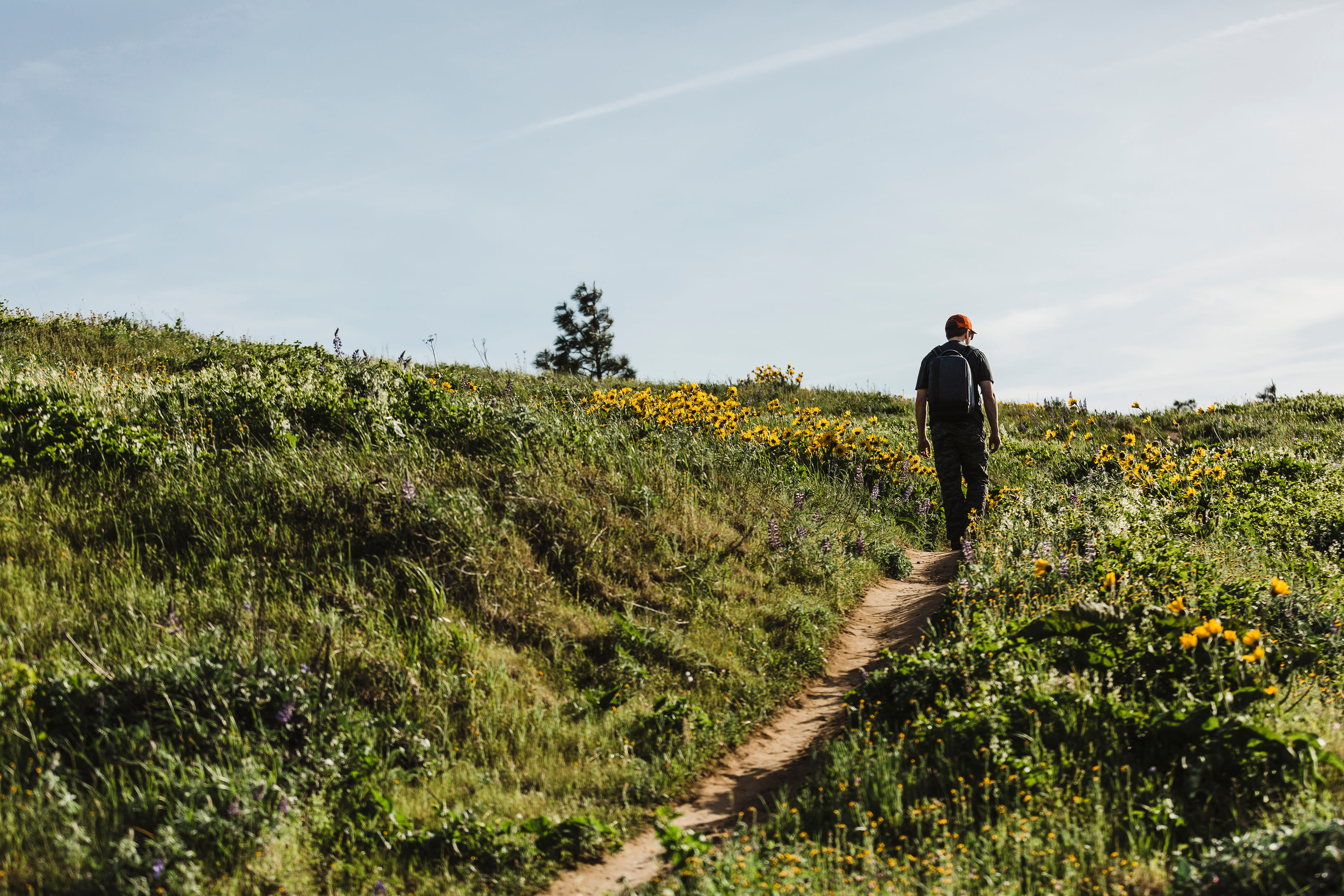
Oregon won Big in the waterfall lottery. Glorious cascades dot our state, punctuating hikes, providing picnic backdrops, and soundtracking picturesque naps. In the spring, streams surge with snowmelt, which makes for especially dramatic waterfall scenes. (Plus, wildflower season has begun.) Here are a few of our favorites.
Columbia River Gorge Waterfall Corridor
30 Minutes from Portland
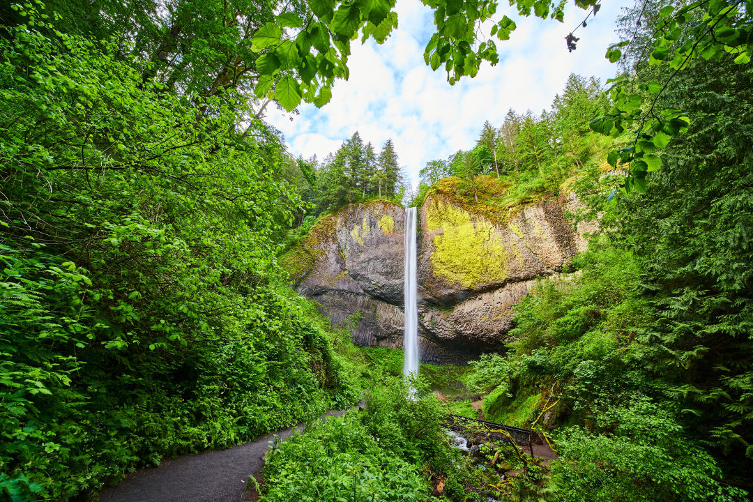
The Oregon side of the Columbia River Gorge, as most Portlanders know, is positively lousy with waterfalls. Find a particularly dense stretch of cascades on the Historic Columbia River Highway between Corbett and Dodson. The grandaddy, of course, is the two-tiered Multnomah Falls—at 620 feet, it's the tallest waterfall in the state (and the second tallest in the country) and a must-see for many Gorge visitors. More than a million people visit annually, and timed-use permits are required between May 23 and September 1, 2025. But there are plenty of other falls to ogle at, including Latourell (take the short walk from the parking area to the viewpoint, or tackle a 2.4-mile loop hike), Bridal Veil (where you'll find two short trails), and Horsetail (visible from the side of the Historic Columbia River Highway, or carry on for a 2.6-mile loop). Note that ongoing construction near Multnomah Falls may impact traffic throughout the area.
Dry Creek Falls
50 minutes from Portland
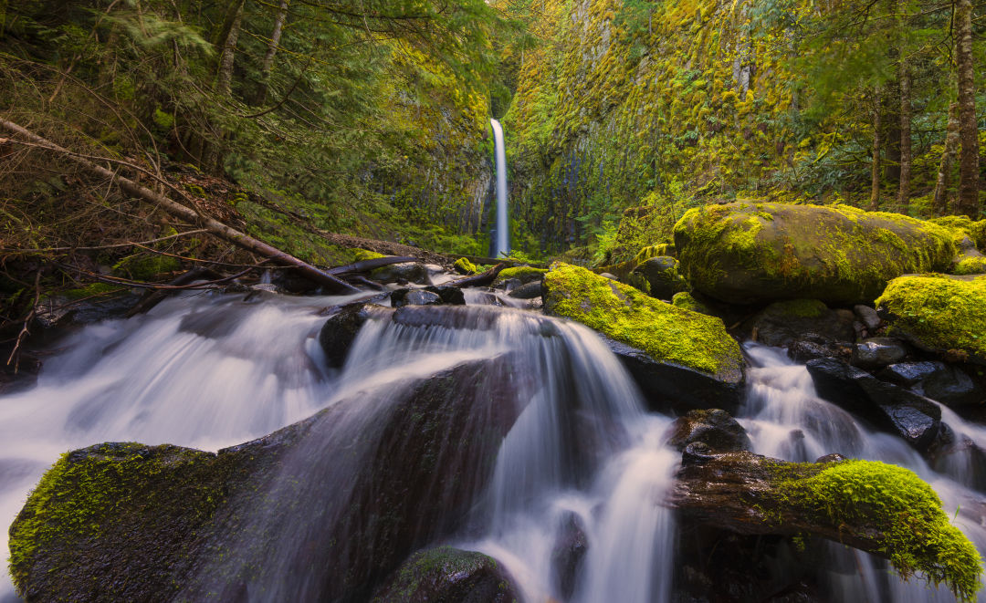
Farther east in the Gorge, near Cascade Locks, you'll find Dry Creek Falls, a 74-foot waterfall surrounded by columnar basalt. Park at the Bridge of the Gods Trailhead for an easy, 4.4-mile out-and-back hike, which carries you along the Pacific Crest Trail and through a forest of Doug fir and big-leaf maple. Once used as a municipal water source for the town of Cascade Locks, the falls and creek did once run dry, and you can still see ruins from the diversion system at the base of the falls. Today, however, Dry Creek puts on a year-round show. Expect to encounter evidence of 2017's Eagle Creek Fire, but the canopy is largely intact.
Silver Falls State Park
75 minutes from Portland
Like the Gorge's waterfall corridor, this very popular state park just east of Salem punches hard, packing 10 falls into a scenic 7.2-mile loop trail. At the 177-foot South Falls, the tallest single-drop cascade in the park, the path dips behind the rushing cascade, so prepare to get splashed, especially during the spring melt. Fall is another stunning season, a time to thread through fiery foliage; color usually peaks mid-October.
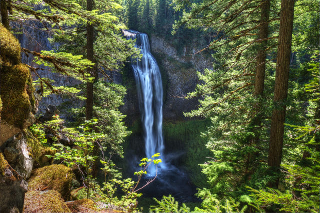
Ramona Falls
75 minutes from Portland
Formed from a slab of columnar basalt, this 120-foot-wide cascade on the west side of Mount Hood fans out like a giant bouquet of mossy toadstools draped in a shimmering, lacy sheet of water. You'll work for this spectacle: The 7.1-mile lollipop loop gains 1,000 feet of elevation and at the one-mile mark requires a crossing of the Sandy River that must be navigated with care, especially when the river is swollen with snowmelt. You'll need to wade through or find a log to walk across, and don't chance it; hikers have drowned here. It's best saved till midsummer or fall. While the challenge tests hikers’ resolve, it doesn’t do much to deter crowds, and you may well encounter a packed house at Ramona’s showy display.
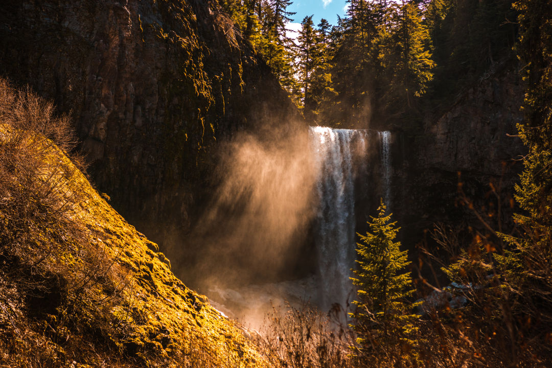
Tamanawas Falls
90 minutes from portland
On the east slope of Mount Hood, the 3.8-mile out-and-back hike to Tamanawas traces the rushing East Fork Hood River and the silt-tinted Cold Spring Creek. It weaves around glacially deposited boulders, shaded valleys, old-growth ponderosa pines, and high ridges surveying rippled canyon walls. The roughly mile-long portion bordering Cold Spring is especially pleasant on sunny days, when rays filter through cottonwood and larch trees. Two log footbridges provide photogenic backdrops along the way. The falls themselves are about 100 feet tall and wedged into a basalt amphitheater, raining down like a permanent thunderhead. Standing space is limited near the cascade, so consider soaking up mist waves a few steps back from the (hopefully) sun-warmed boulder field.
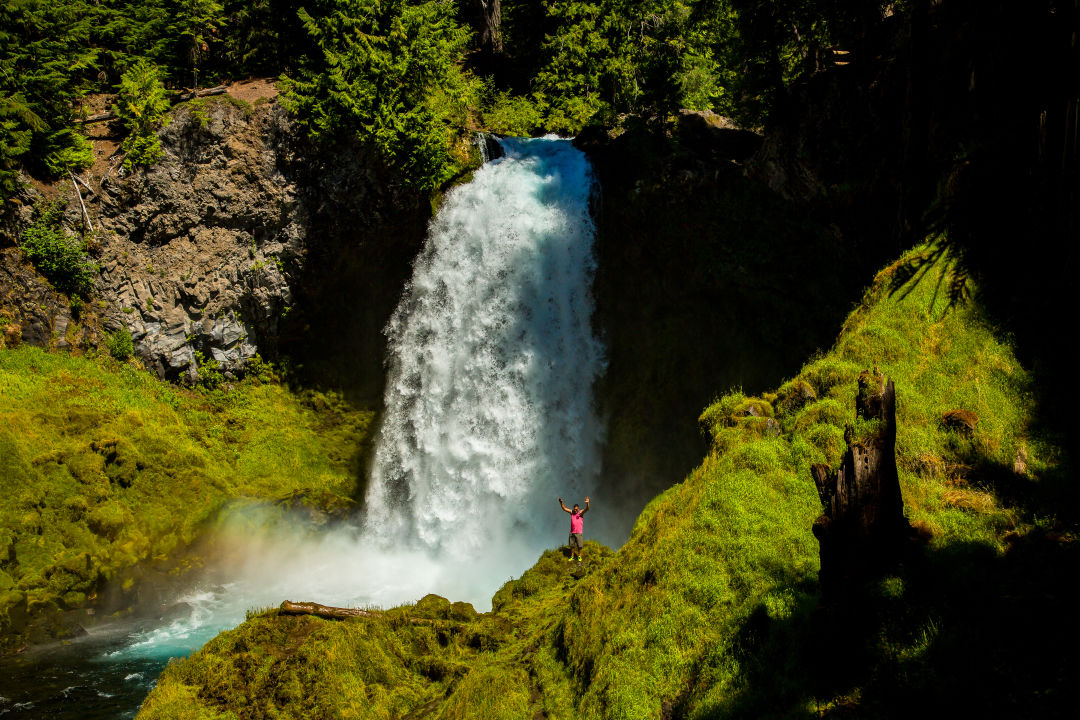
Sahalie & Koosah Falls
2 hours and 45 minutes from Portland
Along the McKenzie River in the Willamette National Forest, find the Oregon waterfall featured in Disney's Homeward Bound—Sahalie, from a Chinook jargon word for “heaven.” There’s a viewpoint right by the parking lot, and an easy 2.6-mile loop leads you to another view of the 73-foot-tall falls as they plunge over a lava ledge, and then to the similarly sized Koosah Falls. (Its name translates to “sky.”) As you stroll, take in striking views of the ice-blue McKenzie as it rushes through mossy, lush forest.
Salt Creek Falls
3 hours from Portland
One of Oregon's tallest single-drop cascades, Salt Creek Falls tumbles 286 feet over a basalt ledge. About an hour southeast of Eugene and six miles west of Willamette Pass, the falls can be taken in from a wheelchair-accessible viewing platform 50 yards from the parking lot. A steep staircase trail leads to the base of the waterfall. A one-mile lollipop loop leads to numerous viewpoints, including one head-on with the falls. For something longer, a 3.7-mile loop follows the canyon rims of Salt Creek and Diamond Creek and takes a spur trail to the very pretty Diamond Creek Falls.
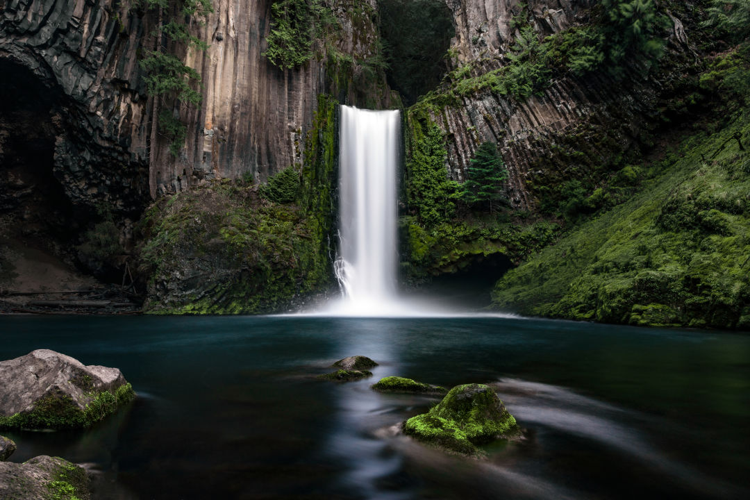
Toketee Falls
4 hours from Portland
The striking, two-tiered Toketee Falls drops roughly 120 feet from an amphitheater of columnar basalt on the North Umpqua River, about 60 miles east of Roseburg. From the parking area, a 0.4-mile trail crosses a footbridge and passes through old-growth forest before reaching nearly 200 stone steps that lead along the side of the canyon to a viewing platform. As appealing as the water below might seem, refrain from hopping the fence and following the slippery descent. Instead, cool off in the mist above.