9 Picture-Perfect Wildflower Hikes Within 90 Minutes of Portland

More often than not, when people think of Portland hikes, they think of lush greenery: thickets of sword ferns and wood sorrel hugging the sides of Forest Park trails, abundant miner’s lettuce and dock near Tryon Creek. But for a brief window between April and June, other colors erupt. Find concentrations of them just outside Portland, along the buttes and orchards of the nearby Columbia River Gorge, things like lupines and larkspur, red paintbrush and desert parsley. Even in the metro area, trails sport pops of purple in the form of Oregon iris and camas when the winter chill begins to subside. Ranging from leisurely loops to thigh-burning climbs, these hikes all reward in floral abundance. Take in the sights (and smells) of the rainbow on the Oregon or Washington side of the Columbia River Gorge, dip out to the Coast Range, or stick close to the city.
COLUMBIA RIVER GORGE, OREGON SIDE
Mosier Plateau
3.5-mile out-and-back
Distance from portland: 1 hour
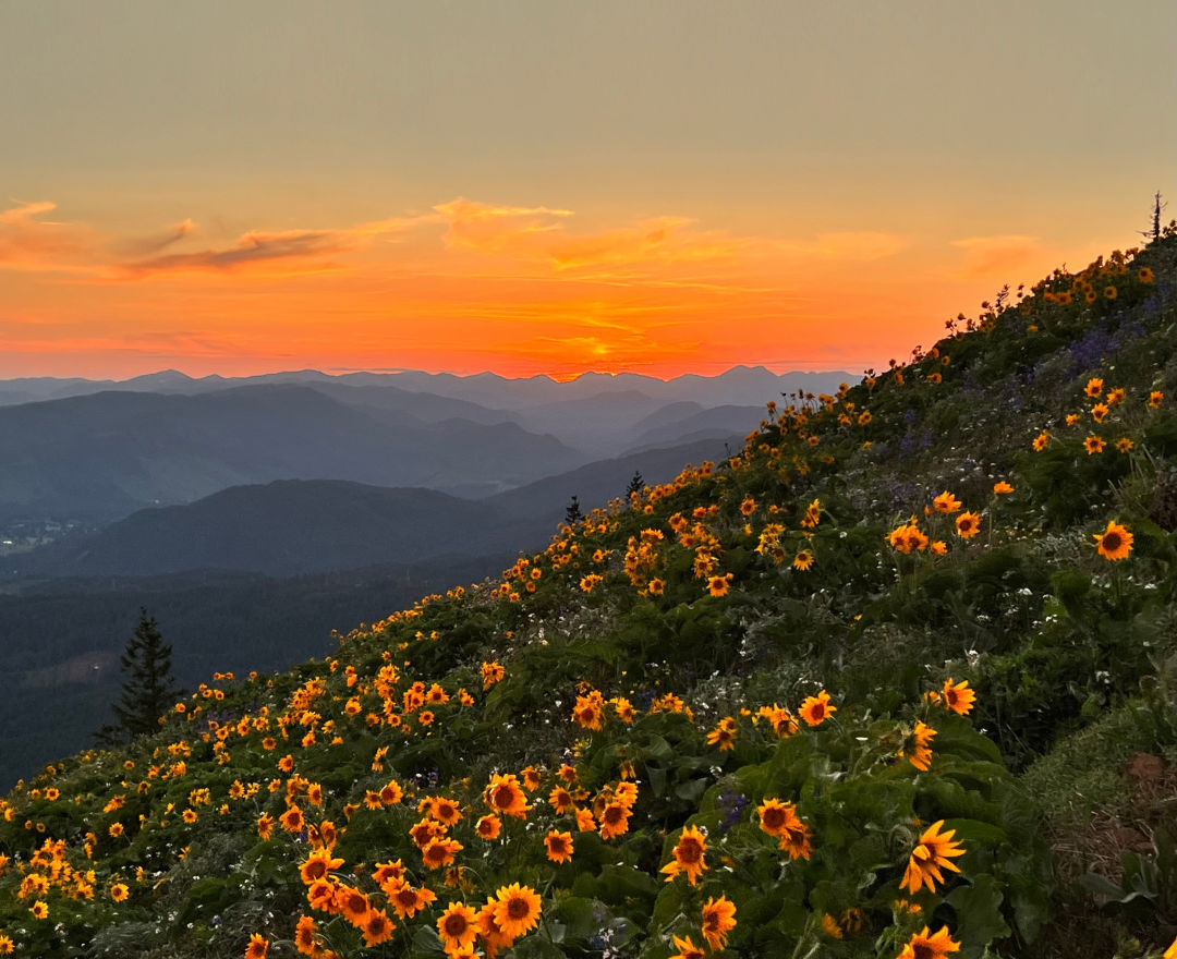
On this short but stunning hike, a veil of yellow balsamroot and purple lupine drapes the 45-acre plateau every spring. And those aren’t the only blooms here: Mosier Plateau is home to more than 30 types of wildflowers, so be on the lookout for desert parsley, cluster lilies, and yellow bells, to name a few.
Park in downtown Mosier (the town’s founder, Jonah Mosier, established sawmills here in the 1850s) by the Totem Pole Plaza and pick up snacks at the market. Then walk east, crossing the century-old Mosier Creek Bridge, which was restored in 2017. The first part of the trail cuts through Mosier Pocket Park along a cemetery where members of the Mosier family are buried. Get your camera ready for the idyllic Mosier Creek Falls, a two-tiered waterfall with a swimming hole that’s popular in summer. From here, the trail gradually ascends along a series of switchbacks with wildflowers dominating the slopes. Top out at a viewpoint that grants a bird’s-eye view of the Gorge spilling out in all directions, with Coyote Wall just across the Columbia River. —Michelle Harris

Memaloose Hills
3.2-mile out-and-back
Distance from Portland: 75 minutes
While it’s an unofficial trail, Memaloose Hills still sees flocks of wildflower seekers in April and May. Expect yellow balsamroot and purple lupine shot through with sparks of red paintbrush.
Begin at Memaloose Overlook—which is itself worth a few minutes of your time, with sweeping views of the Rowena Gap and Memaloose Island, formerly the site of a Native American mausoleum. (Note that the Memaloose Rest Area off I-84 used to be a popular place to park for this hike, but it’s not legal for use as a trailhead.) From the overlook, cross the Old Gorge Highway and take the main trail, which travels among oaks and ponderosas. After a stream crossing, you’ll reach a junction, where a detour to Chatfield Hill meanders through meadows of yellow balsamroot, purple lupine, and red paintbrush before reaching a summit with views of Mount Hood, Mount Adams, and the Columbia River. The path straight ahead takes you up Marsh Hill, another wildflower-blanketed slope. At the top, take in views of Mount Defiance, Mount Hood, McCall Point, and the Columbia Hills. —MH
McCall Point
3.6-Mile out-and-back
Distance from Portland: 80 minutes
The 231-acre Tom McCall Preserve counts more than 300 species of plants among its wide-open meadows and windswept hills, and these three miles of trails seem to have been carved out with wildlife lovers in mind. From the parking area, head south on an old dirt road through open prairie thick with sunflower-like balsamroot and purple-stemmed Columbia desert parsley. Spot blue-hued lupines and yellow glacier lilies, too. After about a third of a mile, a large wooden sign marks the McCall Point Trail. Head up to the right for the short but intense 1,100-foot climb to the summit. If you’re not quite ready to tackle McCall Point, the Rowena Plateau trailhead (which lies just west of the parking area) marks a relatively level one-mile stroll perfect for anyone looking to snap a few pics amid the colorful grasslands without dusting up their Sunday best. Keep in mind that this trail opens later in the season, on May 1. —MH
COLUMBIA RIVER GORGE, WASHINGTON SIDE
Lyle Cherry Orchard Loop
5-mile out-and-back
Distance from Portland: 80 minutes
Once upon a time, the Lyle cherry orchard was just that. But when farmers stopped irrigating, the orchard died—save for one tree, whose survival no one can fully explain. The solitary deciduous denizen echoes the solitude you’ll likely have on this hike—except in springtime, when hikers turn out for hills bursting with larkspur, glacier lilies, shooting star, death camas, grass widow, locoweed, and balsamroot.
From the simple roadside pullout, step over the pyramid-like ladder and continue walking until you’ve reached the Cherry Orchard Trail sign about a quarter mile from the turnout. The first mile up a rocky cliff abounds with steep switchbacks, for a total elevation gain of 1,500 feet, before flattening onto an open bluff with prime Gorge views. Continue up the ridge and weave through head-high grasses and scrub oaks, and when you think you’ve come to a viewless end, keep on trekkin’ through the trees until you reach a spectacular sheer with sweeping vistas. Look for the cherry tree on the eastern edge, where the hill dips toward The Dalles. —MH
Dog Mountain
6.9-mile loop
Distance from Portland: 70 minutes
Blooms on this popular Washington trail are at their peak in May, when the slopes seem practically spray-painted with fantastic colors. The summit offers a wildflower bonanza, plus fantastic views of the Columbia River Gorge, Mount Hood, and Mount St. Helens. You’ll work for it: The entire way out is uphill, beginning with a steep 700-foot climb of no fewer than 10 switchbacks, from which sharp eyes may spot wild strawberry or coralroot orchids. At the half-mile mark, veer right for better views; the left trail goes through a dense forest and is more strenuous. At the next major junction, take the left-hand spur for a more direct route and spectacular views, or the right-hand spur for wooded paths and rarer blooms. No matter how you ascend, you’ll end up at the open slopes, which by mid-May are a riot of lupine, yellow balsamroot, larkspur, and paintbrush—a sight certain to put the spring back in your step.
The secret’s been out for a while about Dog Mountain, so be ready for some crowd-control measures: In addition to a year-round Northwest Forest Pass (or $5 day-use fee) for parking, a $2 vehicle reservation is required on weekends starting mid-April through early June (get it at recreation.gov). Hikers can skip both fees by parking at the fairgrounds in Stevenson and taking the free seasonal weekend shuttle.

Dalles Mountain Ranch
6.9-mile loop
Distance from Portland: 90 minutes
Part of Columbia Hills Historical State Park near Lyle, this historic homestead on the Washington side of the Gorge takes you through rolling hillsides blanketed with bright yellow balsamroot and purple lupine. Along the way you’ll pass an 1878 barn, a wooden wagon, and grave sites of the Brune and Crawford families, who used to live on the homestead and ranch.
From the Crawford Oaks Trailhead (a Washington state Discover Pass is required), take the access road past the information kiosk and climb some switchbacks, eventually reaching views over Horsethief Butte and the Columbia River. Continue along the rimrock and pass through a gate. At a four-way junction, go right to connect with the Vista Loop Trail, crossing Eightmile Creek. At the next junction, take a left and descend toward Eightmile Creek for a shorter loop. You could also veer right and continue on the Ranch Route, passing a tree plantation and crossing another creek through a grove of oaks. Turn right at the Eightmile Creek–Ranch Road junction, and you’ll pass the Crawford Ranch buildings, a graveyard, and an outdoor museum of rusted old farm equipment. On a clear day, expect expansive views of the Gorge and Mount Hood. Though not as strenuous as, say, Dog Mountain, the elevation gain of about 1,300 feet still makes for a moderate workout. —MH
COAST RANGE
Kings Mountain
5.4-mile out-and-back
Distance from Portland: 50 minutes
Looking for a challenge? The steep climb to the summit of Kings Mountain in the Tillamook State Forest includes an elevation gain of more than 2,500 feet in 2.5 miles. Bold adventurers up for a bit of a scramble are rewarded with 360-degree views. The coastal forest was replanted in 1954 and bursts with foliage, including puffy white beargrass, paintbrush, and rare phantom orchids. Abundant signage along the route helps (or tortures) you as you ascend. Just below the summit, find a picnic area with a view—perfect for a snack break before the steepest leg of the hike. Exercise caution on the precipitous descent, as the trail can be loose and slippery.
METRO AREA
Cooper Mountain Nature Park
2.2-mile loop
Distance from Portland: 30 minutes
Tucked in the outskirts of Beaverton, this 230-acre park counts more than three miles of trails, which meander through conifer forest, oak woodlands, and prairie. For this particular path, follow signs for the Little Prairie Loop before turning onto Cooper Mountain Trail. (A detour on Overlook Trail takes you to views of the Chehalem Hills and Parrett Mountain.) Continue through a large prairie, which, come April, is strewn with blossoms, including deep-violet Oregon iris and giant fawn lilies. Along the way you’ll pass a small pond; look for northern red-legged frogs. If you’d like, take a right onto the Larkspur Loop, which crosses a creek and puts you in view of white rock larkspur, a late-spring bloomer. Return to the main trail and veer right toward Blacktail Way, where you’ll traverse oak woodlands and conifer forest before reconnecting with the Little Prairie Loop back to the trailhead. —MH
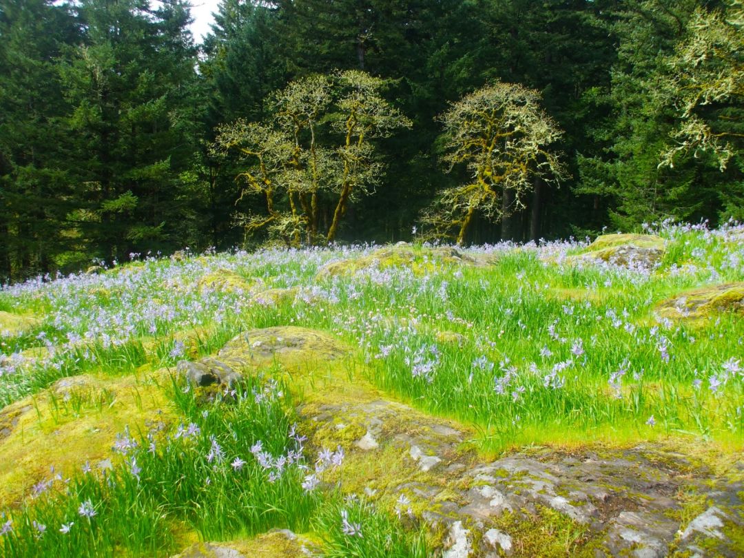
Image: Brian Barker
Lacamas Heritage Trail
7-mile out-and-back
Distance from portland: 30 minutes
Washington’s 312-acre Lacamas Regional Park, just outside Camas, packs in conifer groves, fetching waterfalls, fir-fringed Round Lake, and, in spring, tiers of rocky meadows electrified by scores of camas lilies. Mountain bikers fawn over challenging patches of rooty singletrack and lung-burning chugs up dirt roads. Birders favor the adjoining Washougal River Greenway for a 1.5-mile tour of avian-rich wetlands. A 7-mile out-and-back hike, meanwhile, follows a wide, flat trail along one shore of Lacamas Lake, where Oregon grape, snow queen, and toothwort blossom during springtime.