Forest Park Guide: The Best Hikes
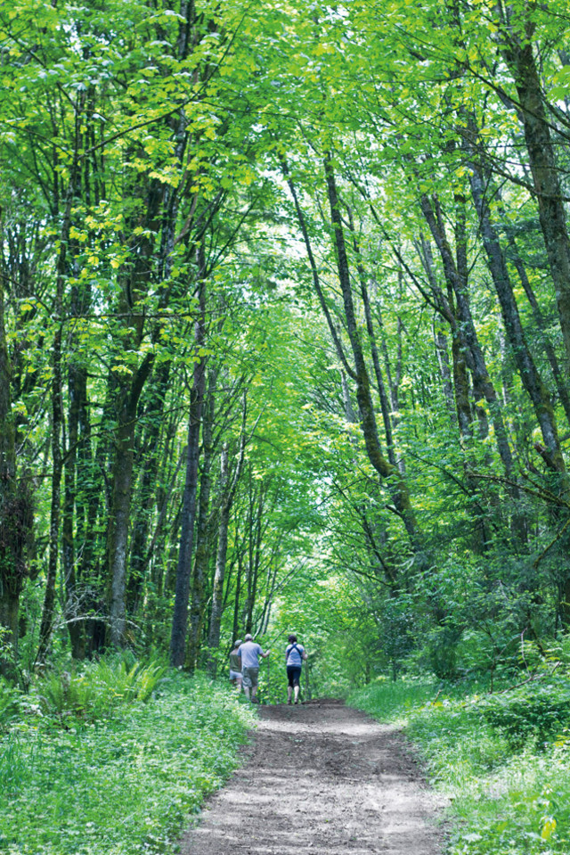
St. Johns Bridge
Image: Chris Pokorny
For a more up-to-date roundup, check out our 2017 list of eight essential Forest Park hikes.
Download a printable version of a map of Forest Park and a guide to all the hikes, runs, and bikes.
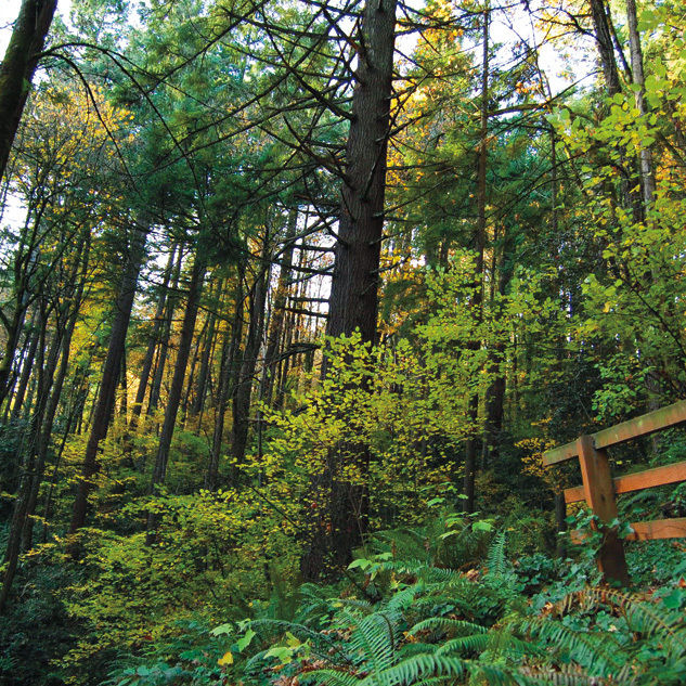
BPA Road
Easy/see map T2/Hike #1
This wide-open, gently rolling double-track path leads to a grassy knoll with sweeping vistas of Mounts St. Helens and Rainier. At your feet, tugboats chug up the Willamette River. So named because the Bonneville Power Administration maintains a string of power lines here, BPA Road also visits a bronze-and-rock monument dedicated to donors who plugged the “Hole in the Park” by snatching a 70-acre plot from the jaws of developers through a cooperative effort of Metro, Friends of Forest Park, and the parks bureau during the 1990s. Toast their collective wisdom from a pair of picnic tables placed at the overlook.
SUGGESTED ROUTE: From NW Skyline Blvd, take BPA Road to Firelane 13. (Round trip: 2 miles)
Heroes And Villains
Hero: John Olmsted

A fledgling Park Board hired Massachusetts park planner and designer John Charles Olmsted in 1903 to conceive an entire park system on par with Boston’s Emerald Necklace designed by his famed stepfather, Frederick Law Olmsted. In his report to the Park Board, Olmsted outlined a network of green spaces that included the first idea of a “Forest Park.” “Future generations . . . will be likely to appreciate the wild beauty . . . the grandeur of the trees, and view-commanding spurs far more than do the majority of the citizens of today.”
Lower Maple Trail loop
Moderate/see map L7/Hike #2
Tranquil canyons? Check. Gurgling water? Check. Oversize fallen log to kick back on? Check. Handy shortcut? Check. (The recently signed Quarry Trail creates a great loop from the lower Maple Trail.) The reasons to love this splendid three-mile circuit along the shade-draped lower Maple Trail just keep piling up. None is better than the junction atop Saltzman Road and Leif Erikson, which affords an eagle-eye overlook of the St. Johns Bridge and Mount St. Helens.
SUGGESTED ROUTE: From Saltzman Road off of Hwy 30, turn right on Maple Trail, left up Quarry Trail, and then right on Leif Erikson. Return via Maple Trail. (Round trip: 3 miles)
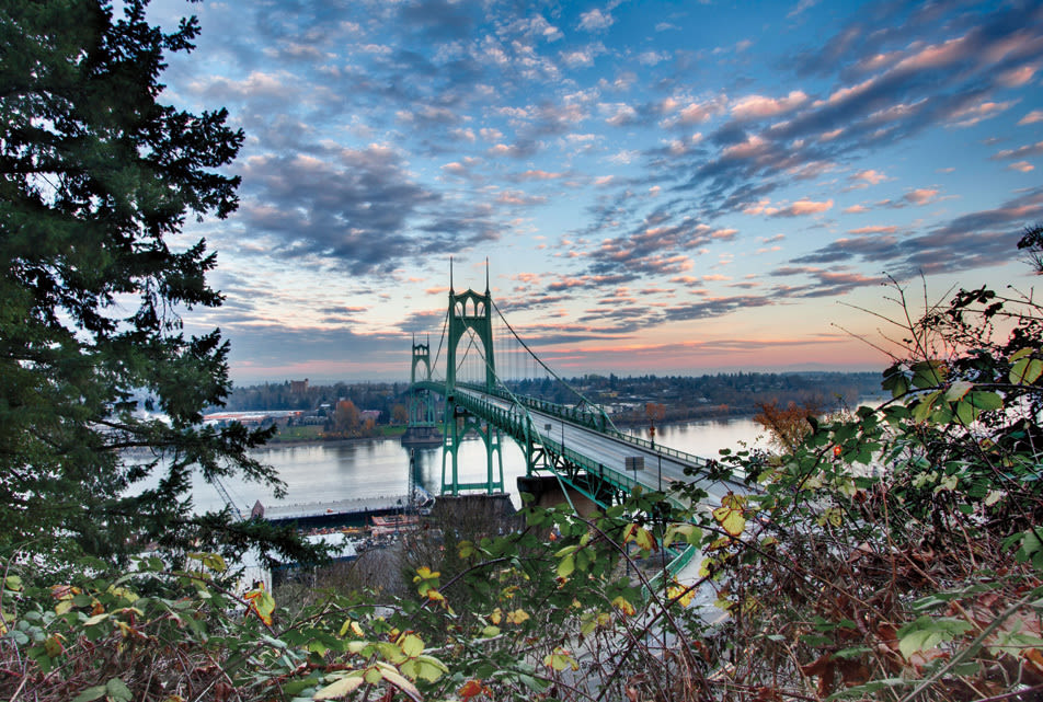
Ridge Trail
Moderate/see map O3/Hike #3
Savor an unforgettable glimpse of one of Portland’s most photogenic bridges at the bottom of the Ridge Trail. The narrow path drops nearly 1,000 vertical feet from Firelane 7, near Skyline Boulevard, amid the quiet, seldom-visited northeast section of the park. Just past Leif Erikson, pause to rest on a rough-hewn bench carved from a log, then exit the woods above Highway 30. Here maple and ninebark limbs frame a close-up portrait of the sea-green arches of the St. Johns Bridge towering over the Willamette.
SUGGESTED ROUTE: From NW Springville Road off of Skyline Blvd, follow Firelane 7 and turn left down the Ridge Trail. Return the same way. ?(Round trip: 2.76 miles)
Nature and Chestnut Trail Loop
Moderate/see map I5/Hike #15
Beat the heat—and the crowds—by slipping into two of Forest Park’s most scenic side trails. The lower half of the Nature Trail plunges into a narrow, shady canyon intersected by a cascading fork of Rocking Chair Creek. Brush past mini-waterfalls and velvety maidenhair ferns on the way to the base of the gully, where a small dam was constructed and a picnic table rests beneath a rare American chestnut tree. A few yards to the right of the tree, the Chestnut Trail climbs back into seclusion alongside a second cooling fork of Rocking Chair Creek.
SUGGESTED ROUTE: From Forest Lane off of NW 53rd Drive, take Firelane 1. Go left down Nature Trail to Leif Erikson. Turn up Chestnut Trail. Go left on Wildwood Trail to return to Firelane 1. (Round trip: 2.5 miles)
“Avenue of the Trees” on Firelane 7
Image: Michael Novak
Firelane 12
Moderate/see map U7/Hike #16
Stashed away on a dead-end lane in hilly Linnton, the entrance to Firelane 12 winds through what feels like a private empire of steep hillsides lined with slabs of basalt, oodles of ferns, white-barked ?alders, and mighty stands of firs. After a mile-long climb, the trail dips down to converge with Firelane 15. Here you’ll encounter Miller Creek, one of the park’s two trout-bearing streams. Continue up Firelane 12 to meet BPA Road, or linger streamside to watch the brook disappear into a green abyss of roots, leaves, and moss.
SUGGESTED ROUTE: From NW Creston Road in Linnton, ascend Firelane 12 to BPA Road. Return the same way. (Round trip: 3 miles)
Maple Trail
Moderate/see map L7/Hike #22
Little-known fact: Nearly three-quarters of the forest of Forest Park is bigleaf maples and red alders—not Douglas firs. Nowhere is this deciduous umbrella more delightful than along the aptly named Maple Trail. In fall, groves of bigleaf maples here rain down piles of crimson-and-gold leaves. But the Maple Trail hikes well in the dog days of summer, too. The 2.6-mile section between lower Saltzman Road and the Wildwood Trail bisects densely wooded canyons peppered with hemlocks and firs, and fords the shimmery waters of Saltzman Creek.
SUGGESTED ROUTE: From Saltzman Road off of Hwy 30, turn left up Maple Trail. Pass Maple Tie Trail and turn right on Wildwood Trail. Descend Koenig Trail and return via Maple Trail. (Round trip: 6 miles)
Download a printable version of a map of Forest Park and a guide to all the hikes, runs, and bikes.
Firelane 15 Loop
Moderate /see map U1/Hike #19
Call it Forest Park’s last frontier. Perched at the park’s northern tip, Firelane 15 borders a power-line corridor that surveys Sauvie Island farmland and St. Helens’s snowy dome. To the west, a blanket of rugged blue hills unfurls to the Coast Range. Such remote topography is a solid bet for wildlife encounters. Park workers routinely spot coyote and black-tailed deer darting into the brush. Bobcat and elk tracks in the mud are not out of the question. And don’t miss the side trail from Fire-lane 15 to Keilhorn Meadow (to the right of the upper gate), a secluded, hemlock- and maple-fringed field—as pretty a place as any to listen for great horned owls.
SUGGESTED ROUTE: From NW Skyline Blvd, follow Firelane 15, cross over the Wildwood Trail, and turn up Firelane 12 to BPA Road. Go right on BPA Road. Turn right on Wildwood Trail. Return via Firelane 15. (Round trip: 2.8 miles)
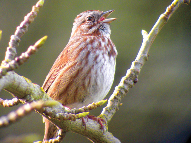
Song sparrows are one of the nearly 120 different species of birds found in Forest Park.
Image: Mike Houck
Audubon Sanctuary Easy /see map F4/Hike #20
Keep a field guide handy inside the Audubon Society’s 150-acre reserve set just off of NW Cornell Road. More than 40 species of birds, including warblers, grosbeaks, and sparrows, have been recorded here. Bird-happy crowds typically head north from the parking area to the Pittock Bird Sanctuary. Here, an easy mile-long loop trail meanders along Balch Creek and encircles a pond scattered with lily pads. But the Founders Trail in the 34-acre Uhtoff Sanctuary is especially noteworthy. Nicknamed “Pileated Woodpecker Alley” it’s packed with abundant snags, a siren’s song to North America’s largest woodpecker. Still skunked on sightings? Tour the on-site Wildlife Care Center, home to Audubon’s fleet of educational birds, which include raptors and owls.
SUGGESTED ROUTE: Founders Trail to North Collins Trail and back to parking lot. (Round trip: 1.3 miles)
Firelane 7
Hard/see map O3/Hike #5
With an awning of curved alder limbs barreling above it, Firelane 7 has been dubbed “Avenue of the Trees.” But it’s also the park’s best path to wildflowers. This south-facing ridgeline trail basks in enough sun to entice prodigious tiger lily blooms, some several feet tall. In spring, the adjacent Trillium Trail is littered with thickets of its namesake blossom, followed by a procession of thimbleberries and huckleberries. For a sweet side trip, descend lower Hardesty Trail to visit “Big Stump,” a massive old-growth cedar nub that bears a pair of eye-like springboard notches cut into its trunk by early-20th-century loggers.
SUGGESTED ROUTE: From NW Springville Road off Skyline Blvd, take Firelane 7 to Trillium Trail and go right. Turn left on Wildwood Trail and continue to Hardesty Trail to return via Firelane 7. (Round trip: 3.4 miles)
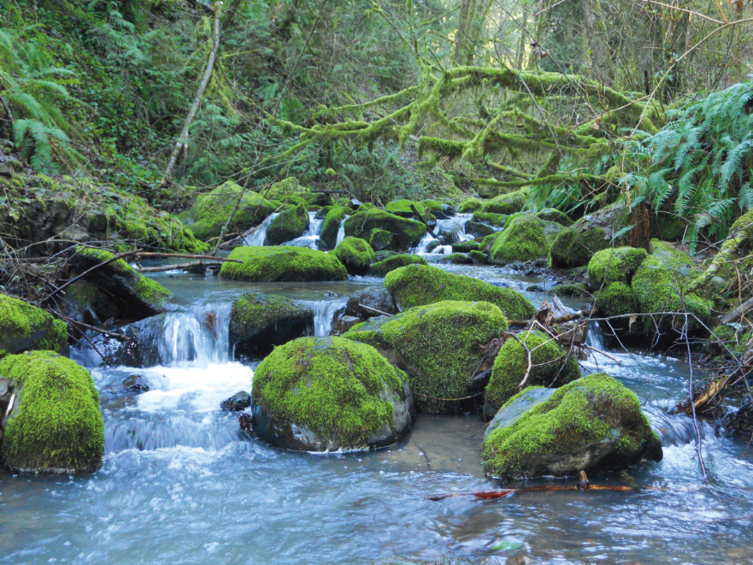
Balch Creek on the Lower Macleay trail is one of the two streams in Forest Park that support native cutthroat trout.
Image: Mike Cottrell Houle
Heroes And Villains
Villain: Lafe Pence

Notorious for hatching a scheme to buy land around Bull Run and the Sandy River so he could sell water to the city at exorbitant prices, Lafe Pence, a former Colorado congressman, dug a clandestine, two-mile system of ditches and aqueducts in Macleay Park in 1906. Pence wanted to hijack water from Balch Creek and use it to flush sediment from a large tract of land he wanted to level for development. His plan was thwarted when Mayor Harry Lane and a dozen police officers stormed the hillside and destroyed the flume with sledgehammers. Portions of Pence’s ditch are still visible near the intersection of the Wildwood and Wild Cherry Trails.
Firelane 9 Loop
Hard/see map Q5/Hike #21
The ravine cut by Linnton Creek must look like a giant feeding trough to hungry birds. Loaded with seed-rich red alders and bigleaf maples, the tucked-away canyon attracts scores of melodious western tanagers, orange-crowned warblers, and evening grosbeaks. At the hike’s halfway point, Firelane 10 zigzags through forest spotted with white oak, western red cedar, and even purple-hued Pacific yew, which sprouts bright red berries that prove irresistible to birds like the orange-breasted varied thrush. A recent hike offered a view of a red-tailed hawk swooping no more than 20 feet overhead.
SUGGESTED ROUTE: From Leif Erikson trailhead off of NW Germantown Road, cross the road to Firelane 9. Descend to the town of Linnton and pick up the Linnton Trail. Turn left at Firelane 10 to return to trailhead. (Round trip: 2 miles)
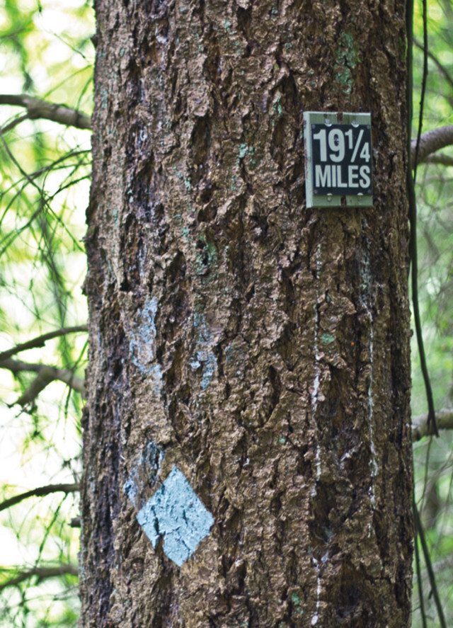
Every quarter-mile of the 30-mile Wildwood Trail is marked by a blue diamond and mile markers.
Image: Michael Novak
Lower Macleay to Stone House
Easy/see map E8/Hike #17
Not even Crayola could box up so many shades of green. Set in a lush canyon alongside the cool waters of Balch Creek, the largest stream in Forest Park, Lower Macleay Trail is an explosion of licorice ferns, leafy salal bushes, moss-jacketed hemlocks, and some of the most impressive fir specimens in the park, including Portland’s most gasp-inducing heritage tree, a 242-foot, jade-crowned giant—the country’s tallest fir within a city. For more color, scope out the creek’s population of native cutthroat trout. Then explore the “Stone House,” the remains of a Works Progress Administration–era structure, built in 1936. Its lichen-coated walls make a killer fort for an afternoon.
SUGGESTED ROUTE: From NW Upshur Street follow Lower Macleay Trail for one mile. (Round trip: 2 miles)
Tolinda Trail to Waterline
Hard/see map Q7/Hike #9
The Tolinda Trail takes its name from the sight of a former Camp Fire Girls camp in the park. But make no mistake: this is one tough cookie of a hike. In less than a mile, the route vaults nearly 400 feet up to Leif Erikson. Temper first-degree thigh burns by enjoying bright blazes of fireweed, numerous lilies, and a welcome shot of solitude. To earn a merit badge for pluck, proceed up the Waterline Trail, a steep, often muddy route that ascends along a ridge to a water tower set in a sun-soaked meadow atop Skyline Boulevard.
SUGGESTED ROUTE: From NW Germantown Road, take Tolinda Trail. Go left at Leif Erikson and up Waterline Trail. Return the same way. (Round trip: 3 miles)
Park Inspirations: Peter Rock
Reed professor and author of My Abandonment, a fictional novel inspired by the true story of a girl and her father found living in Forest Park

Image: Emily Tate
Forest Park is like Portland’s version of the ocean. It’s dark and mysterious, and we can’t always see what’s going on underneath. When I was writing my book, I really wanted to spend a night in the park. Friends said I shouldn’t. They said it might be dangerous because people live in the woods. If I did, I should be armed. So I never did. People who haven’t been to the park ask me, did I make this up? How could there be this place that’s so close to the city, and so wild? I like the area by St. Johns, because there’s this intersection between wilderness and industry, and because most people don’t go there. I have two daughters. I take them to the park. They love it. I definitely have to keep them contained. Otherwise, I think they might turn wild. —As told to Brian Barker
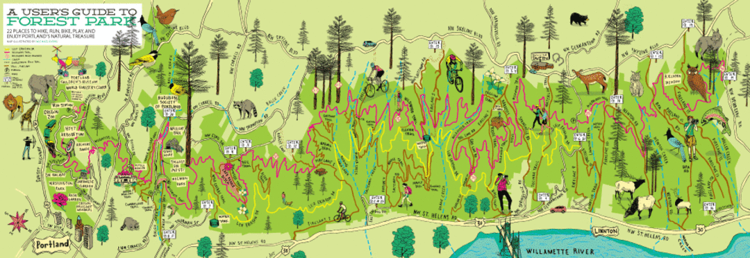
Image: Michael Byers
Download a printable version of a map of Forest Park and a guide to all the hikes, runs, and bikes.
Wildwood–Newton Loop
Easy/see map R4 /Hike #18
Trees do fantastic things on this bite-size loop deep in the park’s dewy, northern interior. Just before the 26-mile mark of the Wildwood, a hollowed-out fir can fit pint-size nature-lovers inside its belly. Nearby, inspect a large stump festooned with Frisbee-size mushrooms. A few steps farther, a fir’s roots rise out of the dirt like a house on stilts and create a tunnel to scamper beneath. For a crescendo, pass by a maple whose clutch of trunks resembles the tentacles of a giant squid. Like we said—fantastic.
SUGGESTED ROUTE: From NW Newton Road parking lot off of Skyline Blvd, follow Newton Road and turn right on first path to Wildwood Trail. Head south on Wildwood. Turn right on Firelane 10 to return. (Round trip: about 1 mile)
Newton Road to Wildwood Trail
Hard/see map T2/Hike #12
Turn northwest onto the Wildwood Trail from Newton Road, and the forest suddenly becomes eerily still. The hushed tone comes courtesy of the park’s remnant old-growth stands. The next half-mile holds smatterings of firs capable of gouging the clouds. Be prepared to earn your visitation, though. The arduous climb up Newton Road is one of the toughest in the park. It’s also gorgeous, traversing a remote, stream-filled ravine. Lazy-bones option: park at the Newton Road Trailhead off NW Skyline Boulevard and walk less than a mile to the Wildwood Trail.
SUGGESTED ROUTE: From BPA Road off NW Skyline Blvd, descend to Newton Road. Go up Newton to Wildwood Trail and go right. Return via BPA Road. (Round trip: 4.4 miles)
Lower Macleay to Pittock Mansion
Hard/see map E8/Hike #8
This lung-pumping scramble gains 800 feet of elevation during a 2.5-mile trek to one of Portland’s most iconic residences, Pittock Mansion. The former Oregonian publisher Henry Pittock’s 22-room French Renaissance wonder is a stunner, with flower-strewn gardens and commanding gazes of the Cascades and all of Portland. Still, all that opulence doesn’t quite measure up to the grandeur of the gargantuan trees encountered below the manor. Inside tip: to avoid the masses at Lower Macleay, ascend to Wildwood Trail via the short but challenging Tunnel Trail (along NW Cornell Road).
SUGGESTED ROUTE: From NW Upshur Street, take Lower Macleay Trail to Wildwood Trail. Take Wildwood toward NW Cornell Road and up to Pittock Mansion. Return the same way. (Round trip: 5 miles)
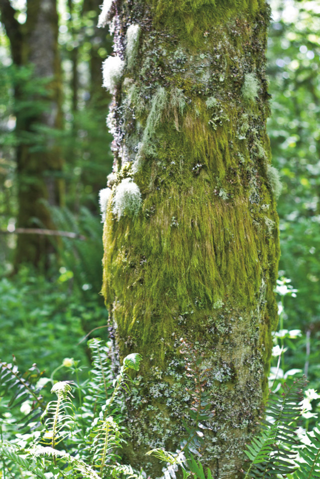
Linchen and licorice ferns are abundant on trees in Forest Park.
Image: Michael Novak
Wildwood Trail, Miles 12–16
Hard/see map M2/Hike #13
Titanic trees and distance from civilized roads are the top draws on this must-hit section of the Wildwood Trail. At mile 16 enter the Wildwood along a fern-choked ridge that’s stacked with handsome stands of younger conifers. At mile 15.75 begin looking for stop-a-minute views of Mount Hood and Mount Adams. And past Firelane 3, between mile points 13.5 and 12.5, ogle several inspiring sequoia-size firs.
SUGGESTED ROUTE: From NW Saltzman Road off of Skyline Blvd, walk one mile to the intersection of Wildwood Trail (mile 16) and turn right. Continue to mile 12. Return same way. (Round trip: 10 miles)
Wildwood Trail from Newberry Road
Easy/see map V3/Hike #14
Curious what Forest Park looked like 200 years ago? The northern reaches of the Wildwood Trail provide a vivid picture. From Newberry Road the trail plunges into a primordial world ruled by giant sword ferns and groves of behemoth western red cedars with patinas like ancient works of bronze. Occasional blooms of fairy lanterns and false lily of the valley spice up the evergreen palette.
SUGGESTED ROUTE: From NW Newberry Road, take Wildwood Trail south to Firelane 15. Return the same way. (Round trip: 3 miles)
Dogwood trail
Easy/see map G5/Hike #4
Early bloomers along the sun-?dappled Dogwood include yellow woodland violets and scores of trilliums. Come summer, candy flowers, fairy bells, and false Solomon’s seal, which perfume the air with fragrant, starlike blossoms, crop up. Keep an eye to the sky, though. Overhead, amid leafy maples and slender firs, red-capped downy woodpeckers busily tap away on tree stumps and, beyond the branches, peekaboo views of Mount Hood and Portland’s skyline abound.
SUGGESTED ROUTE: From NW 53rd Drive, take Dogwood Trail. Turn left on Leif Erikson and go left up Alder Trail. Turn left on Wildwood Trail. Return via Keil Trail. (Round trip: 3 miles)
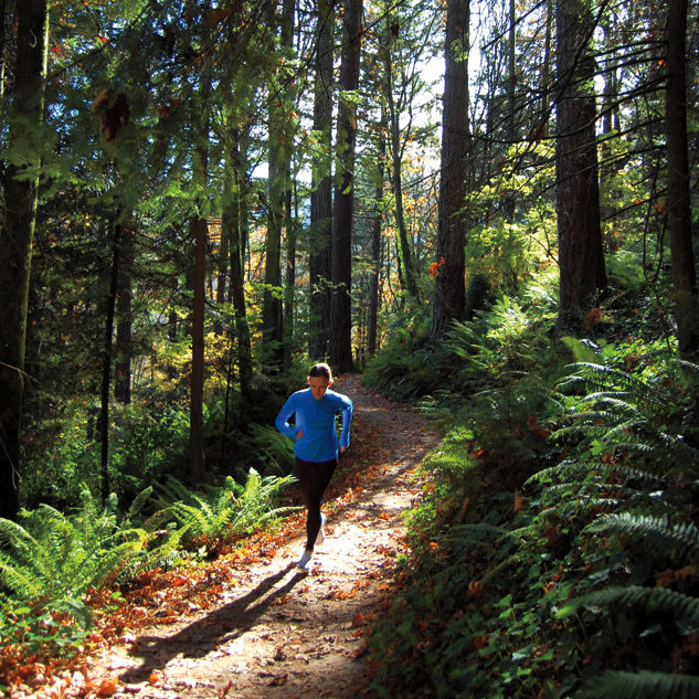
Park Inspirations: Yassine Diboun
Competitive ultramarathoner and professional running coach who trains in Forest Park nearly every day

Image: Emily Tate
I’m a blend of someone who needs to be deep in nature but also likes urban life. I often run the Wildwood Trail from end to end—someone will drop me off on Newberry Road and I’ll do 30 miles and end up at the door of my apartment building. For me, running is about connection to the landscape and nature. It’s about getting lost—not literally, but lost in a different, more primal kind of consciousness. Running through the woods evokes something that has been passed down for thousands of years, and living near the park allows me to go to those wild places, where I can push myself beyond what I think I’m capable of. —As told to Zach Dundas