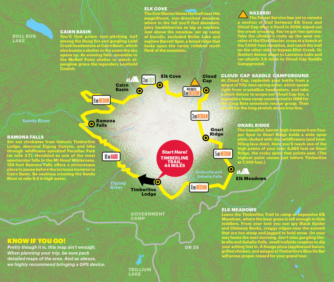
The Ultimate Mount Hood Hiking Route
For those not built to go up our iconic volcano, there is an equally satisfying alternative: go around it. The 40-plus-mile Timberline National Historic Trail #600 circumnavigates the mountain and provides equally spectacular scenery. If Cheryl Strayed can hoof it through the High Sierra, you can conquer this route—especially with a little bit of training and proper planning.
Built by the Civilian Conservation Corps in the 1930s, the Timberline Trail traces Hood’s snowless-in-summer flanks at about 6,000 feet and is replete with rushing waterfalls, rocky ridges, moss-covered basalt lava beds, and alpine meadows chock-full of wildflowers. Most hikers take three to five days to complete the circuit, heading clockwise from Timberline Lodge. The route isn’t without some risk, of course: there are three major and many minor stream crossings, which can be treacherous with high water and unexpected storms. And the Forest Service has yet to formally reroute a section on the peak’s north side after a flood in 2006 wiped out the creek crossing. So you’ll have to get creative. (We’ve offered a suggestion.)
Here, we map out the possibilities to help you plan an epic Mount Hood adventure.