10 Northwest Hiking and Biking Trails to Help You Seize the Summer
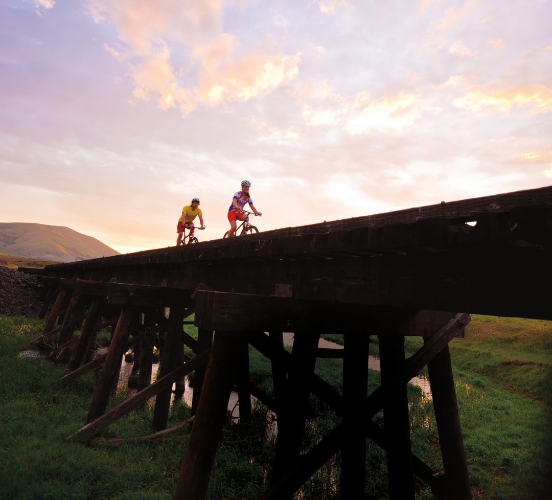
Image: Courtesy Mark Gamba
Klickitat Rail Trail

All told, this abandoned rail line runs 31 miles between the Washington burgs of Lyle and Goldendale, including remote (and spectacular) sections closed during summer months due to fire danger. For a gravel-grind even newbies can take on (with the proper mountain or cross bike, of course), set up a shuttle car in Lyle, then drive up to the trail access near Klickitat and head south. This section traces State Route 142 and the sometimes-raging Klickitat River; in winter, eagles often patrol above.
Round Trip: 13 miles (Klickitat to Lyle)
Nearest Towns: Lyle and Klickitat
Distance from Downtown: 1h 25m
Table Mountain

Let’s just be clear: it’s going to kick your ass. Table Mountain’s soaring, jagged cliff face and spectacular views of the Columbia give it one of the Gorge’s biggest payoffs. The upfront investment required is something—3,200 feet in elevation gain, up to a 15-plus-mile round trip. Along the way, however, you can cool your heels at Gillette Lake, an oasis encased in greenery, and Greenleaf Falls, while soaking up glimpses of Wauna Point and Kidney Lake. Two steep options reach the summit, and the whole Gorge opens beneath you.
Round Trip: 8–15.5 miles
Elevation Gain: 3,200 feet
Nearest Towns: North Bonneville and Stevenson
Distance from Downtown: 1h
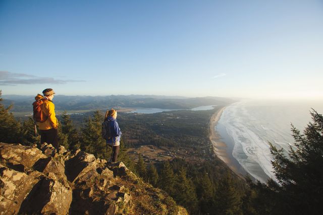
Image: Courtesy Justin Bailie
Tumalo Falls/North Fork Trail

Rewards come quickly at Tumalo Falls: views of the eponymous 97-foot gusher lie just a five-minute walk from the parking lot. Once you’re sufficiently wowed, pick up the North Fork Trail and hike upstream on a gently uphill meander that leads to several smaller waterfalls. Turn around at your leisure—but those up for a longer trek will be rewarded after four miles with the sight of Happy Valley, an appropriately named alpine meadow popping with lupine, larkspur, and Indian paintbrush, with wooden bridges spanning gurgling creeks.
Round Trip: 4–8 miles
Elevation Gain: 1,000 feet
Nearest Town: Bend
Distance from Downtown: 3h 45m
Neahkahnie Mountain

Searching for heavenly views? This 1,631-foot-high headland—which translates (roughly) to “the Place of the Gods” in the Tillamook language—towers over Nehalem Bay and rewards intrepid climbers with panoramas of coastal cliffs and quaint seaside towns up to 50 miles up and down the coast. Skip the north access point from Oswald West State Park—which traverses a noisy mile of Highway 101’s shoulders—and opt for the densely forested, Sitka spruce–strewn switchbacks from the south trailhead, with frequent peeks of the roiling ocean and distant knolls.
Round Trip: 3.2 miles
Elevation Gain: 900 ft
Nearest Town: Manzanita
Distance from Downtown: 1h 45m
Elk Meadows

One of Mount Hood’s classic day hikes sits just a few miles beyond the Meadows Ski Resort, on the less-explored southeast flank of the volcano. Wade through the gushing Newton Creek and clamber up eight long switchbacks for a picture-perfect, subalpine meadow dotted with ripe huckleberries in late summer and ringed with campsites, picnic benches, and a three-walled shelter with unparalleled views of Hood. For a more difficult, 3.4-mile extension, continue up the mountain to the aptly named Gnarl Ridge for panoramic views from the windswept ridgeline.
Round Trip: 6 miles
Elevation Gain: 1,230 feet
Nearest Town: Government Camp
Distance from Downtown: 1h 30m
Canyon Creek Meadows

This accessible, high-Cascade ramble is an embarrassment of riches. You’ll pass two ponds, a once-burnt forest of firs, a sequence of meadows choked with vibrant blue lupine and red Indian paintbrush, and several creeks before arriving at the upper meadow. The front-row view of Three Fingered Jack’s craggy, stratified peaks across the vast expanse of blooms will stop you in your tracks. For an even closer look, scramble another rocky three miles to a perch overlooking a milky-green glacial lake, and then up a steep crest to a saddle on the mountain’s shoulder, where the view stretches from Mount Jefferson to the Three Sisters.
Round Trip: 6.5–7.5 miles
Elevation Gain: 900–1,400 feet
Nearest Town: Sisters
Distance from Downtown: 3h 20m
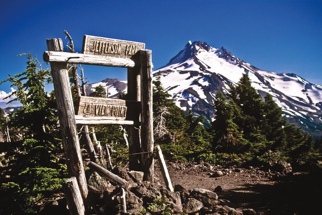
Jefferson Park via Park Ridge

To earn one of the finest views in Oregon, you must first brave one of its worst roads. Indeed, the northern trailhead to Jefferson Park via the Pacific Crest Trail lies at the end of a rutted-out dirt road impassable in a low-clearance vehicle. But by the time you’re safely on the trail—first winding your way south through a landscape of alpine meadows brimming with heather and huckleberries, then facing the awe-inspiring vision of a glacier-blanketed Mount Jefferson looming above a lake-dotted expanse—you won’t even remember how you got there.
Round Trip: 11.5 miles
Elevation Gain: 2,000 feet
Nearest Town: Detroit
Distance from Downtown: 2h 45m
Ape Canyon/Plains of Abraham

When Mount St. Helens blew its top in 1980, it left behind a landscape molded by searing heat and washed clean by massive mudflows. The terrain remains otherworldly—a lunar landscape that, especially on two wheels, is nothing short of stunning. This route traces the Ape Canyon Trail’s singletrack through an old-growth stand of noble firs and emerges on the fringe of the blast zone, overlooking the rocky cleft of the canyon itself, then continues across vast pumice fields on the Loowit Trail. The denouement comes at the Plains of Abraham, and their head-on views of the volcano’s dramatic eastern slope.
Round Trip: 21–26 miles
Elevation Gain: 1,500–5,000 feet
Nearest Town: Cougar
Distance from Downtown: 2h
Alsea Falls

Tucked off a backcountry byway in the Coast Range’s foothills, misty Alsea Falls cascades into a shady swimming hole, creating a lush backdrop for envy-inducing summer selfies mere steps from the parking lot. A more private pool awaits a mile upstream, where the lesser-known Green Peak Falls greets grateful hikers. Across the river, madcap mountain bikers gleefully weave through western red cedars on 12 steep miles of repurposed logging roads.
Distance: 2.8 miles
Elevation Gain: 400 feet
Nearest Town: Alsea
Distance from Downtown: 2h 30m
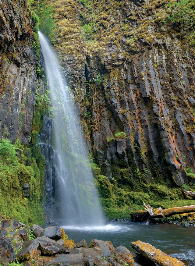
Dry Creek Falls

Every Portlander needs a hike like this stashed in the back pocket: close, just challenging enough to impress flatlander guests who crave a little Northwest adventure, with a cooling cascade as the payoff. Start from the Bridge of the Gods trailhead and head up the Pacific Crest Trail. After ducking under a highway overpass, ascend through light-dappled woods, following the PCT signage, about two miles. Instead of crossing the wooden footbridge that spans Dry Creek, bear right toward the falls: a vigorous, 74-foot spout surging out of an amphitheater of basalt walls, ringed by antique dam gear.
Round Trip: 4.4 miles
Elevation Gain: 710 feet
Nearest Town: Cascade Locks
Distance from Downtown: 1 hour


