These 7 Oregon Scenic Bikeways Are Made for Fall Cycling
Old West Scenic Bikeway
Image: Alex Phillips
You've heard of Oregon’s Scenic Bikeways program, launched in 2009 to dream up beautiful, bike-friendly routes across the state. It's a program without peer, literally, as the only one of its kind in the nation.
In June 2017, the state program launched its 16th route: Sherar's Falls Scenic Bikeway near Maupin. The addition of this 33-mile-loop means the program has now thoroughly road-tested nearly 1,300 miles of heart-stopping scenery, from the dramatic Painted Hills to the cascading waterways of Mt Hood foothills. (We can't wait for the next unveiling.*)
Looking for a little inspiration? Get planning: these seven routes are perfect for late-summer and fall touring.
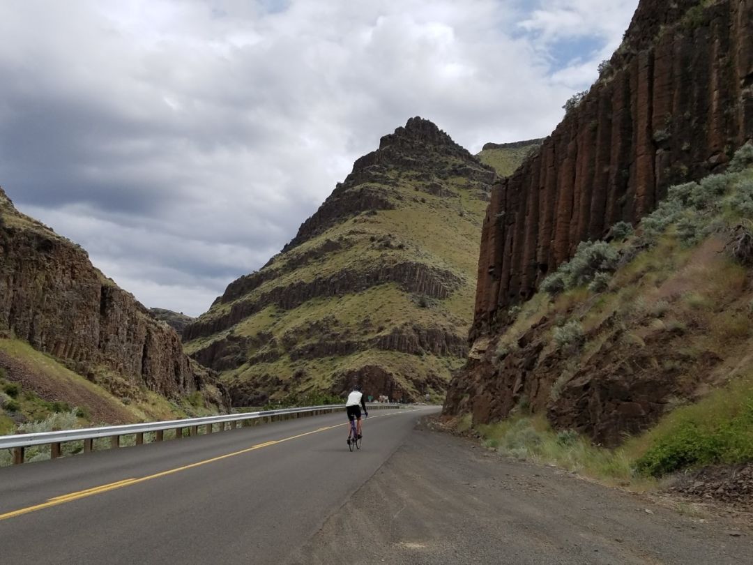
Sherar's Falls Scenic Bikeway
Image: Alex Phillips
Sherar's Falls Scenic Bikeway
Established: June 2017
Distance from Portland: 120 miles
Route: From Maupin to Tygh Valley and back to Maupin, Wasco County; passes through river canyons, tribal fishing grounds, state parks, and small Oregon towns.
The newest Oregon Scenic Bikeway leads through surging river canyons, tribal fishing grounds, and high desert scrubland. Starting and ending in Maupin, the highest elevation for this 33-mile loop— 2,000 feet—hits riders one-third in. The rest is sweet, gentle descent. Much of the route follows the Deschutes River. From Sherar’s Falls, the bikeway leads to White River Falls State Park, where, if you feel like taking a break from pedaling, you can walk to the river’s 90-foot plunge. This ride is best enjoyed in spring—with purple and yellow wildflowers dotting the hillsides—or sunny, temperate fall.
Madras Mountain Views Scenic Bikeway
Established: May 2013
Distance from Portland: 120 miles
Route: From Madras to Culver, and Metolius back to Madras, Jefferson County; passes through Central Oregon’s seven major volcanic peaks.
This 30-mile Central Cascadian loops peaks at around 2,500 feet in elevation, with views of all seven major Oregon volcanic peaks: Mt Jefferson, Mt Hood, Broken Top, Three Fingered Jack, and the Three Sisters. In addition to volcanoes, riders enjoy scenery both pastoral and agricultural (onions, garlic, and mint are all grown in this area).
Wild Rivers Coast Scenic Bikeway
Established: May 2015
Distance from Portland: 275 miles
Route: From Port Orford to Paradise Point State Recreation Site, or Port Orford to Cape Blanco State Park, Curry County; passes through Redfish Rocks Marine Reserve and the Rogue River-Siskiyou National Forest.
Departing form the wind-scrubbed fishing town of Port Orford, this relatively flat 60-mile ride (500 feet being the highest point in elevation) passes through estuaries, lush cranberry bogs, and towering basalt sea stacks. Seventeen miles of this bikeway will take you through the Rogue River-Siskiyou National Forest and along the Elk River. Along the way, visit Cape Blanco, the oldest working lighthouse in Oregon, built in 1870. From Port Orford, you can also choose to head to Paradise Point State Recreation Site, where you can pedal to a sandy beach alongside swoon-worthy ocean views.
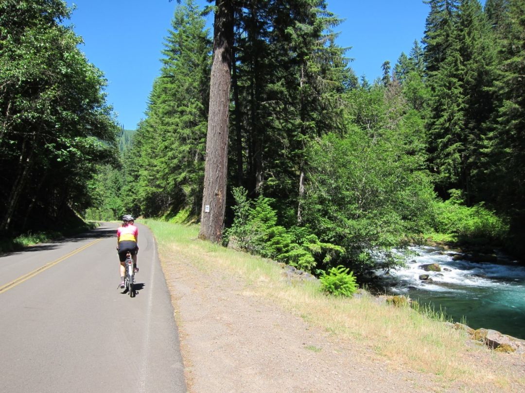
Cascading Rivers Scenic Bikeway
Image: Alex Phillips
Cascading Rivers Scenic Bikeway
Established: June 2014
Distance from Portland: 96 miles
Route: From Detroit to Estacada, Marion County to Clackamas County; passes through Three Lynx and Ripplebrook
This route follows the Clackamas and Breitenbush rivers in a 72-mile trip from Estacada to Detroit. Keep your eyes peeled—it’s not uncommon to spot elk. This route is deemed challenging due to a 3,125-foot climb from Estacada and a 1,985-foot climb from Detroit. (The bikeways program also maps a shorter, more family-friendly ride from Estacada.) Refueling pit stops abound in Estacada and Detroit—you'll have earned it! Intrigued riders shouldn't delay: this route closes in late fall for the winter due to snow.
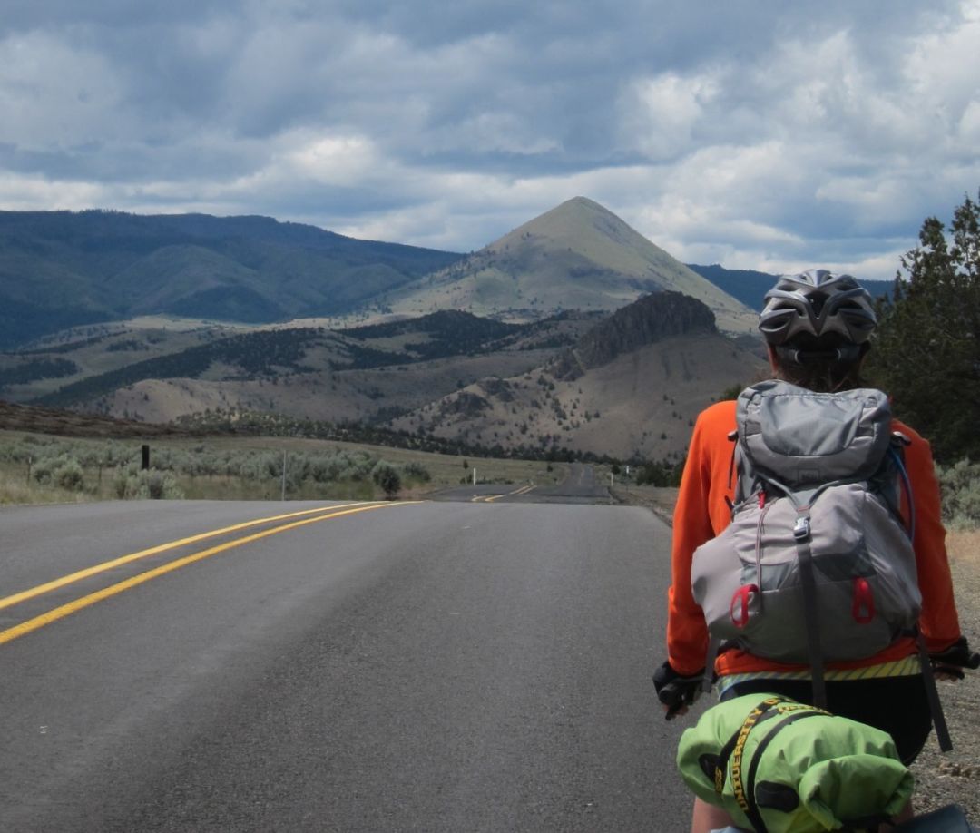
Old West Scenic Bikeway
Established: September 2011
Distance from Portland: 270 miles
Route: From John Day to Prairie City, and Long Creek to Dayville, Grant County; passes through forests, scenic rivers, monuments, abundant wildlife, and fossil geology.
This multi-day, 174-mile route—which, for the truly ambitious, can be stretched out an extra 800 miles with various additional paths—follows two branches of the John Day River and leads you to a few must-see stops: the Kam Wah Chung State Heritage Site, the John Day Fossil Beds National Monument, the wild horses on Murders Creek, and the bald eagle trees outside of Prairie City (as many as 11 bald eagles have been spotted at once). This bikeway sticks to backcountry roads in Grant County (route elevation ranges from 2,000 to 5,000 feet) and passed three state parks, several additional campgrounds, and two bike hotels.
Oregon Outback Scenic Bikeway
Established: June 2016
Distance from Portland: 340 miles
Route: From Lakeview to Plush, and Plush to Adel, Lake County; passes through the Warner Mountains and Hart and Crump lakes.
This challenging bikeway climbs 6,000 feet over 90 miles, but despite its name, rest assured you’ll never be too far from a comfy pillow and a good meal. The southern town of Lakeview serves as the start and end point of the bikeway, where you’ll find food, lodging, and camping. The route climbs the Warner Mountains, vast landscapes of high peaks, cliffs, lakes, and roving antelope and bighorn sheep. About halfway in, descend 1,300 feet into the small town of Plush—“A Small Quiet Drinking Town with a Cattle Problem.”
Painted Hills Scenic Bikeways
Image: Alex Phillips
Painted Hills Scenic Bikeway
Established: February 2016
Distance from Portland: 172 miles
Route: From Fossil to Kimberly to Richmond, Wheeler to Grant County; passes through the John Day Fossil Beds and one of Oregon’s seven wonders—the Painted Hills.
The challenge (and history lesson) you’ve been waiting for: 161 miles of extreme biking and spiking elevation through the Painted Hills. These fragile natural features get their name from the layers of colored soil that reveal, in their distinct stripes, millions of years of geologic history and changes in climate. (Not fake news!) This bikeway connects the three units of the John Day Fossil Beds that hold the world record for best fossil of the Age of Mammals. Towns along the bikeway provide everything you’ll need—including the supplemental water you'll need to stock to make it between towns.
*Editor's Note: In February 2018, the state introduced the Crooked River Canyon Scenic Bikeway, an 18-mile stretch in the Prineville area.


