The Gorge’s Polar Opposite Offers Ancient Old-Growth Forest and Blessed Solitude
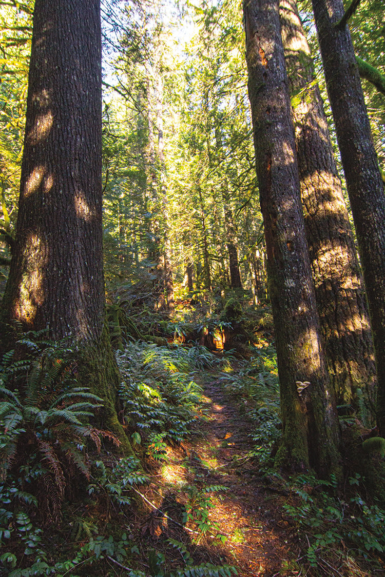
Image: Benjamin Tepler
Early this year, Eagle Creek in the Columbia River Gorge—one of the most visited trails in the state—reopened after a three-year lockdown. In 2017, the trail was ground zero for the eponymous wildfire that blazed through 50,000 acres of waterfall corridor. This winter, amid rebuilt bridges and sprouting evergreens, crowds returned in force (until the trail was temporarily closed again, due to landslides).
If you don’t feel like do-si-doing above a muddy cliff face with hundreds of other Portlanders, take note: there is another Eagle Creek trail near Portland. This Eagle Creek, just an hour away in the Salmon-Huckleberry Wilderness east of Estacada, is diametrically opposed to its Gorge counterpart: wild, cathedral forest with scarcely another human in sight.
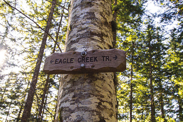
Image: Benjamin Tepler
It owes its solitude to the lack of signage and its location at the end of an uninspired, half-mile trek down an old Bureau of Land Management road. At your first juncture (Douglas Trail leads up to the left) you’ll enter German fairy tale–level wilderness and official Forest Service territory. Continue down through mostly Doug fir and vine and big-leaf maple as the rush of the namesake creek grows.
Beards of moss hang from branches, and giant, gnarled trunks erupt from even more massive, six-foot-wide nurse logs from another era. While the sun barely rises above the valley in this temperate rain forest, spring brings brambles of flowering pink salmonberry, white-petaled oxalis, dangling bleeding hearts, and thorny devil’s club. Elk tracks are common, and songbird choruses are raucous.
Turn back at any point, or make for a spacious campground alongside the creek 3.2 miles in. For a bigger adventure, backpackers can continue across the creek and up a set of switchbacks to the stream’s upper reaches and the Eagle Creek Cutoff Trail, an even farther cry from the Gorge version.
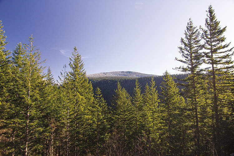
The view from the other Eagle Creek
Image: Benjamin Tepler
Drive Time: 1 hour // Distance: 1–6.4 miles // Difficulty: Easy // Fee: None // Directions: Since Eagle Creek is typically associated with the popular Gorge hike, enter “Harvey Road Trailhead” into your GPS. Whether you take US-26 or 224, your maps will eventually take you to Harvey Road. Ignore the private timber land signs, which pertain to forest on either side of this heavily potholed gravel access road. (Also ignore Google Maps at this point, which will try to take you down gated side roads.) Follow Harvey until you come to a dead-end fork impassable to passenger cars: one leads up to the left and one leads down to the right. This is the unofficial, unsigned parking area, with room for just a few vehicles. Head down the old jeep road to the right to begin your hike; you’ll see a sign for Eagle Creek Trail after a half mile.