Hike of the Month: Mosier Plateau by Transit

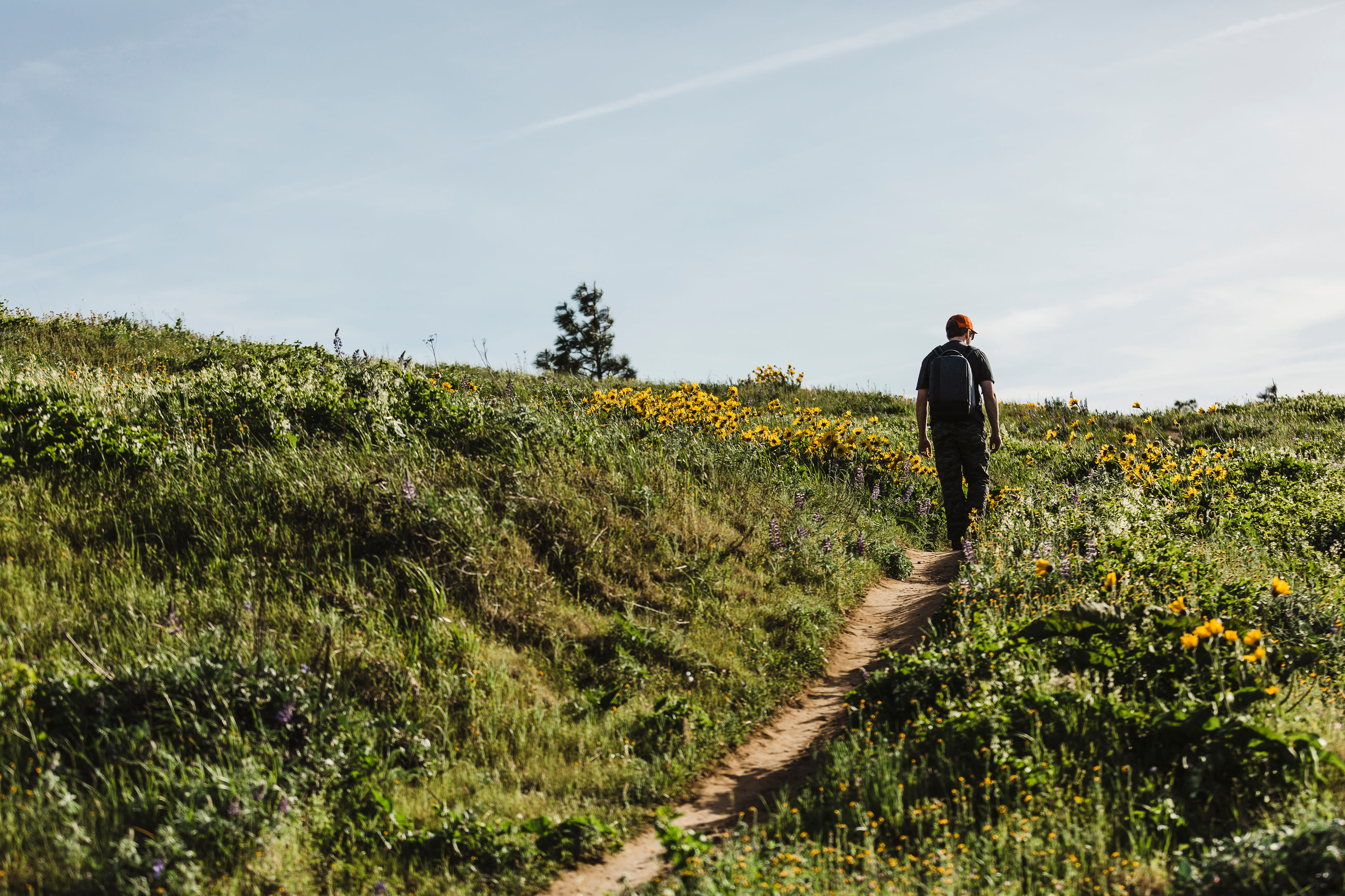
Looking west from the top of the Mosier Plateau Trail in the Columbia River Gorge
Image: Margaret Seiler
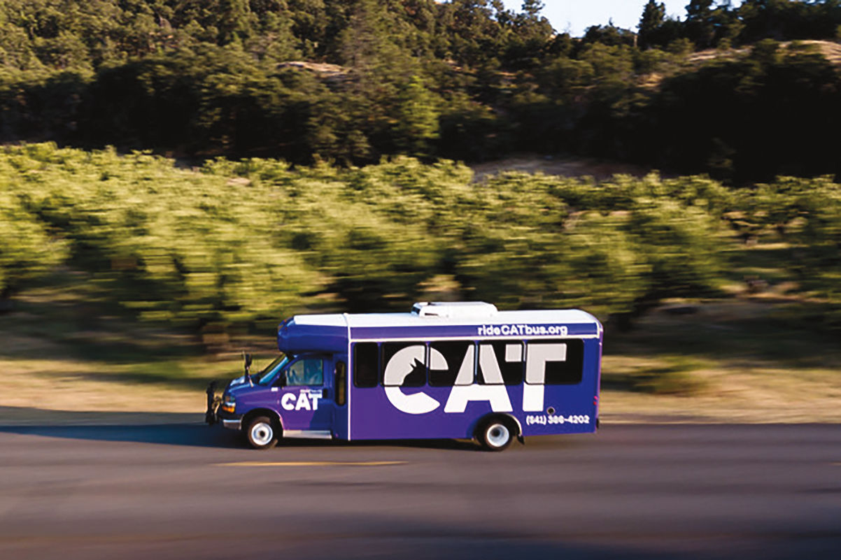
My first sunny wildflower hike of spring 2023 began under a gray sky, early in the morning, at the Gateway Transit Center. Or maybe it began an hour earlier, when I boarded the first of two buses that got me to Gateway, but at that point I could have been any old commuter. It was only when I boarded the purple Columbia Gorge Express, part of the Hood River–based CAT bus system (alas, it stands for Columbia Area Transit and is not the fantasy creature from My Neighbor Totoro), that I was truly trail-bound.
Around New Year’s, I picked up a $40 Gorge Pass at REI, and this was its maiden voyage. It grants passage for all of 2023 on this Portland–Hood River shuttle, which stops at Multnomah Falls and Cascade Locks, and on buses operated by various transit agencies connecting Hood River, The Dalles, and Washington towns including Goldendale, Bingen, White Salmon, Carson, and Stevenson. On April 29, CAT’s free Dog Mountain Shuttle starts its seasonal service, with every passenger automatically getting a permit for the popular wildflower hike.
I’m headed for a kinder and gentler trail, though, the Mosier Plateau, and I’m bringing my bike along so I can wander around Hood River during my layover and check out the Mosier Twin Tunnels after my hike. If I were just going to Hood River, or doing a hike around Cascade Locks, I could have taken a later bus (options leave Gateway at 7:50 and 9:50 a.m., and 12:50, 2:30, 3:50, 5:20, and 6:40 p.m.), but only the first run of the day will let me connect to Mosier.
At 7:48 a.m., the driver, who has the purple CAT logo on his hat, clicks his seat belt. I do the same, not having noticed at first that the 18-seat bus has belts. Two minutes later, the driver, four other passengers, and I pull out from the transit center. No one else gets on at the first stop, but the McDonald’s in Troutdale. We head into the Gorge, passing all the bonus waterfalls that appear this time of year, as well as the absolutely gushing Multnomah Falls. Four more people get on the bus in Cascade Locks. Fog wraps Wind Mountain and Dog Mountain across the river, but the sun is out as we pull into Hood River a few minutes before.
The CAT stop is tucked away in the western part of Hood River, near the Safeway, Walmart, and Taco Bell. A bus goes from there into the uptown business district, the historic downtown, and the fun-filled waterfront, but if you get off then the next bus won’t get you back to the CAT stop in time for the 10:30 bus to Mosier and The Dalles. I highly recommend bringing a bike to explore the town during the layover. Or a book. Or both.
The bus drops off in Mosier at 10:40. It stops on its way back from The Dalles, too, 40 minutes later, but after that the next Hood River–bound bus isn’t till 5 p.m., getting passengers back just in time for the 5:30 express to Portland. So if you didn’t bring a bike to ride back to Hood River on your own, get ready to stop and stay awhile.
A short walk east from the bus drop-off, I lock my bike at Randonnée Coffee, where there are pistachio lattes, very tasty scones, breakfast sandwiches, and bagels on offer. (The coffee shop sits directly in front of Camp Randonnée, a line of Scandinavian-influenced cabins bookable through its Instagram page, if you really want to stay awhile.) A slab of banana or pumpkin bread from Randonnée makes a good hiking snack, as do the meat sticks, trail mix, made-to-order sandwiches, and Hood River–made Monkey Brittle (sort of like banana chips pressed with nuts and raisins) down the road at Brenna’s Mosier Market. Farther east on the main drag, past the trail’s parking lot and other the bridge, the Mosier Plateau Trail starts up the hill. Opened in 2013 with help from an easement secured by the Friends of the Columbia Gorge, the trail is a 3.5-mile out-and-back (including the walk from the parking lot) and part of the Gorge Towns to Trails system. A sign warns hikers not to park at the senior center or they’ll be towed: one less worry for the bus riders.
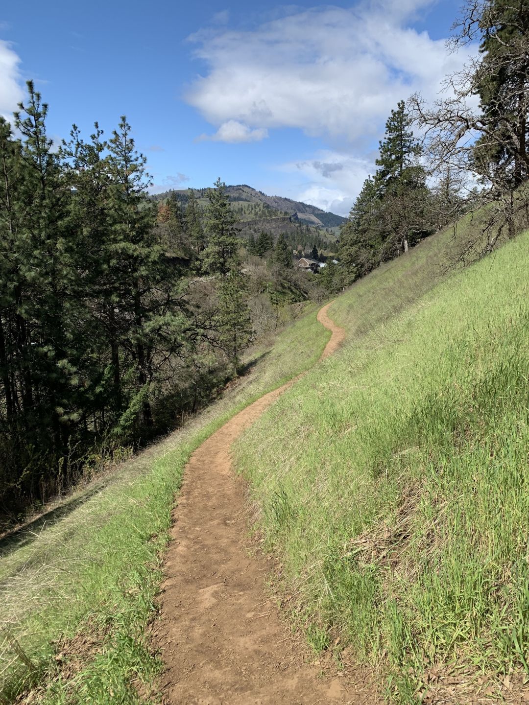
Ranked as moderate difficulty and steep in some places, the Mosier Plateau Trail is not for toddlers. Sure-footed older kids who can obey “Stay away from the edge!” and “Don’t roll down the hill!” rules should be fine.
Image: Margaret Seiler
After a short climb, the trail passes by an old cemetery with headstones from the late 1800s. Beyond the cemetery, the highway noise is replaced by that of the rushing waterfall on Mosier Creek, and soon even that is too distant, drowned out by the wind. After a set of stairs, a series of switchbacks and two more sets of steps, the trail reaches a flatter expanse covered in flowers. Yellow balsamroot, also called Oregon sunflower (but with grouped blooms much closer to the ground than that nickname would suggest), dominates the scene in late April, but there’s also purple lupine, more yellow from Lomatium dissectum (a.k.a biscuitroot), and a subtle undercarpet of tiny pink and white blooms. Viewpoints along the western ridge provide that essential flowers-river-sky photo op. A walk up the wagon trail to the tippy top, now home to a cell tower installation and Pacificorp meter, with views of the eastern gorge and converging orchards to the south. You can keep following the trail down toward the river and the road for more views, or you can turn around here. (The Friends of the Columbia Gorge discourage hikers from making it a loop by walking back along Highway 30.)
Back in town, a smart person who didn’t come on a Monday, the one day it’s closed, could have lunch at the La Vaquita taco and tamale food truck. Signs tacked on a telephone pole beckon visitors to various local wineries (check for opening hours and days before embarking on a bike ride). But I unlock my bike from the rack by Randonnée and follow a different sign, one painted by kids from the school across the road, pointing me to the Mosier Twin Tunnels.
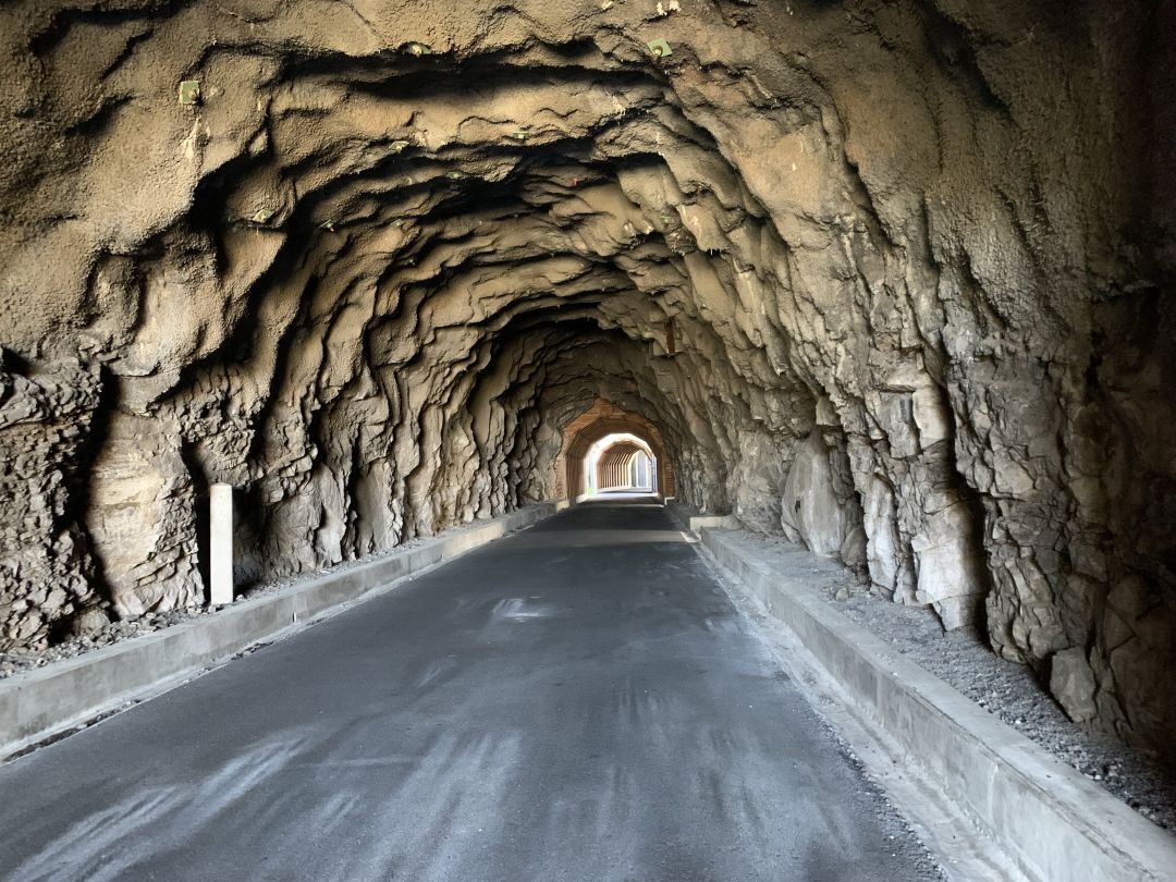
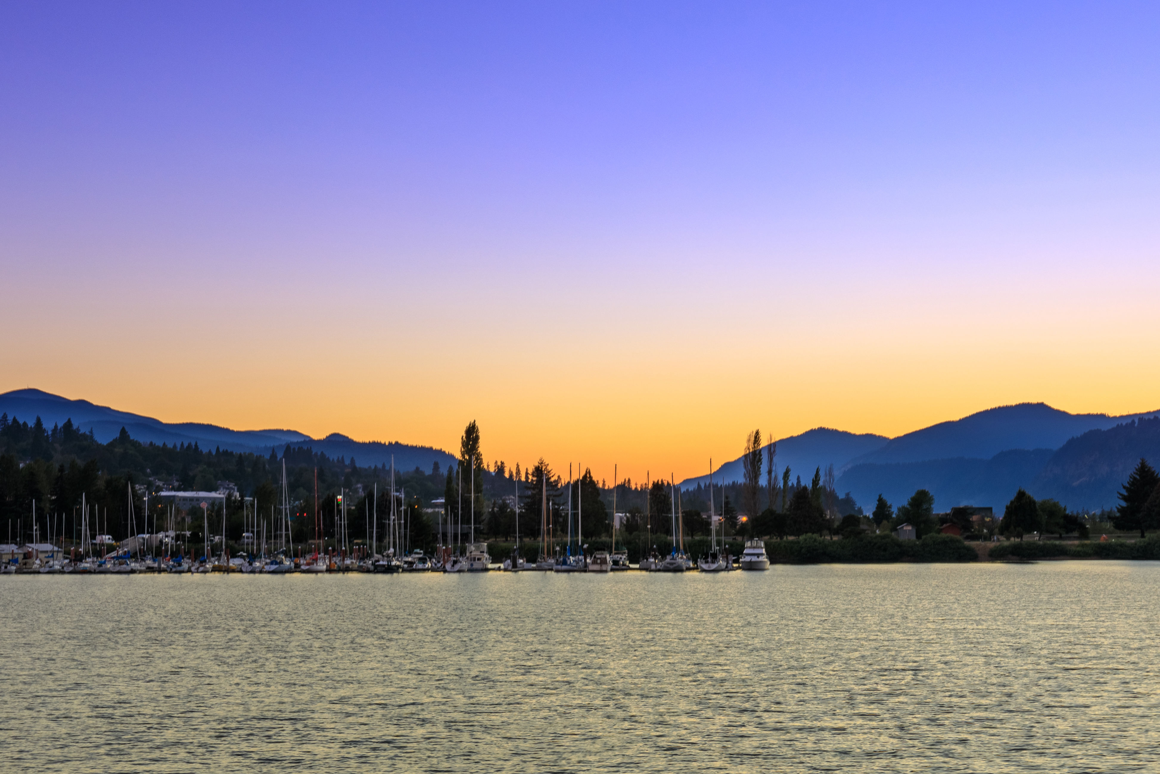
The eastern section of the Mosier Twin Tunnels
Image: Margaret Seiler
The tunnels were blasted out of the basalt during highway construction more than a century ago. Decades after what’s now I-84 replaced this stretch of road in the 1950s (the tunnels certainly couldn’t accommodate an 18-wheeler or a wide load carrying a windmill blade), the trail and tunnels were restored for pedestrians and cyclists.
Just over a half-mile from the sign, up Rock Creek Road, is the Sen. Mark O. Hatfield East Trailhead on the Historic Columbia River Highway State Trail. A mile in along the wide, paved path is the first of two tunnels, one lined with rock and the next framed in wood, both with tunnels off to the side, like transepts in an old cathedral that open to a Gorge view. After that comes a section with a concrete canopy and square columns—put together, the three sections offer a very short timeline of architectural history, cave dweller to Brutalist.
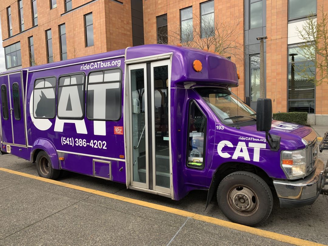
Image: Margaret Seiler
From here, you can keep biking another four miles to Hood River. Depending on where you turned around on the hike and how long you needed to digest your tacos and tamales, you could get back to Hood River in time for the 2:30 express bus back to Portland. The 4 p.m. is more likely, though. Or, if you’ve really taken your time, you can bike back down into Mosier to catch the 5 p.m. bus. Either way, the 5:30 p.m. bus from Hood River is the last run of the day.