4 Hikes for Families Close to Portland
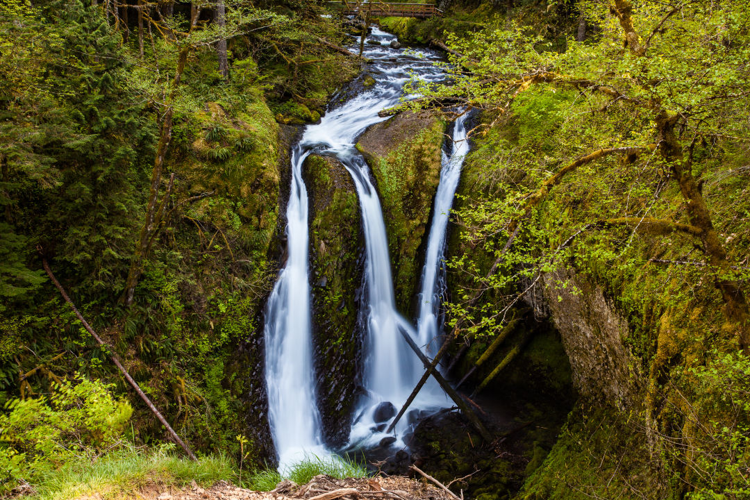
Triple Falls on from Oneonta Creek.
Image: Courtesy Shutterstock/puttsk
Spring break means that it’s time to put down the video game controllers and pick up those trekking poles.
With a whole week off from school—parents, you should take some time off, too, if you can—spring break is the perfect way for families to reconnect with each other and the outdoors. Some of the first few days of sunshine are starting to bleed through the gray troposphere, but we’re Oregonians. We don’t need nice weather to appreciate the foliage, geology, and wildlife that make our state a great place to play.
So, lace up those hiking boots, pack yourselves into the family adventure wagon, and get onto one of these trails conveniently located less than an hour and a half from the city.
Triple Falls
Horsetail Falls is a fun drive-by for a car tour through the Columbia River Gorge. But this moderate hike starting from the popular roadside attraction is great for kids who will enjoy getting up close and personal with three waterfalls. That includes Upper Horsetail Falls, dainty Ponytail Falls, and the stunning Triple Falls of Oneonta Creek. Gravel and packed dirt make this an easy jaunt for all abilities, but with enough elevation to feel like you got your workout in. Spring rain will also make this the perfect time to view water surging over the basalt flow cliffs. Start from the signage at Horsetail Falls and bear right. The hike continues beyond Triple Falls, but a series of small pools just above is a great place to rest, picnic, and turn around.
- Starting point: Horsetail Falls Trailhead
- Length: 4.5 miles out-and-back
- Distance: 40-minute drive from downtown Portland
- Prominent feature: Waterfalls
- Difficulty: Easy to moderate
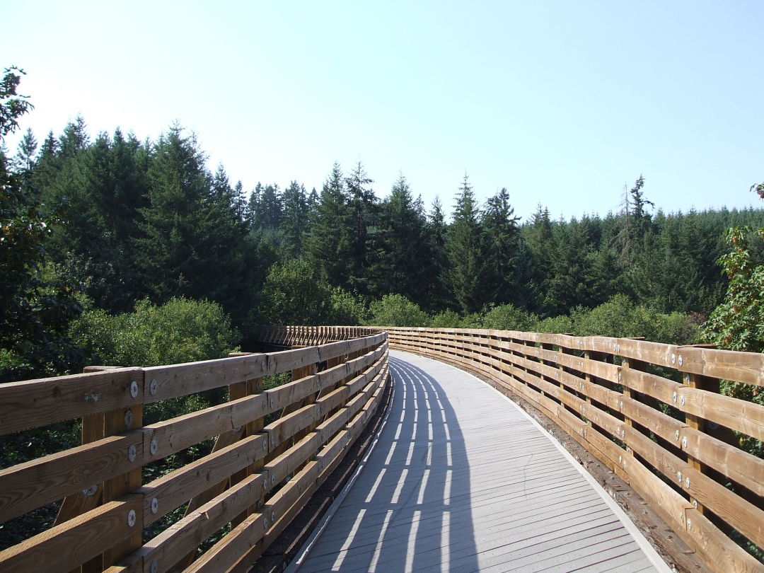
The Banks-Vernonia trail atop the Buxton Trestle Bridge near Buxton, Oregon.
Image: Courtesy Oregon State Parks
Banks-Vernonia Trail
Timber-laden locomotives once roared along this 21-mile stretch west of Hillsboro, but today it’s all yours for the cruising. The gently graded, wide, paved trail links the rural towns of Banks and Vernonia, and its multiple access points allow families to tailor rides to just about any distance. One highlight: the sweeping view from the top of the Buxton Trestle—an 80-foot-high structure a few miles outside of Banks. Choose your own adventure by making a hike of whatever length you want. Access the trail from one of five trailheads that all have ample parking and restrooms.
- Starting point: Buxton Trailhead
- Length: Varying
- Distance: 35-minute drive from downtown Portland
- Prominent feature: Trestle bridge
- Difficulty: Easy

A view of the Willamette River from Canemah Bluff Nature Park in Oregon City.
Image: Gabriel Granillo
Canemah Bluff Nature Park
Tucked on a plateau overlooking the Willamette River and bedecked with new upgrades like maps, trail markers, and an ADA-accessible path, Oregon City’s 332-acre Canemah Bluff Nature Park is a gift for spring breakers. For a mile-and-change loop, start at the 0.2-mile crushed-gravel Camas Springs Trail, prairie habitat that will bloom in spring with camas and trillium. Stop at the new stone-lined overlook, where you can survey the Willamette winding below forested hillsides as the falls rumble just out of sight. Continue on through a dense sliver of fir, alder, and maple, then trace an old roadbed lined with massive wedges of basalt. Within a half-mile of the trailhead, the road ends at the gates of the Canemah Historic Pioneer Cemetery. Continue along the Spur Trail to the Old Slide Trail, which climbs 0.4 miles through corridors of ash trees, linking to the Licorice Fern Trail amid a dusky forest of ferns, alders, and vine maple. Follow this path to a new trailhead that exits into the Canemah neighborhood. Keep left on Fifth Avenue to rejoin the cemetery road, and leisurely make your way back to the main trailhead.
- Starting point: Canemah Neighborhood Park—917 Fourth Ave, Oregon City
- Length: 1.5- to 2.5-mile loops
- Distance: 35-minute drive from downtown Portland, and not far from TriMet's Bus 33 and Canby Area Transit's 99X
- Prominent feature: Views of the Willamette River
- Difficulty: Easy
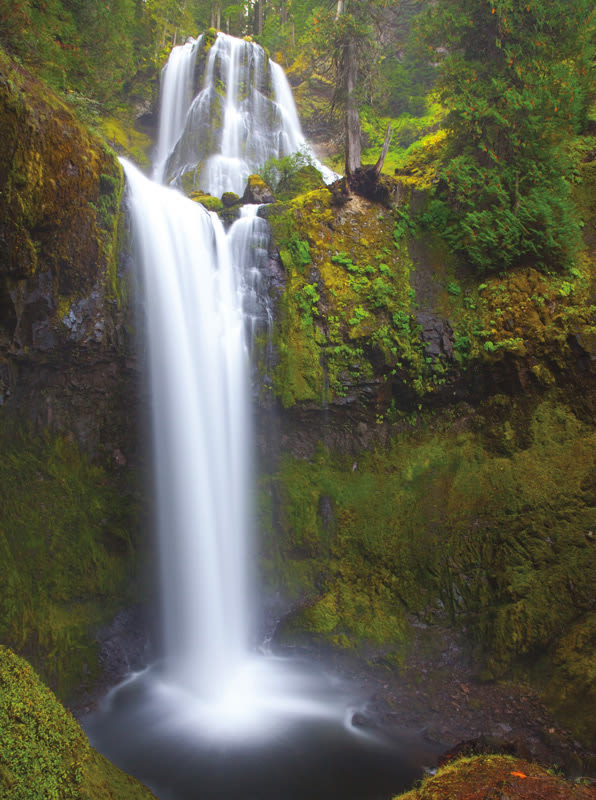
Falls Creek Falls in Southwest Washington's Gifford Pinchot National Forest.
Image: Darren White
Falls Creek Falls
Tucked away in Washington’s Gifford Pinchot National Forest, the 335-foot, multitiered Falls Creek Falls is arguably one of the most striking waterfalls in the area, and is well worth the drive. Be prepared to chug along a forest road for over two miles before reaching the trailhead. The trail meanders along Falls Creek beneath a canopy of Douglas fir, big-leaf maple, and alder. There are also various access spots along the creek for a quick snack break. Almost half a mile in from the trailhead you’ll reach a suspension bridge that takes you over a narrow gorge. Continue uphill and pass a junction with a connector trail (which you won’t take) and follow the Falls Creek Falls trail to the base of the falls, where the lowest section of the waterfall drops 90 feet over a rocky amphitheater—from this viewpoint you also get a glimpse of the middle tier gently cascading over the cliff face. Up for a longer hike? Return to the junction and take the connector trail up a steep hill, which will take you to a viewpoint of the upper falls. From here return to the main trail to finish the hike.
- Starting point: Falls Creek Falls Trailhead
- Length: 3.4 miles out and back, 6.1 to the upper falls
- Distance: An hour and 20 minutes from downtown Portland
- Prominent feature: Waterfalls
- Difficulty: Easy