Table Rock Trail
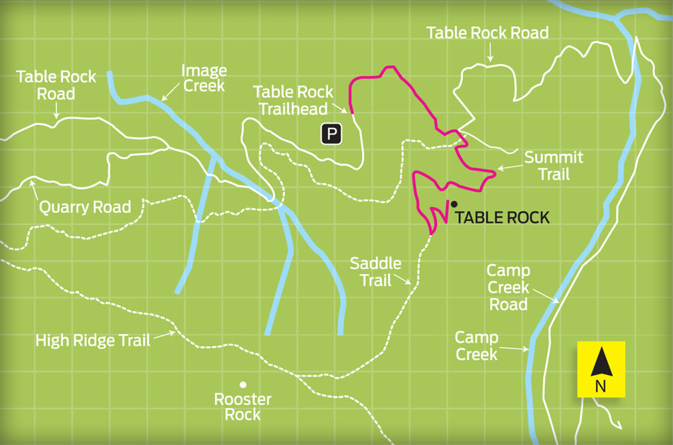
WHY IT’S GREAT At 4,881 feet, the broad, flat summit of Table Rock sits like a giant anvil above the rugged Table Rock Wilderness outside of Molalla. A relic of ancient volcanic flows, the imposing basalt rock promontory is hemmed in by steep hillsides flush with mountain hemlocks, old-growth firs, and clusters of rhododendrons and iridescent, late-blooming gentians. Guarded by steep switchbacks and an immense boulder field that often remains snowbound until well into summer, the upper reaches of Table Rock can be a challenge to negotiate. But come late July, when the lonesome peak finally dries out, a little leg muscle is all that stands between you and the summit’s spectacular views of Cascade volcanoes stretching from Washington’s Mount Rainier to California’s Mount Shasta.
POST-HIKE WATERING HOLE Farmstead Restaurant and Pub Do as the links-lovers do and drop by the Arrowhead Golf Course’s resident bar for a selection of nine microbrews, fresh steamer clams, and double-decker turkey clubhouse sandwiches piled with crispy fries.
28313 S Highway 213, Molalla; 503-829-7427
TRAILHEAD DIRECTIONS From Highway 211 in Molalla, turn right on S Mathias Road. After .3 miles turn left on S Feyrer Park Road; drive 1.6 miles and turn right onto S Dickey Prairie Road. After 5.3 miles turn right on S Molalla Forest Road, crossing the Molalla River. Continue 12.8 miles and turn left up Middle Fork Road, a gravel road. Drive 2.6 miles and turn right, following signs for the next 4.5 miles to the trailhead. No fees or permits required.
Find trails, news, tips, gear, and more at portlandmonthlymag.com/blogs/muddyboot or find a trail here.


