Will a 200-Mile Trail Come to the Columbia River Gorge?
The Gorge Towns to Trail loop is a proposed 200-mile journey spanning both sides of the Columbia.
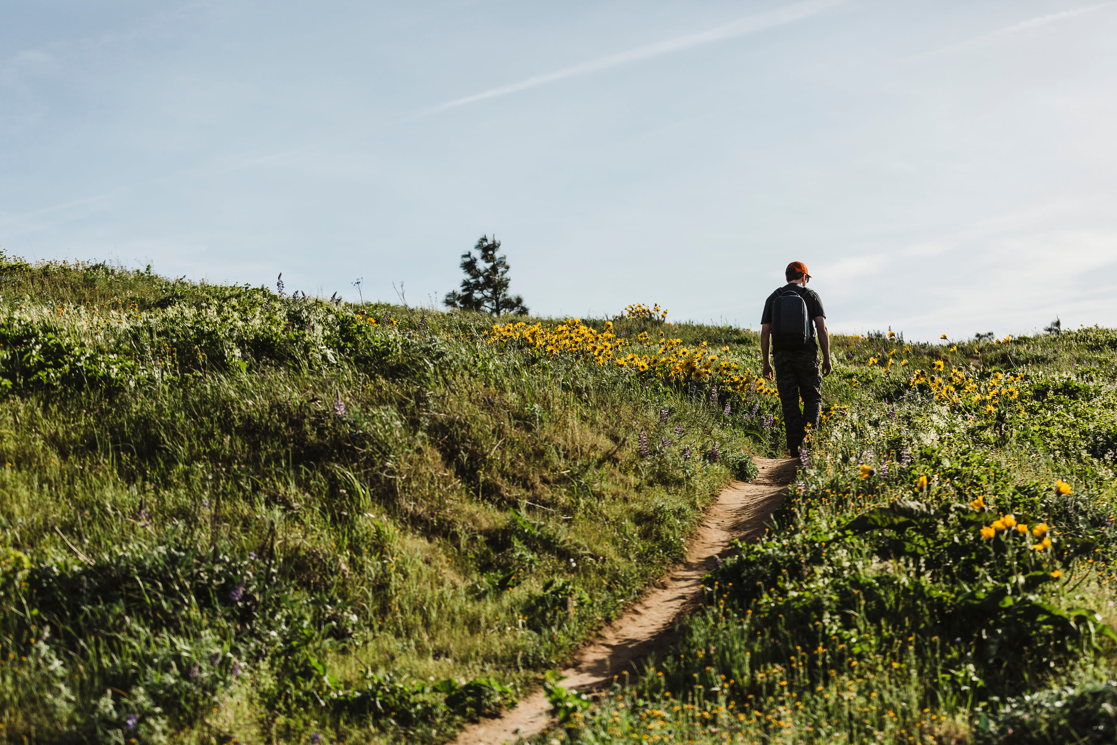
The year is 2117, and it’s the perfect summer day for exploring the Gorge—clear blue skies, not too hot, not too cold. (Imagine, just for a minute, the problems of climate change have been solved.) Instead of a day trip—a hike around Beacon Rock State Park, maybe, or a ride to the Mosier Twin Tunnels capped by lunch—you’re packed for a multiday, bistate trek spanning both sides of the Columbia.
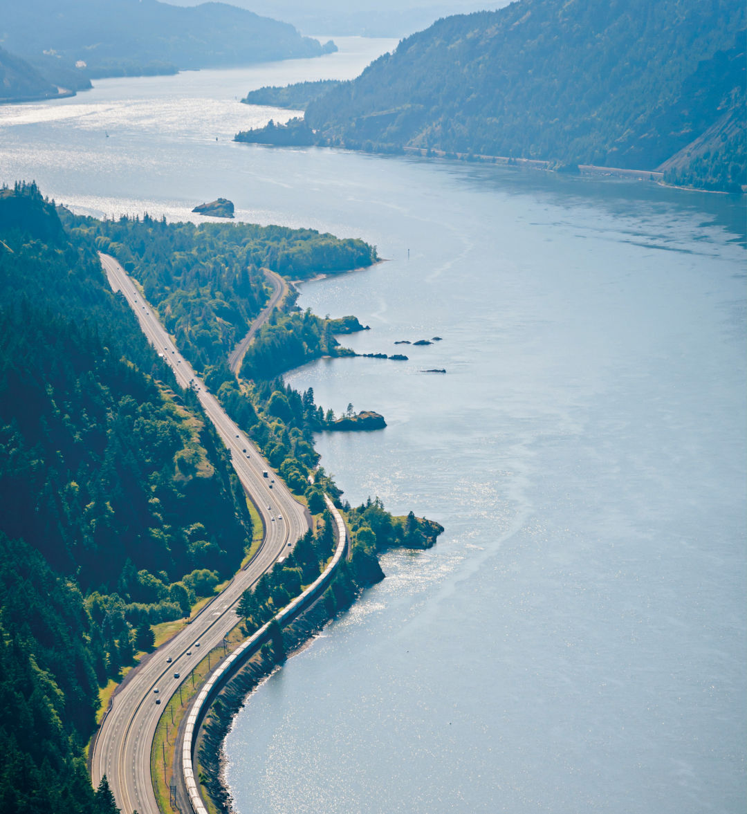
This is the Gorge Towns to Trails loop, a proposed 200-mile journey planners hope could be the future of ecotourism in the Columbia River Gorge, looping from Troutdale past The Dalles on the river’s south bank, and back to Washougal on the north. The vision—which would rely in part on existing trails—would be the first of its kind in the country.
“Nowhere else do four national trails come through an area: the Lewis and Clark Trail, the Ice Age Floods Trail, the Oregon Trail, and the Pacific Crest Trail,” says Renée Tkach, a project manager for the nonprofit Friends of the Columbia Gorge. Since the loop would pass through towns and cities, Tkach says the seamless system would be modeled after old European treks: the 82-mile, coast-to-coast path along Hadrian’s Wall in England; Spain’s 1,203-year-old, 500-mile-long Camino de Santiago; or Portugal’s 280-mile network known as the Rota Vicentina.
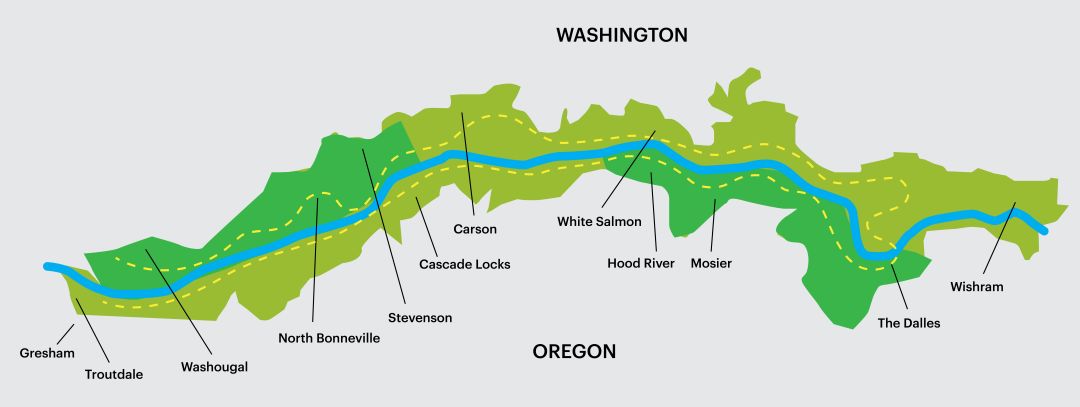
Image: Michael Novak
Without hordes of medieval pilgrims to trample down vegetation, the Gorge loop still has some ways to go. Eighty percent of the land required to complete the loop is owned by state parks, Friends of the Columbia Gorge, the US Forest Service, or other public agencies or cities. But only 40 percent of the trails needed to create the loop now exist. Success depends on an ambitious combination of buying land, bringing private owners on board, and raising funds to build trails. (A mile of new dirt trail can cost about $1 million.) And of course, not everyone is thrilled about the idea. In 2013, the Skamania County Board of Commissioners strongly opposed the plan unless certain concerns were addressed, including property rights, maintenance, and potential sales of private land. In 2014, a National Park Service survey found that 41 percent of residents in Washington’s Lyle County opposed an expanded trail system.
“The issues are way more complex than just connecting towns via trails,” says Dan Miller, a planner for the National Park Service. “I don’t think you’re going to change a lot of those folks’ minds because they’re going to be opposed to a project like this just because it’s a Friends of the Columbia Gorge project, who they view to be from Portland and not the Gorge.”
Even so, the Friends group aims to complete two primary stretches, between Washougal and Stevenson and between Hood River and The Dalles, by 2027. In some cases, small swatches of private land interrupt the intended path, and trail construction in the Gorge must be approved through the region’s designated National Scenic Area. Progress is possible, if slow: in the 30 since its founding, the Scenic Area has gained more than 40,000 acres of public land, helping kick-start the whole loop concept in 2011.
“We realize that [this] is a huge vision and will take many, many, many years to complete—potentially decades,” says Tkach. “It’s not going to happen in my lifetime.”