This Easy Hike Offers Oregon’s Best Mt Hood Views
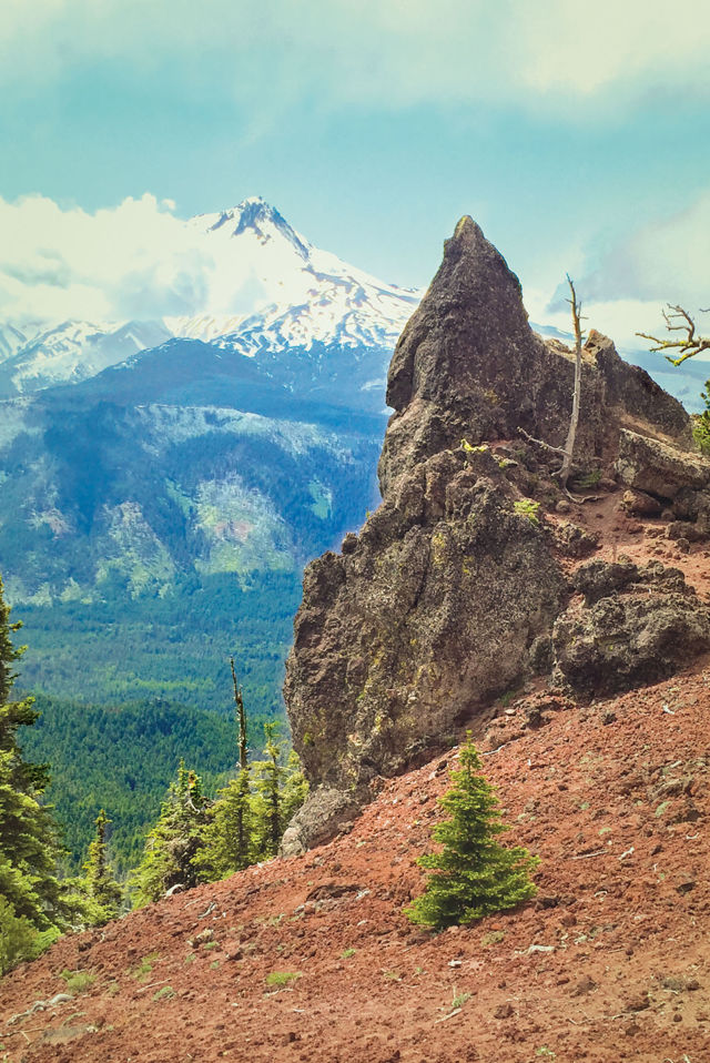
Image: Benjamin Tepler
What’s the best way to see Mount Hood? Some argue for its reflection in Trillium Lake, or right up under its chin at Timberline Lodge. But we maintain that the best view is found atop the second tallest peak in the Mt Hood National Forest: Lookout Mountain, a 6,536-foot ridge just east of the main event.
The easiest and most direct way to Lookout Mountain is via High Prairie Loop 493, a wide, gently graded trail that runs just shy of three miles. (It sees light use most days, but can get crowded on summer weekends.) From the High Prairie trailhead, start your hike in a counterclockwise direction. You’ll walk under mossy hemlocks and through floral meadows vibrant with purple aster, bistort, and Jacob’s ladder. Three quarters of a mile up, you’ll catch your first Hood views, rising a mere seven miles away. Continue past pitted landslides of red, volcanic cinder and dramatic rock formations before cutting east to the summit. On a clear day, views are limitless from the foundation of a retired Forest Service lookout tower: Central Oregon desert, Mount Jefferson, and the curve of Hood River winding from the snowy, 11,250-foot peak. Return the opposite direction along an old Forest Service road originally used to service the lookout tower.
This hike is easily extended into an overnight trip thanks to Lookout Mountain’s location in the center of the Divide Trail, an 8.2-mile route that runs from Badger Lake Campground to near Flag Point Lookout (a functional, rentable lookout tower). Either direction offers solitude, challenging terrain, some route-finding, and dispersed camping with killer views. (If driving to Badger Lake or the Divide Trail access point near Flag Point, you’ll need high clearance and four-wheel drive.) There’s even a fourth way up, via Gumjuwac Saddle near Robinhood Campground on Route 35, though it’s a grueling day hike for the fittest of trekkers. Then again, there’s really nothing wrong with taking the easy way.
Drive Time 2 hours // Distance Just under 3 miles via High Prairie Loop, 9.8 miles out-and-back from Badger Lake, 9 miles out-and-back via Gumjuwac Saddle, or 6 miles out-and-back from near Flag Point Lookout // Difficulty Easy via High Prairie Loop, difficult other ways // When to Go Late June through September // Guidebook 100 Hikes in Northwest Oregon and Southwest Washington, William L. Sullivan