Hike of the Month: Silver Star Mountain via Grouse Vista Trailhead
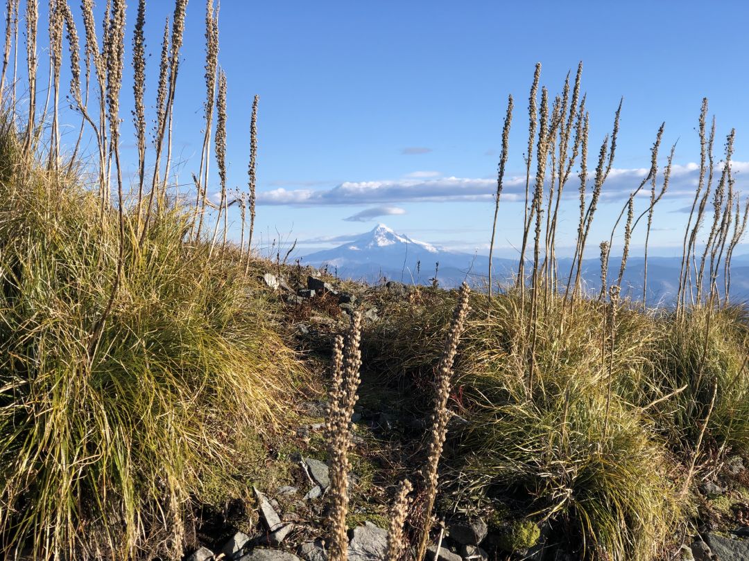
Image: Amy Joshu
It was the type of fall day hikers live for in the Pacific Northwest. The sun was shining, and a light wind brought to life the vibrancy of the fall foliage lining Ward Road. Leaves seemed to dance in time to Creedence Clearwater Revival playing through the speakers of the Ford F-150 I had borrowed for this trek. Off in the distance, the snowcapped peaks of Mount Adams and Mount St. Helens were barely visible above the landscape, a subtle hint of the beauty to come.
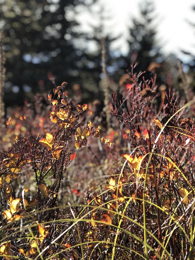
Image: Amy Joshu
Making our way to Silver Star Mountain, situated in the Gifford Pinchot National Forest, we (my boyfriend, his daughter, and our adventure loving dog) turned onto the country roads through Orchards with its manicured green grass, a stark contrast to the yellow and orange of the fall leaves. We passed through Hockinson, Washington, and finally reached the gravel road that would take us to the Grouse Vista Trailhead.
Silver Star Mountain, aptly named for the pattern of five prominent ridges that radiate from the summit, has long been on my list of must-hike spots. While it boasts views of almost every local Cascades peak from the summit, I had put this hike on the back burner for two reasons: The infamous Forest Road 4109 which leads to the Silver Star North trailhead is accessible only to those with 4WD vehicles (and is still sketchy at times even with one), but access via the Grouse Vista Trailhead (and the borrowed F-150) solved that dilemma. Second, summiting the Cascades peaks had been my first priority over lower-elevation treks, but after this hike I couldn’t be more annoyed with myself for waiting this long.
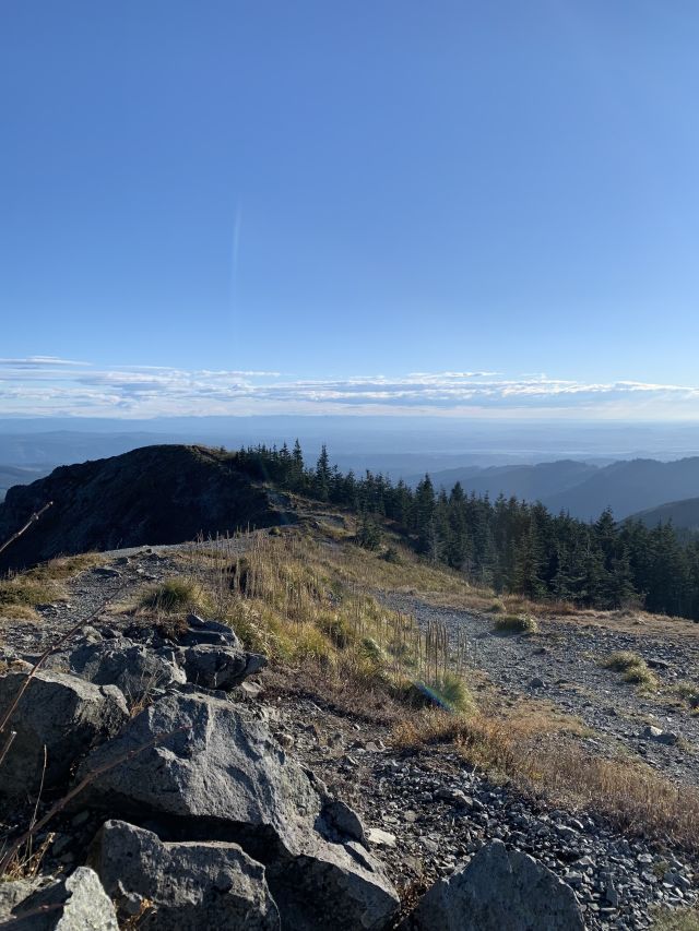
Image: Amy Joshu
In the beginning of the hike a small spring flowed over the trail and felt more like walking up a rocky creek, making me jump from rock to rock to avoid submerging my feet in a mud puddle. This passes quickly, however, and you soon find yourself crunching along fallen leaves juxtaposed with brightly colored mushrooms in a steady climb. Expect the climb to be steady and constant, gaining just over 2,000 feet of elevation toward the three-mile summit. A majority of the hike is spent passing through a corridor of dense trees, but at points the Grouse Vista Trail emerges from the forest into exposed sections, and the summit becomes visible. Sturgeon Rock, a basalt outcrop, and the highest point in Clark County, Washington, towers over the top of the trail. A boulder spray-painted with bright red lettering declaring “45 minutes left” is pretty accurate if you are keeping a steady pace.
The stark landscape here is scarred from the Yacolt Burn of 1902, one of the largest fires in Washington history, burning more than 238,000 acres. After the fire, the loss of vegetative ground cover resulted in a series of rockslides. This has left the landscape resistant to natural reforestation. However, wildflowers and other flora that typically thrive above timberline are found here, especially in the spring, despite being at lower elevation.
Ducking back into the tree cover, a thankful refuge from the howling wind on the ridge line, I continued the ascent. Popping in and out of tree cover, I kept straight on the Silver Star Trail until reaching a large rock pile. This is when you can start to get excited, as the summit is only minutes away. Turn right, pass the campsite, and continue on until you emerge into an open meadow of tall grass, dotted with more signs of a departing fall.
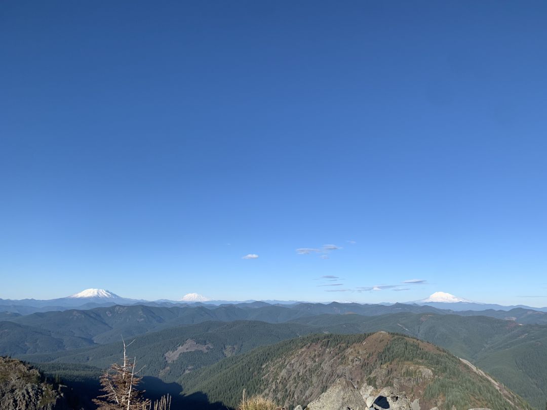
Image: Amy Joshu
The Pacific Northwest truly shows off at the summit. The trail opens up to a breathtaking, unobstructed, 360-degree view of five Cascades peaks: St. Helens, Rainier, Adams, Hood, and Jefferson, plus the entire Portland metro area, the Columbia River Gorge, and the Coast Range.
Bring a jacket and gloves, because even on a sunny day the wind can be cold, and you don't want that to shorten your time at the summit. Stand on the concrete platform where a fire watchtower once stood and take it all in.
Drive time: Just over an hour from downtown Portland // Distance: 6.8 miles, round-trip, with the option to add additional distance with the Ed’s Trail Loop // Difficulty: Moderate // Notes: Approaching from the west, through Hockinson, know that the last eight or so miles are on a gravel road. Most cars should make it when there isn't snow, but high clearance is beneficial for potholes and flying rocks. The Washington Discover Pass is required at the Grouse Vista Trailhead, which is just outside the Gifford Pinchot National Forest. These are not available at the trailhead but can be purchased in advance online or by phone.
Do you have a trail to recommend? Send your trail tips to [email protected]


