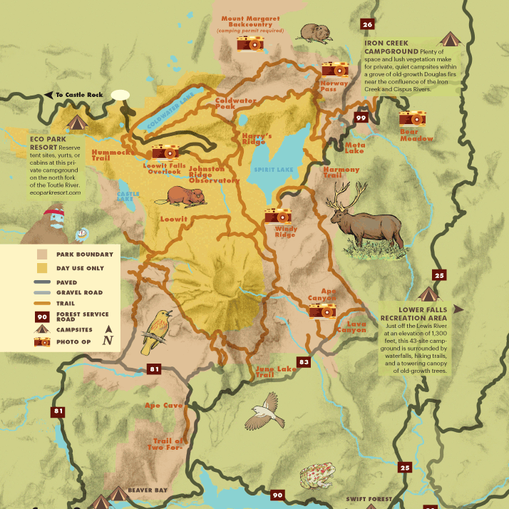
Mount St. Helens: Anatomy of an Eruption
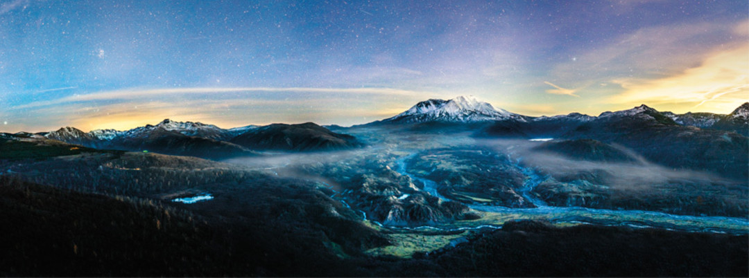
Image: Courtesy Joshua Meador
What happened in the spring of 1980 was more than an eruption—it was a sequence of interlocking events that wreaked havoc on the landscape and habitat around Mount St. Helens.
Debris Avalanche
Then: Throughout the spring of 1980, magma rising within St. Helens’s belly formed a massive bulge on the mountain’s northern flank. When a magnitude 5.1 earthquake hit on the morning of May 18, the bulge collapsed, unleashing the largest landslide in recorded history: scouring and burying 14 miles of old-growth forest in the Toutle River Valley beneath 150 feet of mud and rock.
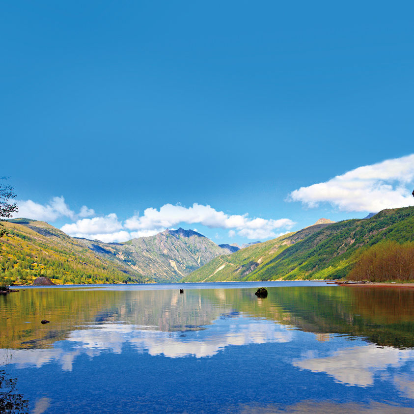
Now: Transformed by gravity and water, the valley is now home to a thriving new ecosystem, including 130 new ponds, stable wetlands, and young forests.
Lateral Blast
Then: As the north side of the mountain collapsed in the debris avalanche, a powerful, steam-driven blast was “uncorked,” shooting outward at 330 miles per hour. The 550-degree blast cloud of fragmented rock and gas snapped and toppled trees within 5 miles in a mere 3 minutes, searing forests up to 17 miles away.
Now: On the outer edges of the blast zone, thoroughly scorched trees remained standing—over time, the combination of these large dead trees and the developing forest below has produced a diverse new habitat.
Pyroclastic Flows
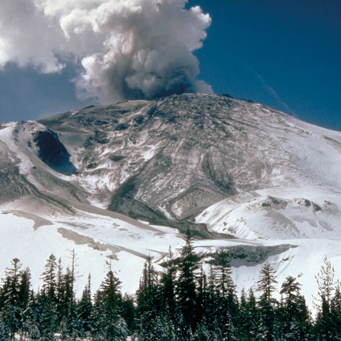
Then: After the lateral blast, turbulent searing-hot flows of gases, ash, and rock fragments spewed repeatedly from the crater’s mouth, following the path of the debris avalanche and piling up at the volcano’s northern foot. What remained in their 1,500-degree wake was a vast, barren pumice plain, entirely stripped of any sign of biological activity.
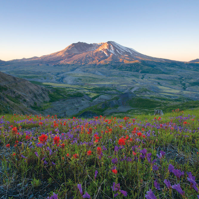
Now: First, only wind-dispersed insects and spiders inhabited the plain. Then came prairie lupines, followed by other hardy plants, and eventually, small mammals, trees, and shrubs.
Lahars
Then: Melting snow and ice mixed with rock and ash to produce debris-laden mudflows called lahars. The eruption melted Shoestring Glacier on the volcano’s south side, and a sequence of those lahars spilled over the rim, sending fast-moving slurries with the consistency of wet cement into the forest below, scrubbing the valley of vegetation and depositing new layers of sand, boulders, and logs into the river channel.
Now: In the decades since, periodic flooding has wiped out the resulting floodplains, slowing regrowth.
Ashfall Zone
Then In the aftermath of the eruption, a 15-mile-high column of ash boiled from the volcano for nine hours, slowly riding the wind northeast, turning day into night across the Northwest. It fell as far away as South Dakota, and eventually encircled the globe. The volcanic ash blanketed forests and meadows downwind of the mountain, damaging foliage and stunting tree growth.
Now Over time, hardy plants like the avalanche lily and the dwarf bramble were able to adapt, growing longer stems and new root systems.
What's Next? The Lava Lottery
“Every volcano has its own personality,” says Carolyn Driedger, outreach coordinator for the USGS Cascades Volcano Observatory. (So basically, we live among a bunch of gigantic, narcoleptic prima donnas. Think about it.) Driedger gives us the lowdown on four Cascadian hotheads—and one simmering neighbor that could provide the biggest pop of all.
The Show Pony: MOUNT HOOD
It’s been a quiet couple of centuries for Oregon’s signature peak (aside from occasional earthquake “swarms”), but Hood could break some nice china if it gets active. A 1791 eruption unleashed bursts of hot gas and rock at the present-day location of Timberline Lodge and sent destructive lahars—floods of mud and debris—down the Sandy to the mouth of the Columbia. Scientists and officials regularly war-game eruption scenarios.
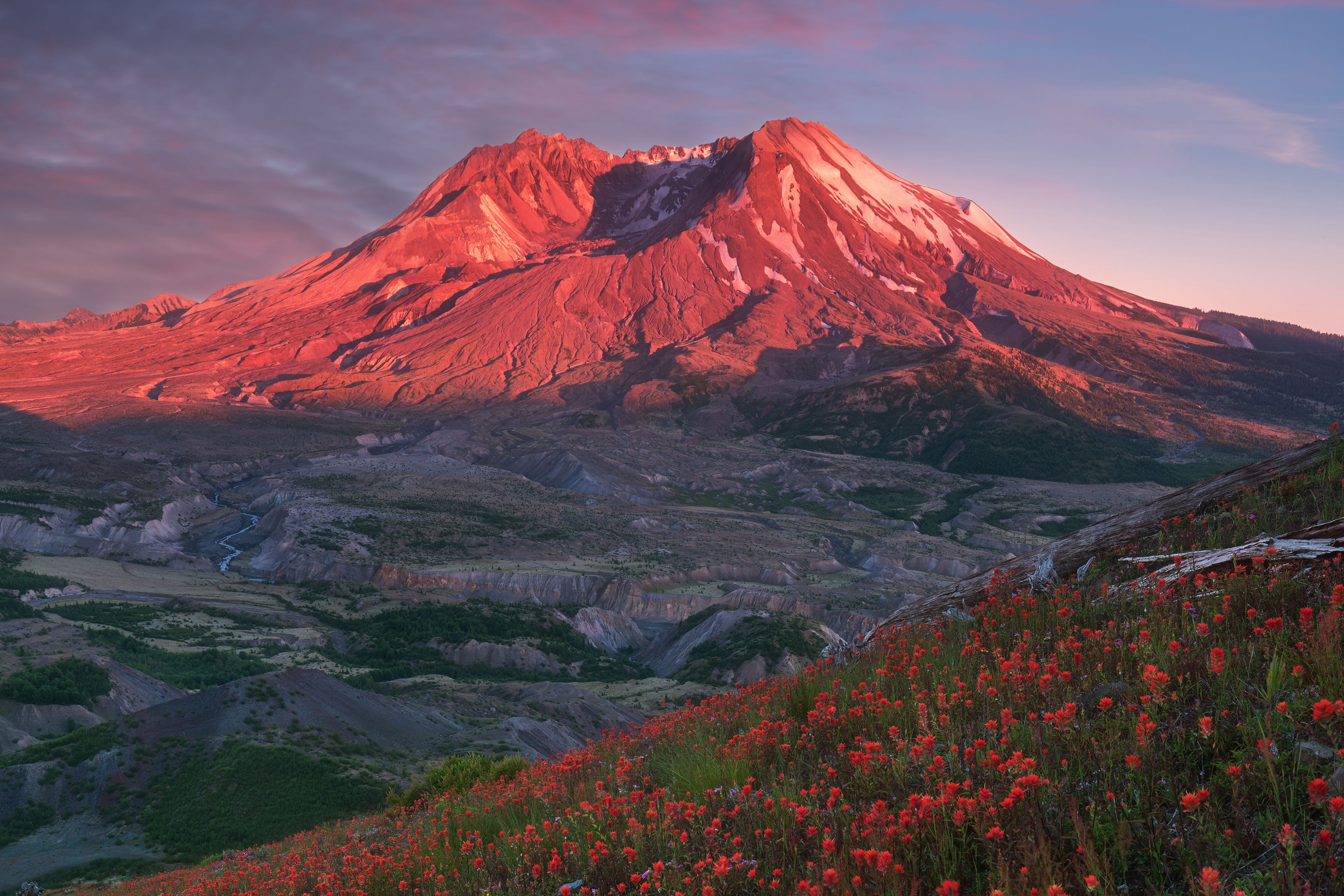
The Changeling: ST. HELENS
The USGS considers this young lady the most likely candidate for near-future hijinx, from “ballistic ejecta” to lahars stretching all the way to Kelso. Driedger points out that the gorgeously conical, Fuji-style look of pre-1980 St. Helens lasted the equivalent of an eyeblink in geologic time. “It only looked that way for a couple hundred years,” she says.
The Crumbling Giant: RAINIER
Seattle’s overseer hasn’t uncorked a major eruption for about 1,000 years. When it does, things could change up there. “Eleven hundred years ago, a Rainier eruption sent lahars all the way to the Port of Seattle,” Driedger says. Eruptions aside, Rainier is essentially crumbling inside: geothermal action has eroded its structure, meaning the peak could collapse on itself, triggering mudflows into areas inhabited by about 100,000 people.
The Underdog: GLACIER PEAK
You may not have heard of GP, tucked in the wilderness east of Seattle, but it ranks alongside St. Helens as a notable problem child. This mountain tends to actually erupt—the USGS map of threats posed by a potential explosive eruption shows lahars sweeping as far west as Puget Sound, 64 miles away. And typical easterly winds could give the nation a St. Helens–style ash blanket.
The Wild Card: YELLOWSTONE
America’s first national park sits on a volcanic powder keg of such theoretical potency, it could lay waste to the continent. (The science/pop-culture blog Io9 recently ran the headline “Yellowstone’s Megavolcano is more than twice the beast we feared.”) Jake Lowenstern at USGS is a cooler voice: “Yellowstone is always exhibiting unrest, yet hasn’t erupted for 70,000 years ... it keeps us on our toes, but remains unlikely to actually erupt any time soon.”