Some of These 6 Oregon Trails Don’t Exist Yet—But They Will Be Epic
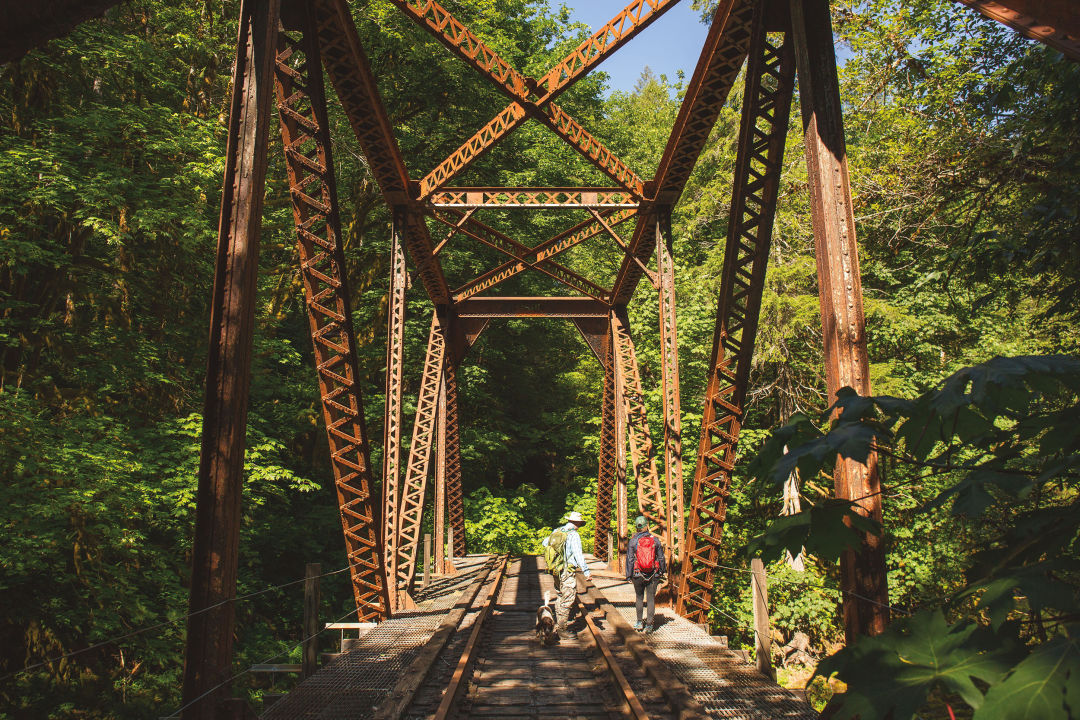
A bridge along the still-nascent Salmonberry Trail
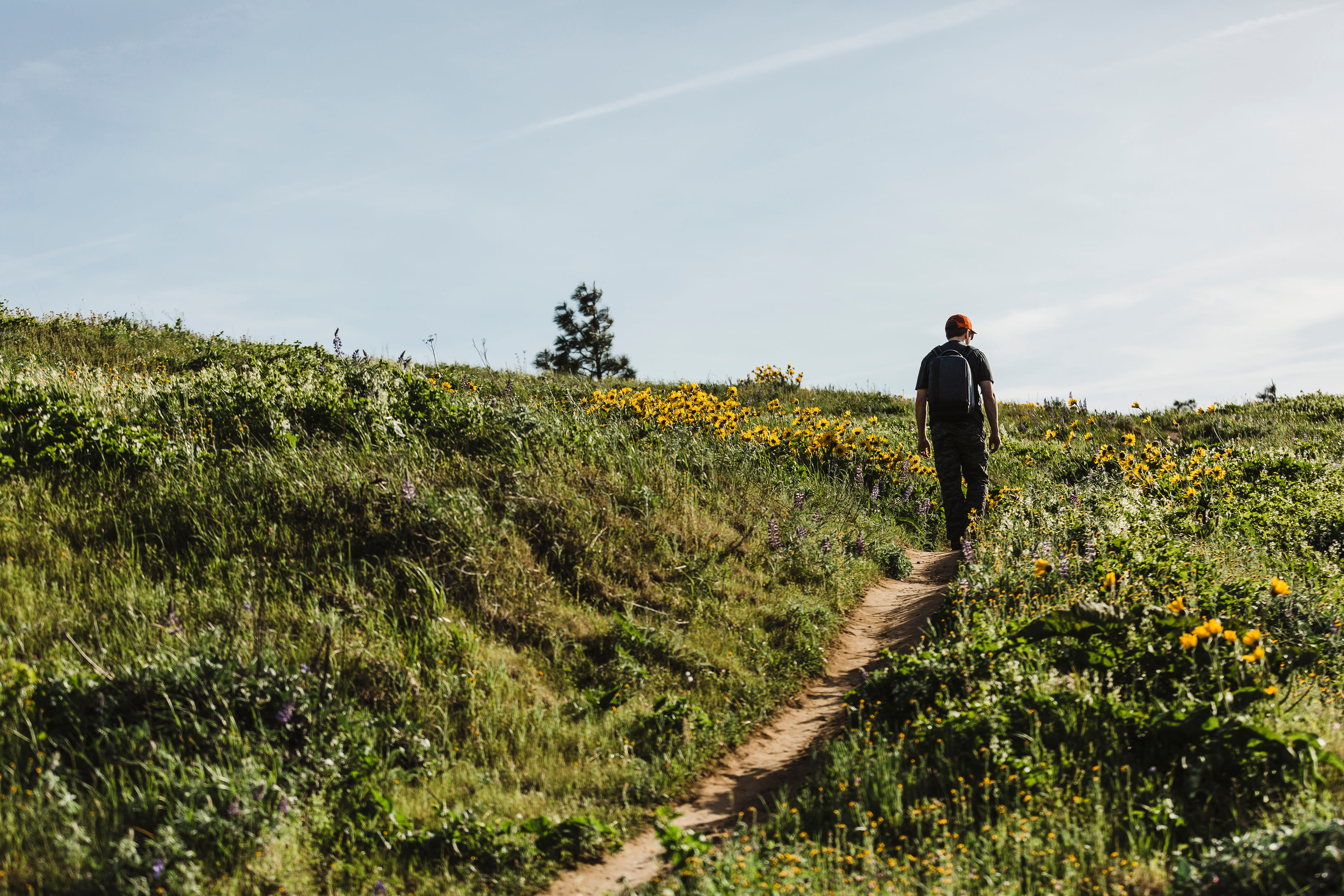
A hiking trail from the metro area to the coast, a carless route around the Columbia River Gorge—in recent years, such fantasies have coalesced into something tangible. That’s in part due to the Oregon Trails Coalition, an advocacy group and galvanizing force launched in 2016. For decades, regional trail organizations have tried to navigate the jurisdictional red tape and funding woes solo, some with little success. “There’s a desire to help more people connect with this place that we love,” says OTC director Stephanie Noll. “The OTC, in a short period, has already started to move the needle.” Here are a few to keep your eye on.
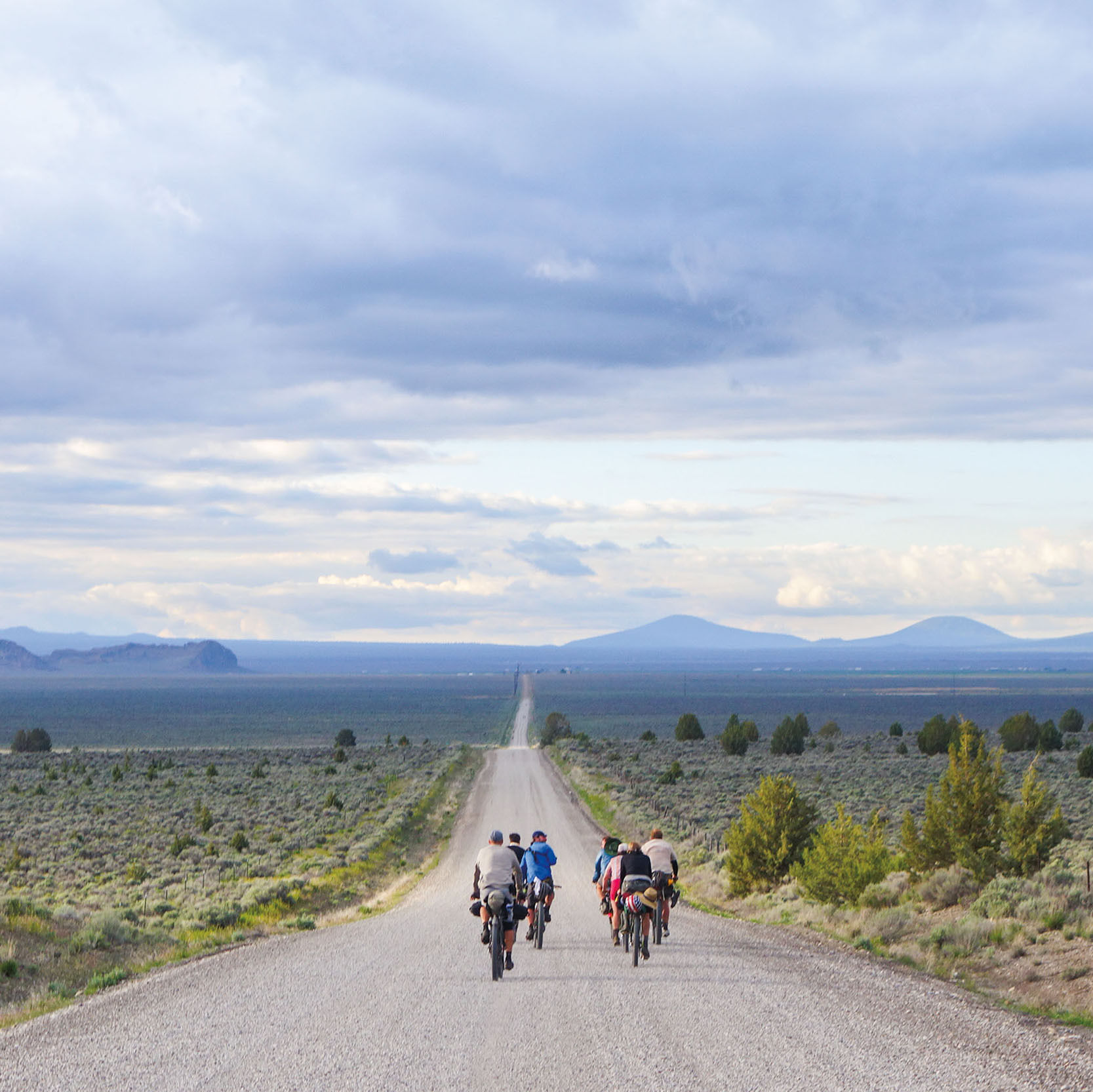
Salmonberry Trail
84 miles, 0% complete / Year Started: 2015
Since forever, Oregonians have been dreaming of a pedestrian path from the Willamette Valley to the coast. Four years ago, the Salmonberry Trail Intergovernmental Agency hatched a plan to turn the defunct Port of Tillamook Bay railroad line—opened in 1911 to ferry passengers from Portland to the coast—into a hiking, biking, and equestrian route from Banks to Tillamook. Starting in 2020, volunteers will work from either end, eventually meeting in the densely forested Salmonberry Canyon—hopefully within a decade. —BT
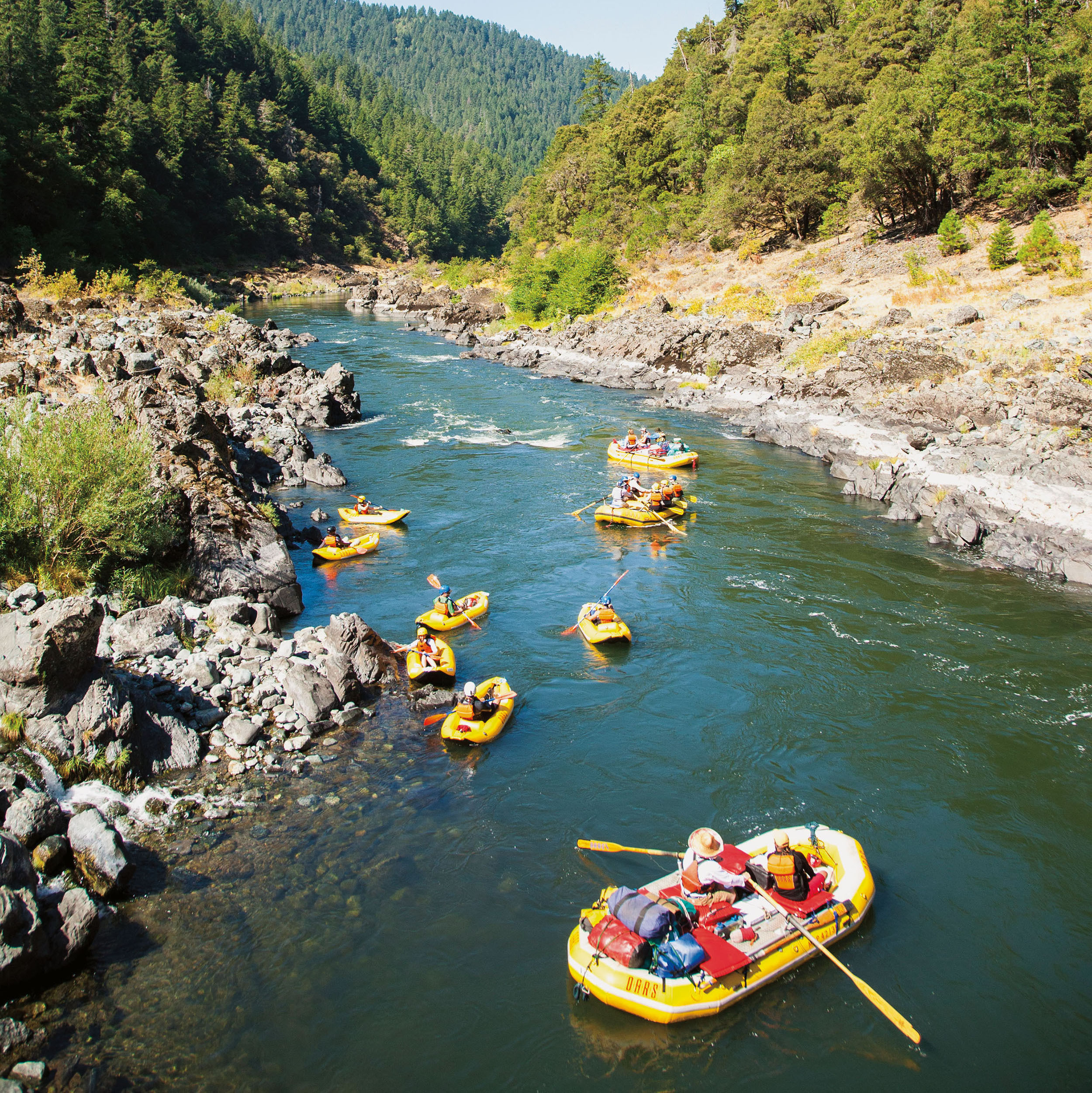
Oregon Coast Trail
382 miles, 90% complete / Year Started: 1971
The ambitious Oregon Coast Trail, with its windswept beach walks, winding rain-forest paths, and cliffside vistas, has always felt majestic in some spots, half-baked in others. Stretching from the California border to Fort Stevens, with a patchwork route that connects 28 beach towns, the coastal trek’s woes range from missing signage to unsafe spots where hikers walk just feet away from cars whizzing by on Highway 101. In 2017, House Bill 3149 required Oregon State Parks to develop an action plan for assessing and fixing the “gaps,” a goal the state agency will complete by 2021. —KC
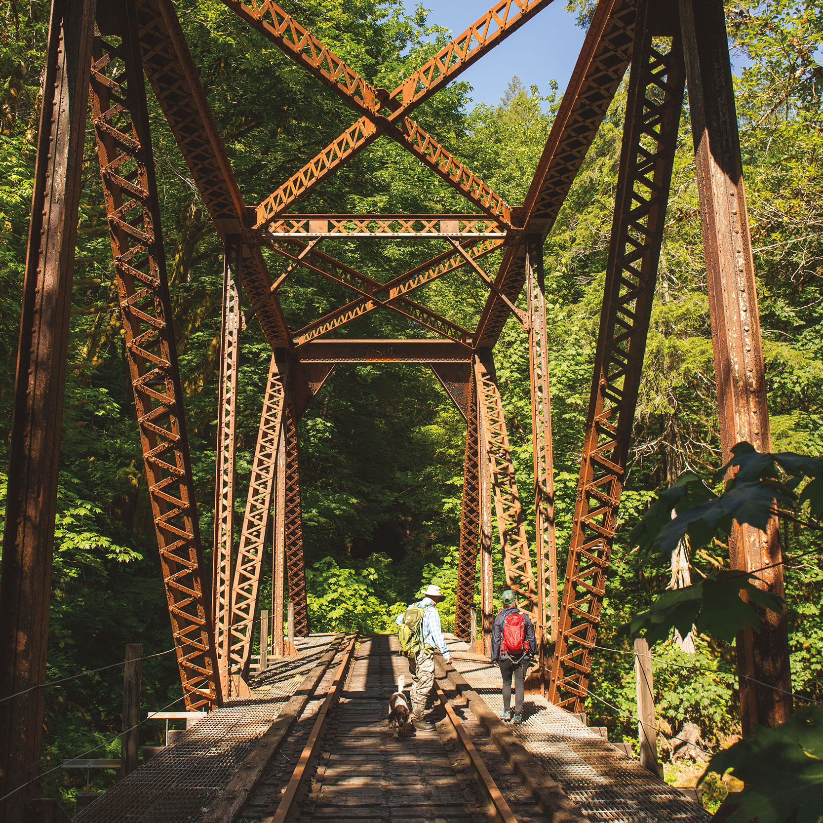
Gorge Towns to Trails
200 miles, 46% complete / Year Started: 2011
The vision: a 200-mile trail system, evoking the meandering, history-rich pilgrimages of Spain and Portugal that connect small towns with the countryside. Eventually, via a partnership overseen by Friends of the Columbia Gorge, the trail will loop from Washougal in Washington to east of The Dalles, connecting small communities in between. Next up: planning and building a six-mile round-trip trail in The Dalles that will connect to an existing Columbia riverfront trail. Baby steps! —MP
Yamhelas-Westsider Trail
17 miles, 0% complete / Year Started: 2012
Seven years ago, a group of farmers, winemakers, and others partnered with Yamhill and Washington Counties with the aim of creating a 17-mile trail along an abandoned railroad track. The initial phase, a 2.5-mile stretch between Carlton and Yamhill, was chosen to create a safe bike commute for schoolkids in the wake of bike-related fatalities along the parallel Route 47. The eventual path between McMinnville and Gaston will go through wheat fields, past hazelnut orchards, and along a wildlife refuge. The plan has met challenges from some local farmers. But trail supporters are pressing on, their long-term hope to someday extend as far as Forest Grove, connecting to the Banks-Vernonia and future Salmonberry Trail—and that wine conutry weekenders might take advantage. —FM
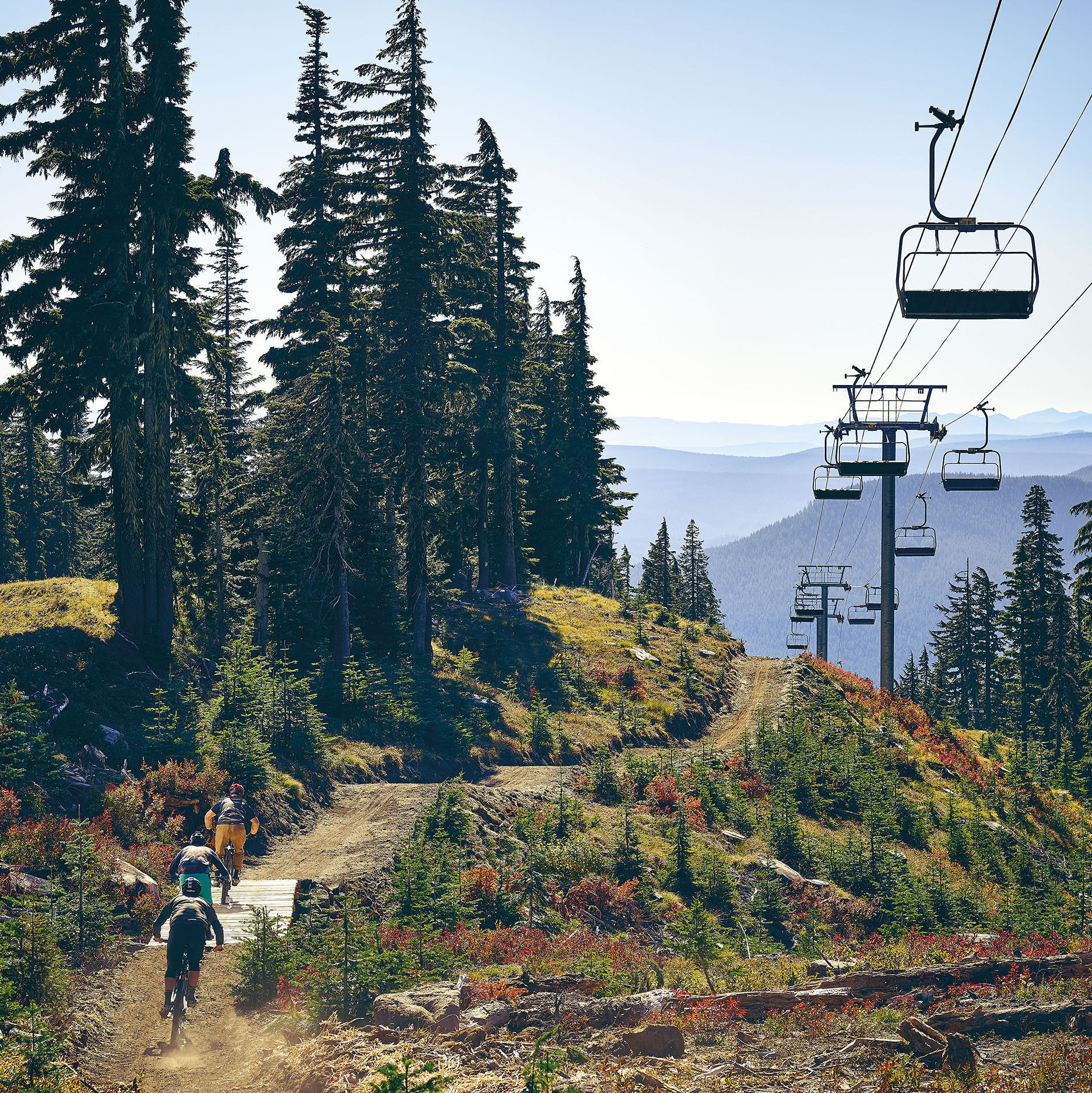
Oregon Timber Trail
669 miles, 100% complete (But only 62% singletrack) / Year Started: 2015
This long-distance mountain bike route winds through the Cascade Range from the California border to Hood River, mixing singletrack with dirt and some paved roads. Conceived as a connection of existing routes, the trail is overseen by a nonprofit aiming to add more singletrack each year, zeroing in on spots with the most elevation loss for fun downhills. While it’s mostly used by car campers doing day rides, it is possible to bikepack the length of the trail in about three weeks. —MS
Historic Columbia River Highway Trail
73 miles, 89% complete / Year Started: 1915
The same Reagan-era legislation that gave us the Columbia River Gorge National Scenic Area also mandated we reconnect—for recreationalists, specifically—America’s lush, waterfall-studded Columbia Highway. For three decades, the Oregon Department of Transportation has been cobbling the original pieces of the old highway (opened in 1916) back together as the Historic Columbia River Highway Trail—a fully bikeable (eventually) stretch between Troutdale and The Dalles. This summer, ODOT will open a three-mile multiuse stretch east of Cascade Locks. Then the agency turns to the trail’s tricky, pricy, final five miles: another leg, rounding Mitchell Point, that could wrap up (gasp!) as speedily as 2030. —RD