Two Years After the Eagle Creek Fire, Some of the Gorge’s Most Iconic Hikes Are Open Again
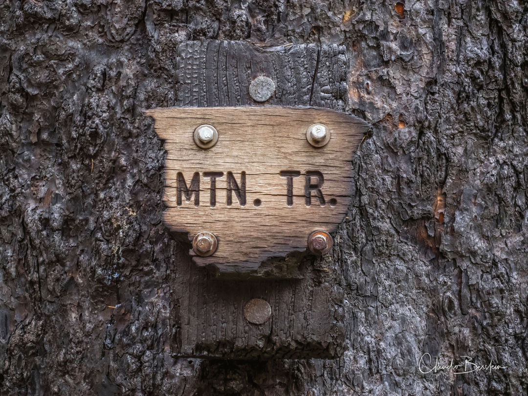
The burnt remains of a Larch Mountain Trail sign marker
Image: Courtesy Claudio Berstein
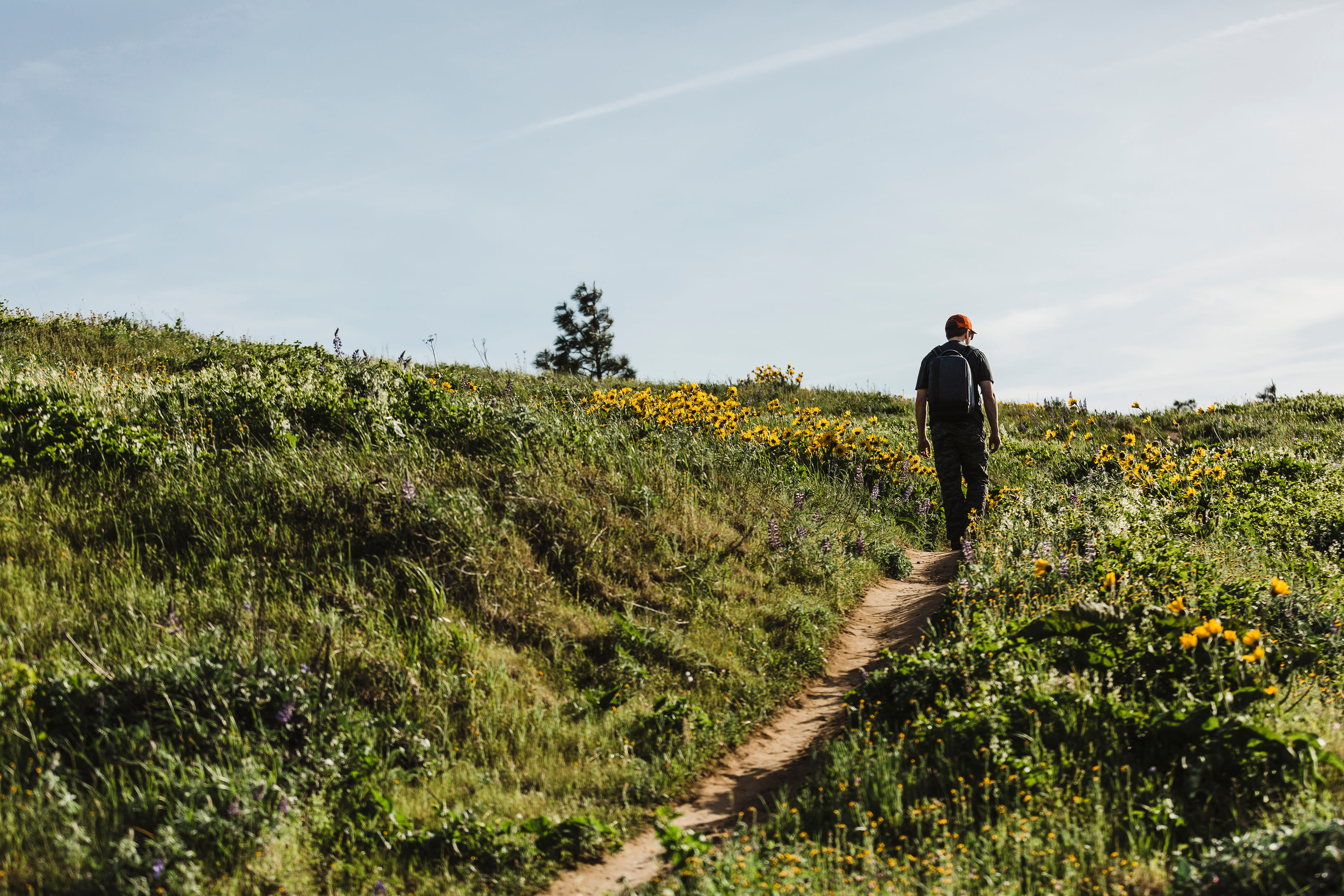
This summer marks the second anniversary of the historic wildfire that scorched 48,861 acres of forest in Oregon and Washington. Ignited by a carelessly tossed firework on September 2, 2017, the Eagle Creek Fire took three months to contain at an estimated cost of roughly $40 million, not to mention lost tourism dollars in surrounding communities. Two years later, the disaster is still a tender subject for many Oregonians—a gut punch to one of our state’s most cherished natural areas. But the natural world also thrives on wildfire cycles, and the Gorge’s recovery has been swift and stunning. Starting this summer, you can experience its regrowth and resurrection on several newly reopened trails.
The Eagle Creek Fire was a “mosaic burn”—a varied patchwork of fire intensity. “That’s how we think it burned prehistorically,” explains John Bailey, a professor of forest ecosystems at Oregon State University. “Tighter, smaller-scale mosaics, not a lot of the modern, big, 1,000-acre patches.”
In lower-intensity areas where sturdy Douglas firs and ponderosa pines weathered the heat, damage can be hard to spot. “People walking through those parts of the forest might not even notice they are inside the fire perimeter,” says Bailey. Higher-intensity areas, where the entire landscape was razed, are flourishing with wild new ecosystems. Grassy, herbaceous plants, like dandelion and bright fuchsia fireweed, thrive in the treeless, nutrient-rich, post-burn soil. That means vibrant wildflower displays in early summer and wide-open views for hikers in spots that were once obscured by dense forest. (Bailey says trees in high-severity areas will take decades to recover.)
Thanks in large part to trail-building nonprofit Trailkeepers of Oregon, some of the Gorge’s most popular “waterfall corridor” hikes—classics like Angel’s Rest, Wahkeena Falls, and Horsetail Falls—reopened this past winter. This month, Larch Mountain Road, an access point for many trails above the waterfall corridor, is set to reopen. But, as Trailkeepers executive director Steve Kruger cautioned after a landslide above Multnomah Falls this April, the landscape is still very fragile: “Hikers need to take the long view on this area being safe and fully repaired. The takeaway is that the beauty is far different, but still spectacular, even with the fire effects.”
Want to see the Gorge’s budding ecosystem at work? Here are our top recommendations.
Angel’s Rest
Trip Length: 4.8 miles / Difficulty: Moderate
Yes, it’s one of the busiest trailheads in the Gorge, but it’s also ground zero for observing the mosaic burn. “The lower portion had fire that just gave the forest floor a refresh,” says Kruger, “but as you get up to the top, it’s significantly different. In February 2018, it was like a moonscape: just shale, rock, and burnt sticks. But by spring, the trillium and larkspur bloom was fantastic. This year it’ll be just as brilliant.”
Sherrard Point
Trip Length: 0.6 miles / Difficulty: Easy
Not so much a hike as a jaunt, Sherrard Point is accessible from Larch Mountain Trailhead on the newly reopened Larch Mountain Road. While the wildfire never reached this paved trail, the volcanic “plug” atop Larch Mountain is one of the premier Gorge viewpoints, offering a perch over most of the burn area and views north to Mount St. Helens.
Dry Creek Falls to Herman Creek
Trip Length: 6.6 miles / Difficulty: Easy
Bring two cars for a gently graded shuttle hike along the Pacific Crest Trail near the Bridge of the Gods, where the Pacific Crest Trail Association worked tirelessly to restore the burn area. You’ll make a pit stop at Dry Creek Falls (2.4 miles) and pass basalt pinnacles (4.1 miles) with excellent views of the Columbia River throughout. Note: you can also make a shorter out-and-back trip to any of these features.